
Darling River System
Australia's longest continuous river system.

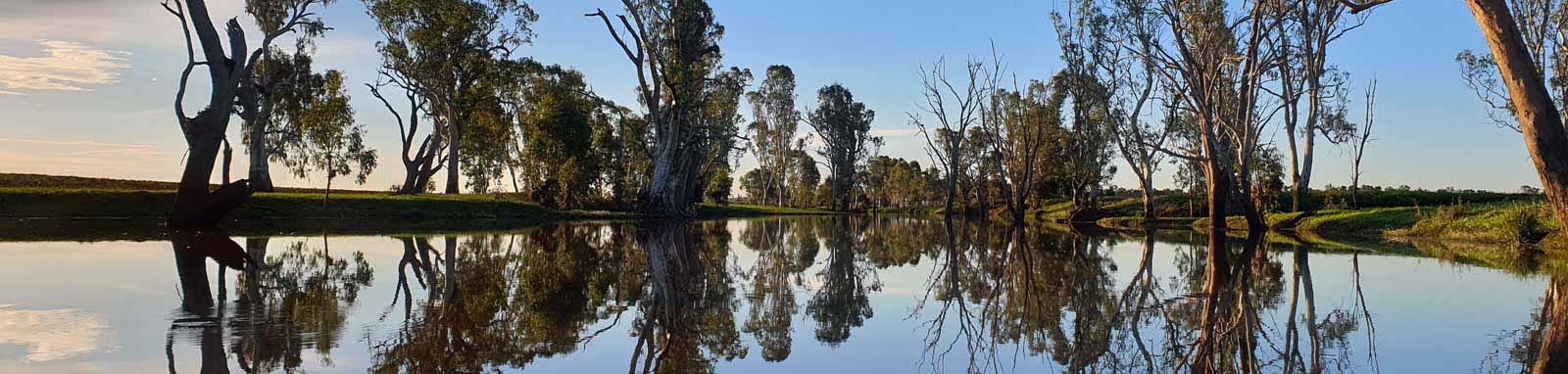
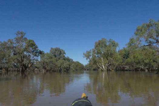
The Darling River is perhaps the outback's most famous waterway. It was once vital for travel and commerce on top of a long Aboriginal history that stretches for tens of thousands of years. This history can still be seen today, from the fish traps on the Barwon River that could be the world's oldest standing man-made structure, to the historic Tilpa Hotel and the heritage paddle-boats that still operate at Wentworth. The waters of the Darling River eventually join up with the Murray River before flowing out into the Southern Ocean near Adelaide.
The Darling is part of the longest continuous river system in Australia. Looking upstream, the Condamine River is the most remote source, near Warwick in Queensland. This flows across the Darling Downs and joins with Dogwood Creek to become the Balonne River. Below St George the river disperses out over the Culgoa floodplains, where the Culgoa River is the major distributary. Eventually most of these branches rejoin up with the Barwon River where the waters form the Darling River.
Key sections of my own trip down the Darling.
- Prelude: Mt Superbus
-
Blog 3 - 4 Jun 2020
Walking from the summit of Mt Superbus down to the first crossing. - First Leg: Upper Condamine
-
Blog 15 - 19 Feb 2020
Inflatable kayak from the first crossing in Cambanoora Gorge to Warwick. - Second Leg: Lower Condamine & Balonne
-
Blog 23 March - 25 April 2021
Sea kayak from Warwick past Surat to St George - Third Leg: Balonne & Culgoa Rivers
-
Blog 11 - 22 March 2020
Sea kayak from Surat past St George to Bourke - Fourth Leg: Darling River
- Blog 1 - 22 May 2021
From Walgett to Bourke down to Wentworth - Firth Leg: Murray River
- Blog 23 May - 10 June 2021, Wentworth to the ocean
| Rivers | States | Length |
| Condamine River | QLD | 730 km |
| Balonne River To the Culgoa River | QLD | 365 km |
| Culgoa River | QLD, NSW | 443 km |
| Darling River | NSW | 1,545 km |
| Murray River From Wentworth | NSW / VIC border, SA | 832 km |
| Total length | 3,915 km |
GeoScience gave a length of 1,195 km for the Condamine/Balonne/Culgoa Rivers and 3,672 km for the complete system using 250K maps, which is significantly shorter than my measurements off the satellite images.
The most common starting point for people paddling just the Darling River is at Brewarrina on the Barwon River. Brewarrina is 121 km upstream from the Culgoa River confluence that marks the official start of the Darling River. It is a 205 km leg between Brewarrina and Bourke.
Guides, Resources and References
General Overview and Location Guides


Gear
Refer to the Murray River Gear Section for a discussion about kayaking and camping gear.
I would look at a creek boat (high flow) or packraft for the upper gorge. The section from Killarney to Warwick was choked with log jams, so you will be entering and exiting your boat on a regular basis. A shorter length boat would be easier to handle in the narrow creek. A tested repair kit is vital for an inflatable.
The river opens up below Warwick and a canoe or sea kayak would be recommended. Small sections of easy rapids above Surat and a few more just below Beardmore Dam, otherwise generally flat water paddling.
Planning
Information to ensure an enjoyable and successful trip.


Additional Information


My Personal Journeys
My rambling blogs and trip tables for trips down the Darling River system.
I am planning a Goondiwindi to Wentworth trip (2023) and I will update the Barwon and Macintyre River blog and trip table with the details of the entire trip once completed.
Source to Sea (2022)
The complete Source to Sea attempt in one single continuous trip.

Darling Double (2022)
Short blog and trip table from my 2022 Darling Double trip where I paddled down the Darling River before heading straight onto the Great Darling Anabranch that was flowing for the first time in nearly a decade.
Darling River

Great Darling Anabranch

Source to Sea (2020-21)
The complete Source to Sea trip that was spread over a year as I made use of two separate rain events to traverse various sections while being interrupted by COVID restrictions.

