Risk Assessment
My personal take on the dangers of the trip
Traversing the complete Murray-Darling System 2020/21
I first comtemplated paddling the Darling River while camping with family along the banks of the upper Condamine River back in 2015. However, a lack of both time and rain prevented me from seriously considering attempting it for nearly five years. With an la Niña finally breaking the drought, I finally got the opporunity to complete the trip while running through a gauntlet of covid-19 restrictions and hurdles.
My journey mostly followed two separate flood events, one in autumn 2020 and another the following year. The first flood allowed me to complete the upper gorge and also the remote lower Balonne and Culgoa section. After a year delay due to covid-19, I restarted from Warwick and paddled all the way down to the ocean, although I had to skip repeating the Culgoa due to lack of flow and instead paddled the Barwon from Walgett.
2020
15 - 19 Feb 2020
Six days in an inflatable kayak from the first crossing in Cambanoora Gorge to Warwick.
11 - 22 March 2020
Sea kayak from Surat past St George to Bourke
3 - 4 Jun 2020
Walking from the summit of Mt Superbus down to the first crossing.
2021
23 March - 25 April 2021
Sea kayak from Warwick past Surat to St George
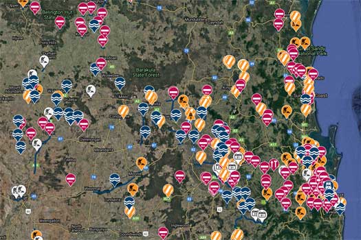
After a wet week, I finally picked up my new car yesterday, an old Subaru Outback. Given it had a minimal 7 day warranty, I decided to take it for a test ride up around Warwick and back via Killarney to see my sister. This was my first introduction to the flooding across the dividing range that had been going on for nearly a week. This drive also took me along the upper sections of the Condamine River. The Condamine was navigable!
Rain, even flooding... Maybe, maybe, maybe, is this trip really possible?
Even with only the old inflatable kayak, I decided to try and give it a go. With another forecast rain event Thursday, I estimated that Friday was likely the best day for departure. I didn't want to leave earlier in case I got caught below the potential flood waters. This gave me 2.5 days to plan, organise and pack for the trip.
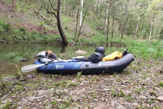
The rain was not as heavy Thursday night and Friday morning as forecast, but the river gauges were still showing a decent flow down the Condamine. It was well below flood levels but still much higher than normal. I headed out late Friday morning towards the upper gorge. I hit a temporary hurdle just a few km from my brothers' camp where I came across a locked gate. I back tracked up and had a chat with one of the local farmers and he was happy for me to bypass without raising any alarms (big fines possible if I got a ticket doing this).
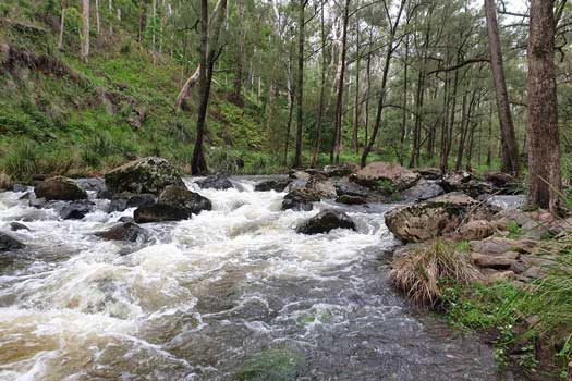
I finally put in about 4pm and got in 3 hrs paddling downstream. Even as a small creek, I only had to drag the kayak over a couple small bouldery sections and two portages over downed trees. Maybe around Grade I to II, but the inflatable did get caught in a few sieves and I had one swim. Like the Murray, these short whitewater sections were going to be some of the best paddling highlights, and the local environment of the healthy gum forest and rocky cliffs made this section special.
The kayak was also having a bit of a hard time. One of the small drags had put too much pressure on the canvas and ripped the seam and this was progressively getting worse. After a couple of hours the seam gave way completely and the bladder squeezed out like a balloon. I had some spare 8mm cordage for portages that I used to tie the outer canvas back around the inner tube and this helped reshape the kayak back into shape. Rough and inner tube exposed, but it was still holding together enough to continue. Late in the day, the floor inner tube got a puncture and that started a slow leak too. Luckily it didn't add that much to the overall buoyancy, albeit slowed the speed slightly. I pumped it up occasionally and kept going. Since the river course was close enough to roads all the way down to Chinchilla, I wasn't worried about a complete inner tube failure so I kept going.
It was getting dark when I lost my pack overboard for about the third time. While retrieving it, I lost my footing and was caught in a strainer that sucked me under. Maybe it was not a good idea to keep going past dusk! Nearly completely out of the gorge, I set up camped on the river bank with one eye open in case it rained during the night.
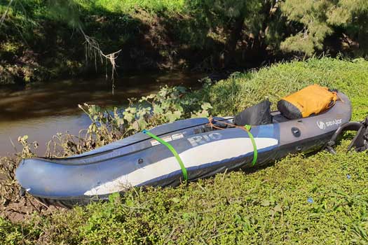
I had mostly pleasant paddling down the lower gorge. The river was flattening out and rapids were few and far between. I spotted a couple of Platypus in the pools, one surfacing right beside the kayak. The water dragons became a lot more common as I made it into flats. Most reacted to hearing / seeing me by jumping into the water, only to realise that I was actually on the water and they would panic and swim back to shore before scurrying up the banks again.
Barbed wire fences became common and it required a lot of care with the inflatable kayak. I managed to either lift up the fence and carefully glide the kayak under, or those that were damaged in the flood water, to glide over the wire. It seemed to be the tree changers, the less experienced weekend farmers that constructed the worst and most dangerous fences across the river that were typically destroyed in the flood, while the real farmers downstream made simple and easily replaced fences that seem to handle the flood waters much better. The latter were much easier to traverse.
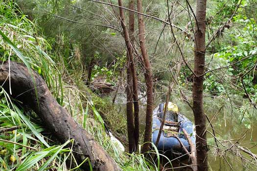
It took most of the morning to reach Killarney, where I stopped to get some tie-downs (cam buckles) to replace the rope that was holding the boat together. This seemed to help avoid getting as many snags. As I left Killarney, the stream became narrow and the banks became tall and much steeper. Water depth was almost always deeper than 1.75 m. The river zig-zagged and log jams became very common. Even with the great flow, the next two days paddling were extremely slow. While I could drag / lift the kayak over many log jams, portages were required on a regular basis and the steep muddy banks made it extremely difficult to exit the stream.
Nearing dusk I found a spot where the bank wasn't overly steep where I was able to scramble up the muddy bank to make camp for the night.
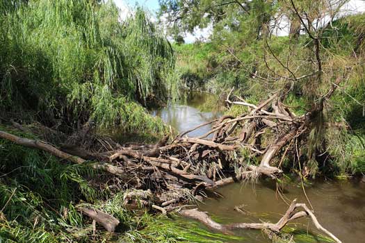
I had the feeling of being lost in a maze of log jams all day without seemingly making any progress towards Warwick. These were even more common than the day before.
The strategy that I used on the log jams was to pull the logs out from the jams till I could get the boat through, or to do a tricky portage around the jam. The former was like playing a game of Jenga at times, desperately waiting to pull out the log that would make the jam disappear downstream with the current. While this was usually much faster than a portage, this was slowly shredding the skin on my hands as I handled the coarse she-oak (ironwood) bark with wet hands.
The day started badly with a short 50 m section where the banks were almost vertical with 3 large log jams in quick succession that I had to exit the creek to bypass. The banks were close to vertical and each step that I made in the soft dirt seemed to crumble away. To add insult to injury, a 4th log jam just around the corner that required another portage. It took close to an hour to traverse the log jams in this section. Luckily these become less common during the day, but enough to ensure that minimal progress was made today.
I was still close to some farmhouses as it was getting dark, so I set up a hidden camp in the long elephant grass. Cold dinner of couscous and tuna.
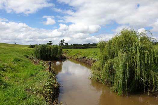
Another fairly slow day due to the amount of log jams from the flood. Both weirs and concreted fords became more common in this section. Generally these were not overly difficult to traverse, but the odd portage was needed. There was one particular nasty drop off directly onto rocks that was about 1.5 m high.
I stopped at Craike Rd Bridge and managed to arrange a few supplies from my sister who was driving by doing her weekly shop in Warwick. It really was water that I wanted. The stream water was really too muddy to filter, and I felt slightly nauseous drinking the boiled water. Much better to get 15 L fresh water! I got some fresh fruit for good measure. Being mid-afternoon, I decided to call it a day and try to fix up the kayak. Sadly, the puncture repair didn't hold on the PVC tubing and I couldn't fix the floor inner tube.
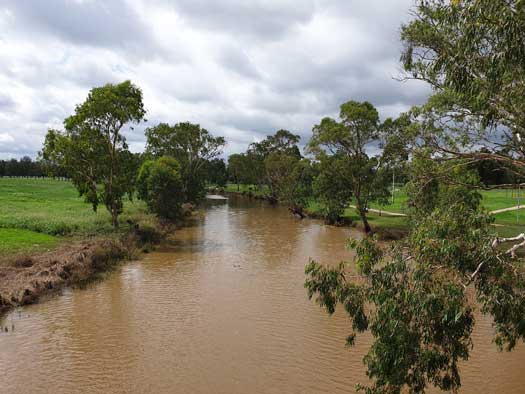
As I turned northwards, the river opened out with the she-oaks being replaced with river gums. It made for much nicer paddling with minimal log jams. The narrow sections were much nicer than those paddled upstream and while the water level was dropping quickly, these sections were still quick in the ducky. There were also a lot of long deep pools that were a bit of a slog in the inflatable kayak that was not designed for speed. The banks were still fairly muddy from the recent flood that made the less common portages difficult still.
By the time I crossed the Warwick Killarney Rd, the river was mostly wider and deeper now. Enjoyable paddling with minimal flow. Being latish in the day, I made camp early just before the build-up of houses upstream of Warwick.
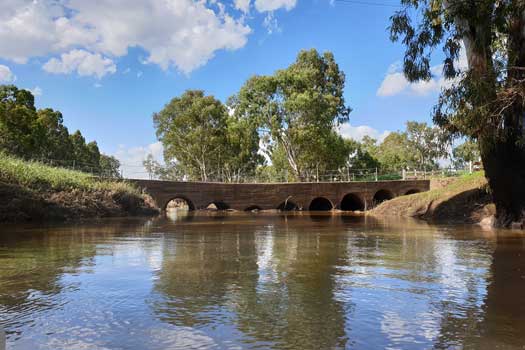
Up early and arrive at Warwick at 9.30am. I get some super glue to try to repair the kayak puncture and a few more fresh supplies. I'm still optimistic about pushing as far downstream as possible, Dalby or further would be a target even in the slow kayak. After finding a nice spot downstream of Queens Park, I pull the boat up and fix the puncture.
After waiting an hour for the glue to dry, I pump the boat up only to find a second more major puncture where the valve rubbed through the opposite site of the tube, about the size of a 10 c piece / dime. So another patch and another hour of waiting. This time it seems to have done the trick, albeit I'm not really trusting that super glue is going to hold together that well, time should tell.
Sadly, I never found out how well the patches were going to last. I did make it through Warwick and into the countryside, however the inflatable kayak had a fatal run-in with a sharp branch and popped. I barely made it to shore before it deflated completely.
I call in a pick up and start contemplating how to tackle the next leg.
After a 3 week delay prepping and planning, there was no longer any flow seen anywhere between Warwick and Condamine Township. As such, I started from Surat, which was the next town downstream hoping I still had a chance at catching up to the flood waters.
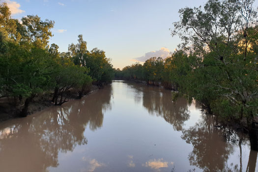
I was ready to set off after about two weeks, over planning the Condamine to Culgoa stretch of the system due to the remoteness and high potential risk. Sadly the water level was dropping rapidly and already there was no flow anywhere between Warwick and Dalby. Flow was enough to start at Chinchilla, but I couldn't find anywhere with long term parking for the car and had warnings from both the local information centre and the police not to leave the car unintended anywhere due to a spike in stolen cars. I decided to wait another week and caught a ride with my brother who was making the trip down to Wentworth for work. By Sunday, flow had stopped at Chinchilla and Condamine, and even Surat was starting to look low. I was concerned about starting from St George, which would throw me directly into the longest and most remote section without any knowledge of what was in front of me. Luckily it rained at Roma and it pushed up the flow at Surat.
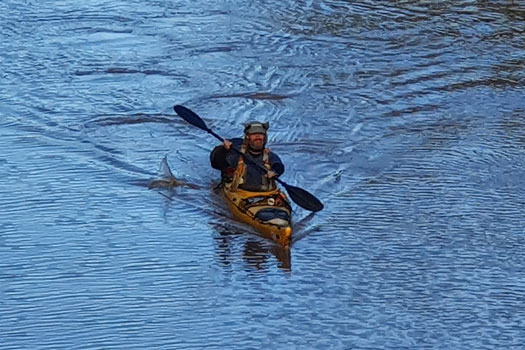
Arrived at midnight and couldn't assess the river till the morning. Up at dawn and was pleasantly surprised at the gentle flow. This gently helped propel me down the river with an extra 1 or 2 kph. No wind, sunny and pleasantly warm, it was a fantastic way to start back on my journey.
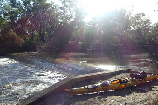
Only a km or so down I hit the first weir and quickly realised the hidden dangers on the river as it had a particularly nasty hydraulic jump that would have sucked me under like a rag doll. There is a reason these are known as drowning machines! With a perfectly level lip on the weir with no spray, it was hard to see and luckily I heard it in time to move to the side of the river. Visually I would have only seen this very late and it would have been a struggle to react in time to avoid the drop. This was one of the three low head dams between Surat and Bourke that I had to navigate, there are others along this section of river, but all were submerged by the high flood waters.
The nature of the river changed below the weir and the current picked up slightly. Longish flat water sections with 2 - 3 kph flow were separated with short, narrow and faster falls. You had to stay alert to navigate around any downed trees as the canopies act as fairly nasty strainers. Luckily, the water was high enough to clear any fallen logs and there were no log jams. Average speed along this section was the fastest at nearly 9 kph.
Flow 35 Cumecs and rising. Peaked at 96 Cumecs 36 hrs after leaving Surat
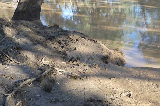
After what was likely the muddiest campsite ever, I continued down the river. Mud was a feature on almost every campsite and river exit from Surat to Bourke. It was impossible to avoid. The only variation was the stickiness and depth. As a guide to how sticky it was, I didn't clean the mud off my paddles one morning and even after an hour's paddle, the mud was still sticking to my carbon fibre blades!
While I seemed to be catching up on the higher flood flows throughout yesterday's paddle, the water level had fallen about a foot overnight. It still had a decent flow and great depth.
Over the course of an hour or two, the nature of the river changed from a relatively fast creak to a slow river. While I was still nearly 100 km from Lake Kajarabie, the high dam water level had banked the water back about half water to Surat. Sulphur Crested Cockatoos were particularly common and noisy today. They weren't the smartest though, as I got close they would set off with noisy alarm calls and fly about 200 m downstream only to repeat the process as I caught up to them again.
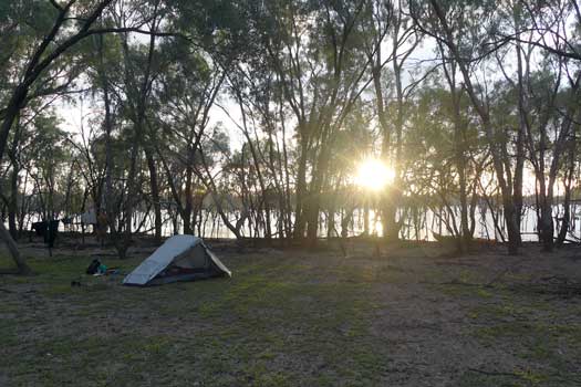
Once past Eagle Bend, you really start getting into the wide flat waters of Lake Kajarabie. The birdlife really picked up too. This is an artificial lake and there were 1,000's of dead trees that provided great nesting grounds for a wide array of birdlife. The maps were absolutely useless here with the high water level, but for the most part it was easy enough to follow what would have once been the old riverbed.
I camped on a low island in the middle of Lake Kajarabie. Even though the lake was at 103%, this island was definitely flooded just weeks before, but with a falling water level, I felt content to stay here for the night. I think this was one of my favourite campsites of the entire trip.
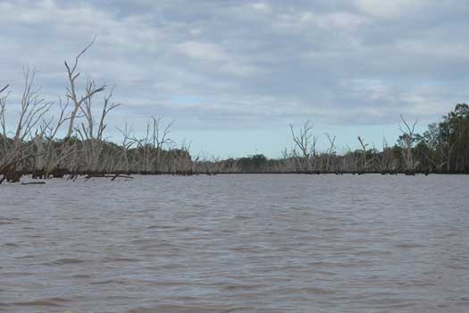
It was becoming even more difficult to navigate Lake Kajarabie due to the high water level obscuring the normal shoreline. I nearly took a wrong arm of the lake on at least two occasions. I had to resort to the GPS unit a few times to confirm the right direction to head. While you would eventually find your way, a wrong turn could add an extra hour or two onto the trip.
I was glad I was in a plastic kayak here too as I couldn't count the number of times I hit submerged logs along the way. While normally it would just bounce over or broach hard onto an edge, occasionally you would come to a screaming halt as you grounded on a trunk. The lake water had hardly any visibility due to the inflow of the flood waters so it was impossible to see these submerged hazards. Due to the submerged trees I avoided trying to do sneaky shortcuts and tried to stay on the main channels.
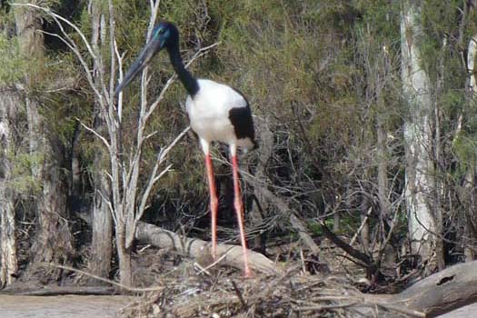
There was a significant portage required to get past Beardmore Dam. I initially took the kayak out beside the picnic area above the buoy line on the eastern side of the dam. As the road turned away from the river, I scouted out the dam and quickly realised that I shouldn't have gotten out so soon. There was a closed boat ramp with unlocked gates that allowed me to cross without unloading the kayak. It was about another 300 m to the put in point below the dam. I only scouted the left side and this is likely the best side to tackle the dam.
Even with the high flow release, the next few km below the dam were the shallowest of anywhere that I saw during this trip. The river snaked through low scrub and decent flowing branches quickly ran dry with a lot of shallow rocks hidden under the muddy water. I was forced to backtrack at least 3 times to find deep enough flowing current to continue. Again I was glad that I was in a plastic kayak as it took a bit of a hammering along this section.
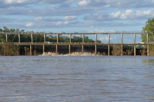
Finally meeting up with the headwaters from the St George weir, it was easy paddling. At St George, I restocked up on some supplies of fresh food albeit I still had 2 to 3 weeks supplies of dry food. With my water purification systems untested in the muddy flood waters, I also stocked up with 30 L of water hoping this would get me to Weilmoringle.
There was another major portage around St George weir, ~200 m. Being late in the day I only made it about 2 or 3 km down the river before making camp on the gravel shoreline. There was a significant amount of broken glass to avoid.
Flow was 100 Cumecs.
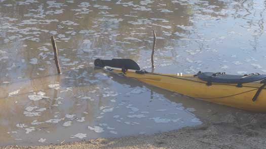
The river had risen more than expected and the kayak was partially in the water when I woke in the morning. I'm glad I was in the habit of tying the bow line onto something every night!
After hearing the rapids all night, I finally discovered the source of the sound. A short Grade II section. It was difficult to say if this was natural or if it was part of a submerged weir. There was a nice line straight down the middle, but a 5 m fully laden sea kayak wasn't really on with the amount of rocks. If I had tried and gotten into trouble, I would have been risking damage to the kayak and potentially even my life on the strainers or capsized without a helmet on. Luckily there was an easy sneak to avoid another portage.
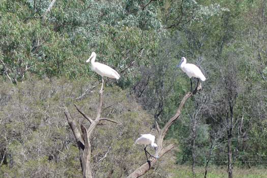
For the most part it was relatively easy flatwater paddling for most of the day down to the Culgoa and Bokhara river heads. However there were times where the river would channel and occasionally become tricky to navigate. Missing the main flowing channel once caused a bit of grief as I had to tackle shallow flow with multiple log jams. I managed to make it through without backtracking / portages, but it was definitely much harder. This 2 km side trip took maybe an hour before meeting up with the main channel again. This is potentially what the river would be like with a low flow. Not pleasant nor recommended!
As I got close to the main divide I started using the GPS to ensure I didn't miss the Culgoa turn. In hindsight, this wasn't necessary. The Bokhara River was nearly completely blocked off with trees and would have been easy to miss without tracking where you were on the map. The Culgoa River is the only likely possible route to follow even in these high flows. Camped at divide wondering what the next section would bring.
Flow was 130 Cumecs, up from 100 Cumecs from the day before.
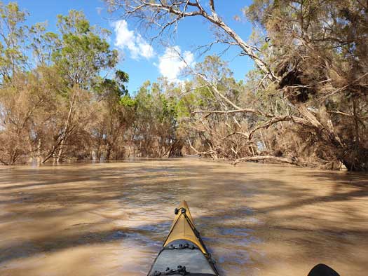
Portage required just 500 m downstream over a weir. Complete unpack to get the gear and boat over a barbed wire fence. This was the first of two weirs for the day, I was able to wheel the kayak around the second weir without unpacking thankfully. I saw a lady fishing at Cubbie station and got a simple "hello" without a second glance. Maybe it is common for kayakers to paddle past in the middle of nowhere!?
After yesterday’s detour down a minor channel, I was taking no chances today and was checking the GPS unit every time there was a major split as well as taking the time to assess where the major flow was going. While most of these channels were short diversions, some were much longer.
There was a noticeable decrease in birdlife and an increase of goats. Fly levels were unchanged.
Flow was around 50 Cumecs, slightly ahead of the release from the Beardmore Dam seen the day before.

The river was becoming a maze today. It would branch out and slowly the flow reduced then the branches would come together again and the flow would increase. Occasionally branches just seemed to disappear into the surrounding floodplains never to return. There were more downed trees and log jams today, but none required any portages.
Pulled up to camp only to find a sea of mud. Looking around I found a single dry spot that was big enough for a tent, but looking up I saw three dead trees all leaning directly over this spot. I decided to kayak down to find another spot a few hundred metres down the river. Little did I know at the time, but I had taken my life jacket off and left it hanging up at this first camp site. The second site was higher and I set up for the night.
I had my first attempt using Alum to treat the water. Never having used it before, I used a full tablespoon and left the water overnight to settle. In the morning a quick boil to treat the water and a taste test revealed a horrible salty taste. I still had heaps of water from St George, so I wasn't too phased as I poured it out onto the ground.
Flow was around 50 Cumecs.
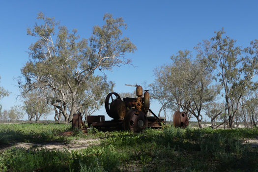
I really was "back o’Bourke" now, well almost. The river gums lessened and were slowly replaced by Brigalow-Gidgee woodlands. The height of the banks were decreasing, or maybe the height of the floodwaters were increasing maybe? Like yesterday, it was still like a maze of channels in places, but I was slowly getting more used to this and was finding it easier to take the correct channel, most of the time.
I was about 3 hours down the river when I realised that I didn't have my life jacket. I couldn't believe it. I forced myself to double or triple check the camp site for gear / rubbish every morning, how did I miss it? Then I remembered the campsite shift from the night before and I realised what I'd done. I wanted to kick myself and I knew that I had gone too far to even contemplate going back for it.
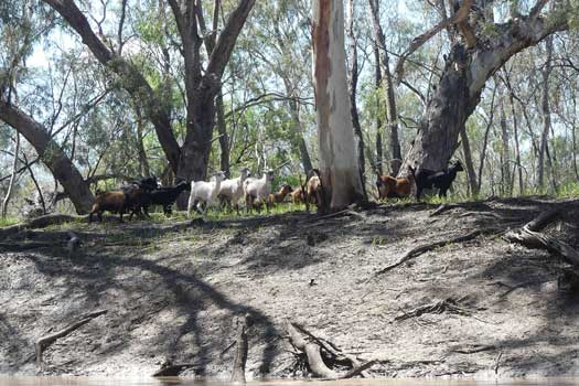
While the Acacia was now the dominant tree in the area, there were still just enough of the taller river gums surviving to mark the course of the river. This would prove invaluable in the coming days to define the path of the river. The national park surveyed 24 mammals, 170 species of bird, 29 lizards, seven types of snake, and 15 types of frog, but I was finding the woodlands nearly completely devoid of life, well devoid of anything other than goats.
After a morning paddling along mainly isolated woodlands, it was surprising to see the build-up of houses and sheds around Brenda station, including a flyby of a farmer in his mustering copter. I push on for another few km before making camp for the night. I tried playing with the Alum for water again, but still used way too much Alum and it was too salty.
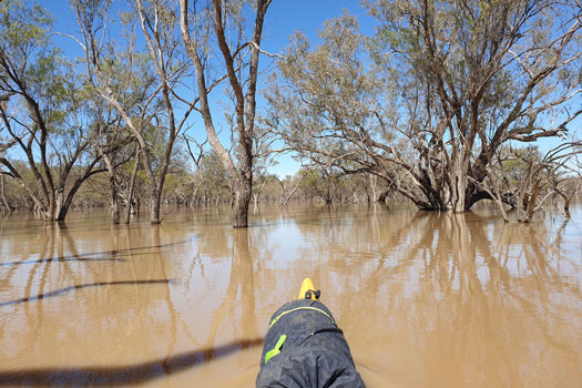
I have definitely caught up with the flood waters now. It was pleasant paddling down a wide flowing river for the majority of the day and the river spread out into the flood plains on a regular basis making it feel like an inland sea at times.
As noted already, the river gums were important markers to define where the river was going, and usually you could see the main flow snake its way in the general direction of the river gums in the distance. If you missed the main flow, you would quickly start hitting submerged logs and / or mud and you would be forced to backtrack into the main channel. It was actually mildly frustrating at times when you wanted to take a straight line shortcut but you would be forced to snake left and right through the most indirect path that was 3 to 4 times longer than a direct path across.
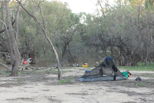
I set up camp early and finally nailed the use of Alum for water purification. I was actually starting to run low on water and while there was still a slight salty taste, it was drinkable. Second lesson on water treatment, use a lid when boiling it over open flames. The water picked up a fairly smoky aftertaste!
It was hot work treating the water and this inspired me to take the first swim of the trip. I think this may have been my first ever swim in brown muddy looking water, but it was surprisingly pleasant after a week without a shower and definitely refreshing.
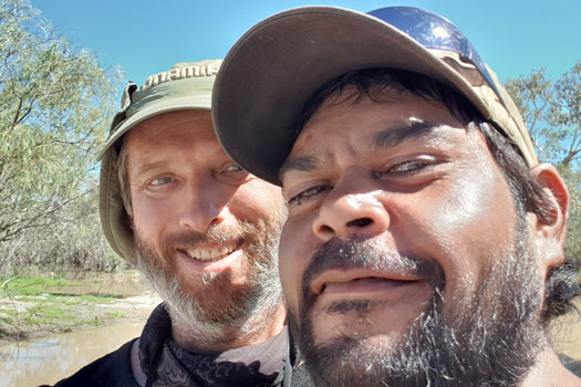
Weilmoringle is a tiny remote indigenous community of less than 100 residents in far western NSW. It rarely makes the news except for the occasional flood that will isolate the township, or maybe with a rare tour by politicians in times of drought. With the high floodwaters I was able to paddle right up to the flood banks beside the main housing area. You can tell the locals are having a hard time at the moment with the current drought making farm work scarce. It was a fairly hot day, and I couldn't see or hear anyone except for the background hum of the odd air-conditioning unit. One of the locals was out watering his garden and he happily let me fill up my water containers. It was really nice to be able to chat to someone else after over a week on the water with no social interactions. He cheekily suggested a lot of paddlers make it down past the town, naming Marks (2017) and the Condamine boys (2011) trips past. After 30 minutes or so, I head on down.
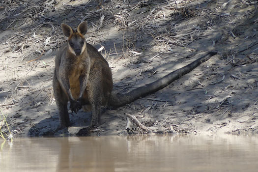
Below Weilmoringle the terrain changes slightly and I was able to take a few shortcuts rather than being forced to follow the main river channel. Like the Culgoa floodplains the river had mostly broken its banks but there was more variation of height unlike the floodplains that were perfectly flat. This allowed for deeper shortcut sections. The main danger of the shortcuts were fences. If the water wasn't deep enough and you did find a fence, you would be forced to portage over or backtrack. I generally avoided doing these unless I had a clear view across the shortcut down to where I thought the main river course was flowing. That was usually estimated by one of the few river gums that stuck its head out over the lower Acacia woodlands. And unlike the floodplains above, you started getting more defined shorelines again. Normally the flood waters would stretch out between 500 m and 1 km.
Being the 9th day on the water without a proper break, I felt very lethargic today. I found a nice campsite, and stopped early. Enough time to heat up some water and take a swim and a shower to wash off the mud and dirt. It was so nice to feel clean again! I also play with the Alum again and nail the process.
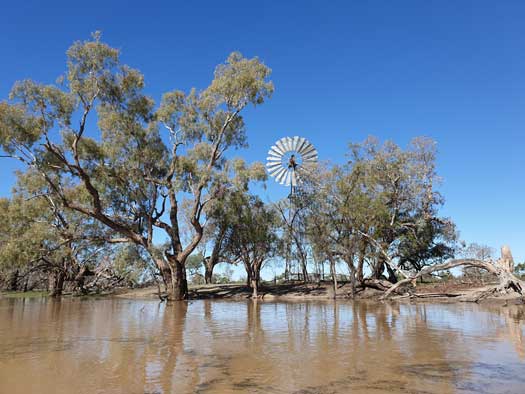
It felt like déjà vu today. Paddling left and right down through a similar flooded landscape. I was taking more ambitious shortcuts and often hit shallow ground that forced me to paddle back up against the current to the main flowing channel. I really wanted to stop and rest up, but also wanted to push on to the Darling River.
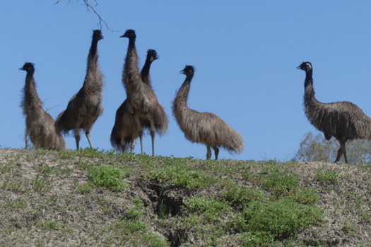
I saw my first ever emu in the wild. There were a pair drinking by the water's edge, but they spooked easily and sped off across the paddocks. Wallabies seemed common and I didn't see a Kangaroo all day. I saw my first cow today too. I had expected to see more livestock travelling on and off through farmland all trip. Low stock numbers were likely due to the ongoing drought and many farmers would have destocked their herds.
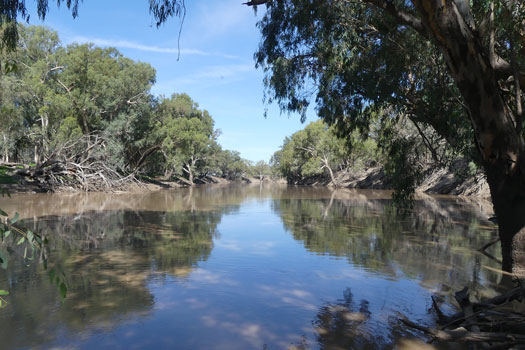
I did a big water cook up this morning. I managed to completely refill my water supply, enough to get me to Bourke hopefully. It is a time consuming process having to boil a couple of litres of water at a time, then wait for it to cool slightly before starting the next pot. I finally hit the water around 8:30am.
The morning paddle was similar to the previous two days, but it definitely had more of a farmland feel to it. It felt that I was getting back into civilization even though there wasn't actually much increase in farm houses yet.
After around midday, the river was slowly channelled back into a river and the banks slowly started to increase in height again. It may get rather repetitive if these banks block out the view all the way to Wentworth!
I finally made it onto the Darling River at about 3pm. The Barwon River is definitely the more major river, but the majority of the flow seems to be coming from the Culgoa River. I quickly discovered the need to change my paddling technique to generally stick to the outer edge of the river channel to follow the flowing current. The other main change was that Black Cockatoos appear to have replaced the Sulphur crested cockatoos.
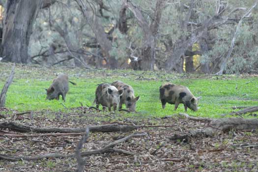
The Darling has much higher banks again at about 8 metres above the main river, similar to those last seen at Surat. It is going to make camping harder. I find a spot where I can pull the kayak up out of the water and make camp for the night, sharing the spot with a family of wild pigs that didn't really seem to care that I was there.
I was planning to have my first full rest day today, having made it out of the Culgoa safely, but as the campsite isn't overly nice, I pushed on.
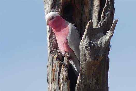
The morning was mostly spent chasing Pelicans down the river while tracking left and right trying to follow the current. Birdlife in general was picking up a lot again since leaving the floodplains, Pelicans, Kites, Red-tailed Black-Cockatoos and a wide variety of various parrots were all common.
There were a few people fishing at Mays Bend, the first people that I had seen since Weilmoringle, but I just wave and continue on my way. Mays Bend is a free camping spot with no facilities at 30° 2' 23.6" S, 146° 1' 23.9" E. From here there is a slow build-up of houses before Nth Bourke and limited camping spots until you are well past Bourke itself. I later found out there is a rest area at Nth Bourke and that apparently has a toilet block too.
Since I was planning to stop and resupply at Bourke in the morning, I paddled past Mays Bend and struggled to find a camping spot away from houses. I finally found one just upstream of Nth Bourke. After struggling a bit to get the kayak up out of the water I started to set up and this was when I got a text from my brother.
He was asking if I wanted to be picked up and this came as a complete wtf moment. While I was on the water, the world had finally seen the horrors of the coronavirus, and he had been glued to the news all day. Tasmania, South Australia and the NT had closed their borders and Queensland had just announced it was doing the same. Having portrayed a zombie apocalypse in a police state where I was going to be locked in South Australia all winter if I continued, I took up the offer to get picked up. So I repacked and headed towards North Bourke where I stopped at the rest area. My brother decided to drive up that night, doing an all-nighter and I drove back to Ipswich the following day.
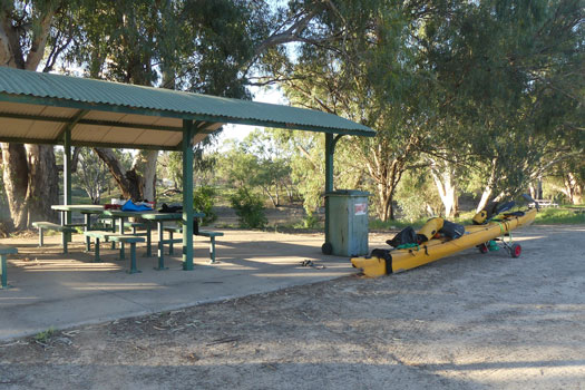
In hindsight, this was totally premature. I could have kept going and the 14 day self-isolation period in South Australia would have been done on the river, and upon arriving back into Queensland, I'd just have to self-isolate again for 14 days. As soon as I discovered this after getting back, I tried to reorganise going out. Bourke is about the worst spot logistically to get to. It will require a boat drop-off, and if I can't leave the car there, to drive down and park the car at Wentworth before busing back to Bourke.
I finally managed to find a place to leave my boat in Bourke, and a long term parking spot in Wentworth, but literally minutes before I was intending to leave late on Tuesday afternoon, the place that I was going to use for parking in Wentworth had to cancel, and this stopped me from returning. The QLD borders closed 7 hours later at midnight.
So the trip is over for the time being and I am stuck in Ipswich waiting to get the green light to continue...
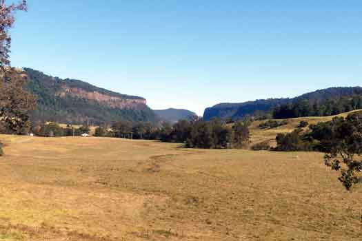
With restrictions starting to lift, I was finally able to head out and continue the Condamine. This was simply a walk along the Condamine River and Spring Creek roads from the first crossing to the source near Brett Rd. A rather uneventful 25 km walk taking care avoiding the higher than normal traffic flow as others also escaped the big smoke for a taste of the country.
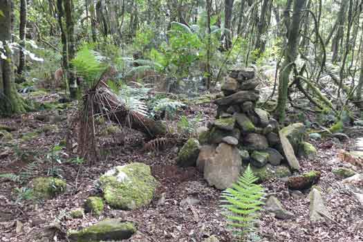
After a cold night camping, I headed up to tick off Mt Superbus. The majority of the track was fairly easy to navigate but it was almost a scramble at times. Most hikers appear to stop at the rock cairn that signals the north peak and I had to leave the trail to find the true summit that was nestled in a small patch of tree ferns. While it was a sunny day, clouds obscured the sun at times and this made navigation relatively difficult for such a simple ridgeline hike.
If you plan to do this hike, definitely take a compass to enable you to track true north without the sun nor landmarks and even a backup GPS unit is recommended to help find the actual submit (28° 13' 17.9" S, 152° 27' 20.4" E).
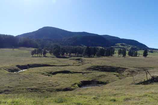
There was enough time to go for a drive out west to assess the conditions for the upper Condamine. Flow had stopped back in March, but I was still hopeful that the majority of the river could still be paddled, even if it did mean frequent portages. Sadly water levels were extremely low and it definitely didn't look possible. The land seemed to be sucking all of the trapped water out of the river. This will have to wait for the next rain.
I headed home a bit deflated, and now patiently waiting on either the borders to open or for an out of season rain event to allow me to continue.
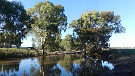
Watching the floods provided some hope of returning to the Condamine. The storm that caused the rain to fall on the northern rivers had overflown the borders and was also falling on the Darlings Down. The Condamine was in flood. However with flows up around the 100 cumecs mark, I waited for these to subside. Wednesday next week should be about perfect.
Mostly packed and ready to go Monday and I heard the news that I didn't want to hear. There was a local Brisbane lockdown due to covid. While I could have made it to Warwick by 6pm legally, I followed the health instructions to stay put. Even with the early lifting Thursday afternoon, I wasn't able to organise a start in time and by Monday the flow was too low. I had missed my chance....
A fortnight later, the forecast rain the weekend fell in the upper Condamine, enough to paddle. A smaller fall at Toowoomba made a smaller intermediate flow too. Nearly a month after the floods, I set out again.
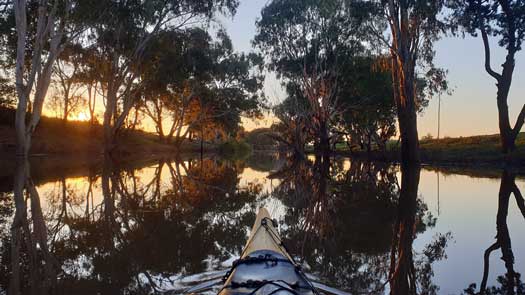
I finally started at 5pm and had an hrs paddle, just enough time to clear Warwick. It felt great to be back on the river. Unlike the last time at the Victoria Rd bridge, the water was fairly high but well lower than the recent flood marks that were a few metres higher.
Cold night, maybe I need my winter weight bag. Single digit temperatures are a bit cold for this Queensland lad. That’s sub-50°F for any American readers.
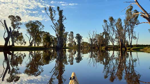
Good days paddling with a taste of things to come. Three log jams, two fallen trees, two weirs, a road and a low bridge required portages, some required me to drag the kayak up steep muddy banks. I still managed a good 70 km.
I had a lot of water dragons, turtles and birds for company.
It was rather ironic looking back and noting I could remember all of the times I had to exit the boat to portage. Little did I know what was ahead...
Really cold night again. Nearly too cold even with all my spare thermals on. Maybe I need some pogs to keep my hands warm while paddling first thing in the morning too.
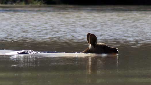
I spooked a small mob of Roos mid morning and they twice crossed the river ahead of me. It's the first time I've seen swimming roos in the wild.
I somehow managed to lose my sunglasses on one of the on-water protages. That made for a nasty afternoon paddle into the sun.
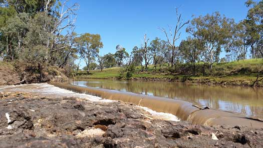
A side trip to Cecil Plains store, which is at the far side of the town. It ended up being a long detour to buy the replacement sunglasses, particularly after the two portages for the weir and old low bridge.
While I started at the rear of the flow I think I'm starting to push ahead of the flow with the odd grounding on shallow sandy patches.
Mostly under the influence of weirs or still pools for most of the day. There were very few free flowing sections.
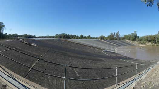
More of the same today, making landfall beside the shooting range 8 km from Chinchilla. I jogged the first 4 k in bare feet to ensure I made it in time. A fleece blanket and additional food.
It was fairly late by the time I got back to the river so I bivvyed by the river rather than pushing down to the camp at the weir. I was still undecided but there seems to be enough flow to continue.
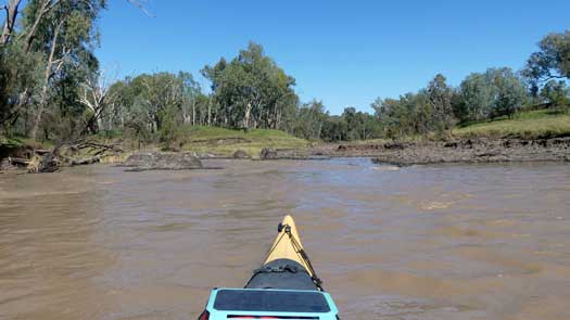
A gentle couple of hours paddling and birdwatching to the weir. Seeing the flow there will determine my next move. There seemed to be enough water and I decided to bite the bullet and continue.
Just a km or two downstream I was really wondering if I should reconsider. A short rapid section required a portage (no water) and then I had a km of constant log jams. It was so bad you had to consider if it was worth getting back into the kayak or to simply walk the kayak to the next jam.
By lunch I was having to haul the kayak down the riffles between pools. I was getting plenty of practise getting in and out of the kayak! I also discovered an unexpected hazard exiting these small riffles, quicksand! The recent floods had deposited a large volume of sand that was still settling at the top of the ponds. The first time I sank all the way up to my chest, only arresting myself by grabbing onto the kayak. These soft sand sections have become common.
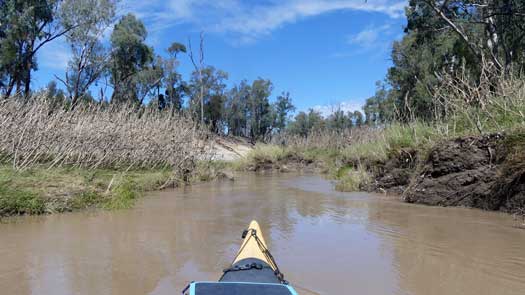
The river rose 10cm overnight, enough to make paddling the riffles possible again, at least for the first couple of hours till lunch.
Log jams are commonplace with the low flow. Maybe 40 today though it felt much higher than that. That isn't counting the fallen trees or logs that you could slip under or over without getting out of the kayak.
Couple rocky sections of mud rock required careful portages to avoid cheese grating the boat. With a decent flow these would make for easy Grade I / II rapids but likely wash out in high flows.
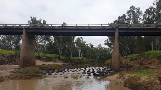
The stretch between Chinchilla and Condamine made me really consider if I should stop or continue. I figured there was a following flow above me in a couple days so I lent towards the latter.
About 90% of the day seemed to be on flat weir or pool water. This was probably a good thing as I would have been crossing the gap between the two flows. Unbeknownst to me, the flow I caught at Warwick would eventually fail to reach the lower Balonne so today's paddle was rather critical in making it down to St George.
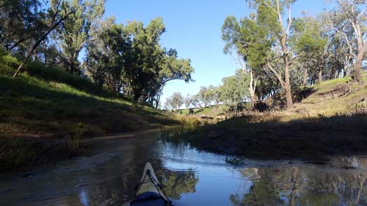
Flow dropped 10cm overnight. That was confirmation that I have now crossed the flow and I was onto the very tail end of the previous flood. Now there was only one real main concern that was the Beardmore dam. Well the dam and how much water the irrigators were taking. I hadn't been able to check online to see the river levels since Chinchilla and I had no idea of what was happening.
There were significant log jams around Dogwood Creek confluence and the first couple km on the Balonne.
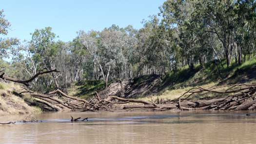
I should have stopped early on one of the rather nice beaches around 4:30pm but I pushed on till 5pm. This ended up being a particularly bad mistake. After crossing a partially submerged log for the millionth time, the load shifted right as I executed a long left hand sweep to clear the log. Suddenly I was in the water along with my "splash proof" camera and other unsecured items from my deck / cockpit. By the time I collected everything up and gotten things onto the shore, I realised I didn't have my paddle. I figured it must have been caught in a small eddy and had gotten stuck underwater on something. I spent 15 minutes unsuccessfully searching the deep muddy waters in failing light before giving up and setting up camp in the twilight.
I'm unsure what made me do one final paddle check in the morning, but I saw it floating upstream of the log that tipped me. It must have been caught in rubbish stuck in a circulating eddy under the log and had finally broken free overnight.
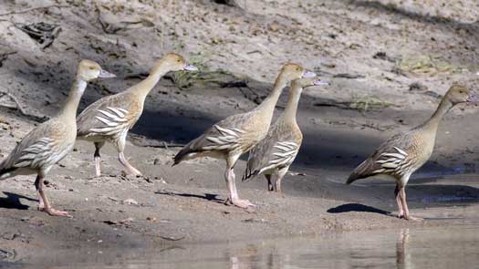
Rest of the day was fairly std with many log jams albeit I provided some truckies with a side show clearing a small log jam under a low bridge to avoid a portage over the road as well as playing chase with a small flock of plumed whistling duck (Dendrocygna eytoni). I chased the same flock of five birds for close to 3 hours. Every time I got close, they would just fly around the first bend before landing. As I caught up, they would repeat the process.
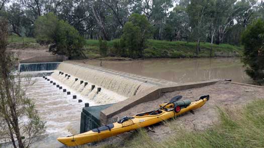
A couple hours of paddling and I was at Surat, the starting point one year earlier. I had phone coverage but no internet so I was still in the dark of what was happening downstream.
The unmarked Surat Weir looks nasty in a low flow with concrete pillars that seem to be designed to trap objects in the eddy. I was rather glad I didn't try and boof over it the first time down!
I got concerned with the number of log jams under the weir, I hope this doesn't become the norm. I tried not to consider this too much, it was becoming a common theme seen a few times now, after a weir or section of rapids there was often a section like this. These conditions were in stark contrast to the cruisy paddle I had last year where I didn't have to face a single log jam.
I finished the day with one of the more unusual campsites after I discovered a small sand bank that was just big enough for the tent while portaging around a fallen tree.
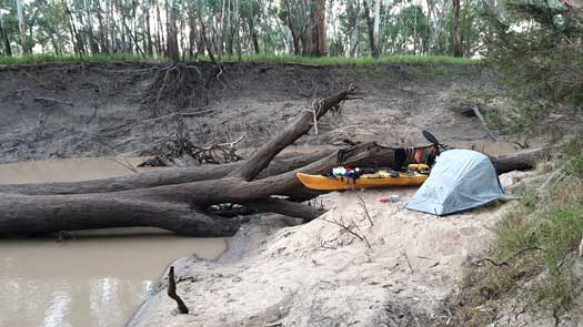
Another slow day battling log jams. Disheartened to see how much the only large irrigator on the stretch was still sucking out of the river. It almost seemed like 1/3 of the water was being sucked out.
Nearly two hard days paddling and I was only just past the first campsite from last year's trip. That felt a bit demoralising...
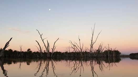
I was only a few km from the long reach of the dam, but I still had to face a couple of difficult log jams to get there. From the Lakes upper reach it was easy paddling without any issues.
I pushed hard to make it all the way to the dam in the moonlight, maybe some of the nicest paddling of the leg to date. I bivvyed on the upstream side of the dam, still without internet to know what was happening downstream.
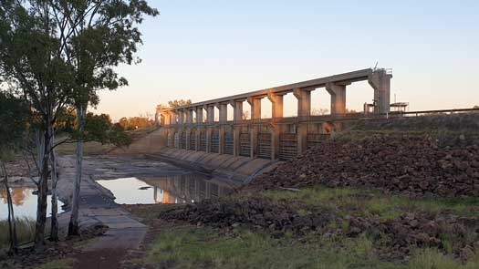
Up early and was a bit horrified to see that there was no release at all from the dam. Well, some slight leakage wetting the concrete. After 15 solid days pushing hard down to St George to hopefully manage the Culgoa had been ruined by the irrigation storage schedule.
To rub salt into the wounds, no flow at the dam also meant the next 5 km downstream would be effectively impassable as it was mostly shallow riffles and rocky sections. This forced a 7km road portage from the dam down to the Carnarvon Highway where you can get access to the river again where it is banked up from the Jack Taylor Weir at St George.
A rather uneventful paddle down to St George with the exception of a swimming snake sighting and a couple of well behaved and friendly boaters.
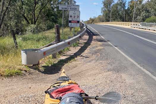
I arrived early in Walgett with minimal information about the river access nor a confirmed storage option for my car. First task was to scout out the Namoi River to see if I could access the Barwon from Walgett.
All of the small side roads shown by Google Maps were either restricted access or driveways through private land. Talking to a local cop, I was told of a small weir in the Namoi before the Barwon and I decided to do an exploratory paddle from Walgett since there was no sign of any flow in the river. I didn't want to risk a dry section with my very heavily laden kayak. With the Barwon so high, the reported weir was nowhere to be seen and the pathway to the Barwon was clear. A nice 10 km warm-up!
Having confirmed the starting point was feasible, I headed out to the showgrounds where I expected to find somewhere to park the car for a couple of months. What I found was a rather dodgy old bloke wanting nearly $20 a day with no cover nor security. I definitely wasn't going to pay this guy over $1,000 just to park in a paddock for two months! I stopped at a diner for lunch and the lady suggested I try one of the local businesses and thankfully he was willing to allow me to store the car in his yard. He suggested a box of Great Northern beer in exchange for the parking so I talked him up to two boxes to make sure it was worth his while. Parking sorted, I packed the kayak and started the rather long walk to the river. I hadn't realised how far the river was and it was a fair workout dragging the kayak 2.5 km through the centre of town to get to the river.
Flow and height were good but they were a long way below the high flow mark from the recent flood. I decided to head directly to the river rather than to pull the kayak up and over the bridge to the boat ramp. I did regret that as I had to drag the kayak through mud that was over a foot deep by the time I made it to the river.
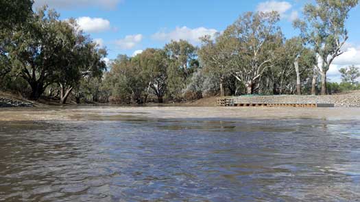
I repaddled down to the Barwon with a rather sedate pace being fully loaded in still water. It was good to get onto the flowing Barwon. With all of the delays, I didn't make it too far down, about 12.5 km as the crows fly. I did make it past the Walgett Weir that was just submerged enough to paddle over with a bit of caution. The river was fairly quiet with just two fishermen seen, trying their luck on the retreating floodwaters. Even with the high flow, it was a bit of a struggle to make it up the muddy bank to make camp for the night. I was still maybe 5 m below the tops of the banks and the flood water level was still shown on the river gum trunks, close to the very top of the bank.
The flow at Danger Bridge was 7,400 ML/day, 6.3 m.
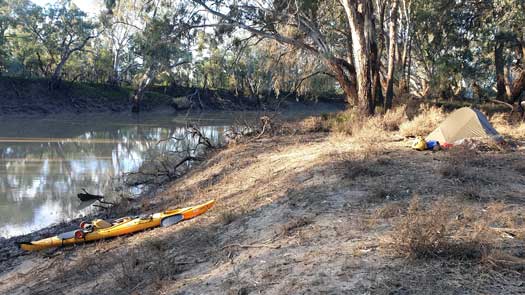
I had initially started with my 3-season gear weeks earlier, and definitely felt the cold on the Condamine. I was definitely much warmer overnight with my winter sleeping bag and 4-season tent, toasty even.
The river was fairly typical of the other major inland rivers. Tall dirt banks that were mostly lined with River Gums though a number of Box and Bottlebrushes were also present. Wildlife wasn't overly abundant but I still had a few sightings. One of the few wallabies I saw had a rather undignified swim after slipping on the river bank. I also saw the first feral pig that was swimming effortlessly across one of the side channels of the river.
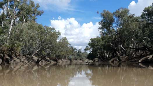
Surprise visit during the night with mice running around that was slightly concerned after having had some food in the tent. Thankfully no damage occurred overnight. In the morning I did find three mice sleeping under the tent, and more in the kayak where I hadn't fully secured the hatches. They got into a packet of dried pasta that made a bit of a mess. This was just a taste of what those had to face during the mouse plague that was sweeping across the countryside. The following night I heard a couple but no more mouse encounters to be had until Goolwa at the coast.
The next couple of days blurred together as I paddled down to Bre (Brewarrina). With no maps other than my GPS it was difficult to estimate distances and progress as the river snaked it's way down the basin.
On the 2 May, the flow at Danger Bridge was 6,500 ML/day, 5.95 m.
On the evening of the 3 May, the flow at Geehe (downstream of the Macquarie confluence) was 10,500 ML/day, 6.8 m. This fell to 9,400 ML/day, 6.5 m overnight.
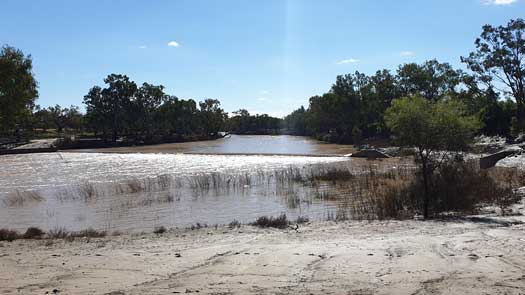
The weir at Bre was flowing fast and made for an interesting portage as I tried to get out on the town side beside the fish ramp. Steep banks, deep flowing water and weeds repelled my efforts. Eventually I ended up dragging the kayak over the muddy rocks that separated the main channel and the fish ramp much to the amusement of a few onlookers. It is probably best to use the far side with a high water level.
The weir had about a metres drop at 2.95 m (9,000 ML/day), so the river level would need to be above 4 m to paddle over.
I stopped for some snacks and additional water, though first I had to wade through a long section of thick mud that completely covered the boat ramp. It was at Bre where I discovered that Telstra's subsidiary Belong doesn't have the same coverage. I assume it is due to the lack of competition that Telstra doesn't allow Belong customers access to much of the basin. It is a bit rough that the national telco provider doesn't provide an affordable option for many of the poorest communities in the country. This trend continued down the basin where coverage was limited to small sections around Walgett, Bourke, Tilpa, Poocaria and Wentworth. From there coverage was fairly consistently down the Murray with the exception of lock seven and eight. While I couldn't connect, I could see where there was coverage and anyone with Telstra should get regular coverage with a number of remote sections without any coverage.
Below Bre was the first time on the trip it felt that I was really catching up with the flood waters. The flow seemed to be increasing slightly and using the maps I determined I was getting close to 8-9 kph. I made good time to the confluence with the Culgoa where the Darling officially started and decided to make camp for the night. The water level was 10.5 m and 20,000 ML/day and all coming from the Barwon river. The confluence was barely recognizable compared to my first trip down the Culgoa where the level was only slightly lower at 8.35 m (11,000 ML/day).
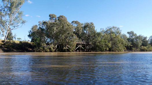
The flow gave me a fast trip down to Bourke with a few significant shortcuts along the way. By the time I got to Nt Bourke, I was really close to the main flood waters and the tall banks seen last time were now fully submerged. I stopped at the Old Wharf and picked up some fresh supplies for the next leg. The drinking fountain beside the wharf seemed to be the only water source. There was barely any flow and it took nearly 30 minutes just to fill my dom bag. With fresh supplies, I headed down past the weir that was completely submerged. There wasn't even a ripple. I pulled into a small shortcut where I camped on the banks for the night. It was the first time that I didn't really have to contend with mud but I was rather close to the irrigation pumps at the weir that were a tad noisy. Falling water levels overnight nearly caused a portage as the shortcut taken as it was now fairly shallow. Lesson learnt, stick to the main river when camping!
Compared to my first trip, the river height was over 4 m higher at Bourke, from 5.2 m (9,300 ML/day) to 9.4 m (30,000 ML/day).
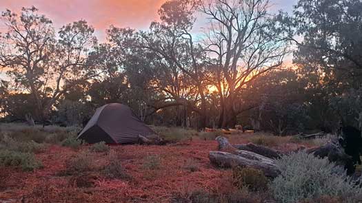
Excellent progress was made down the river and like the day before, the Upper Louth Weir (Weir 19a) was completely submerged. It was refreshing to be able to paddle near the tops of the banks allowing one to see out across the landscape. There were a few flowing shortcuts that also assisted progress.
Overnight, the river fell by just 1 cm. I was very close to the main flood peak!
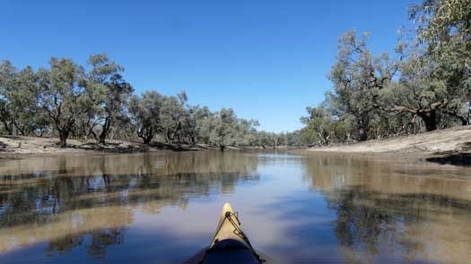
Up early and paddled down past a group of fishermen camping, they seemed surprised to see a paddler go by. Shortcut opinions were becoming more frequent, but lessons learnt from the Culgoa were still in the back of my mind and I carefully did my best to assess each before heading away from the main river. Before taking one, I would either be able to see the side branch reach the main river, or to ensure that the branch was flowing with at least 150 ML/day and in a direction that suggested it was heading back to the main river. Even with these precautions, I still had a couple detours that probably cost me more time than the savings made in the other shortcuts taken.
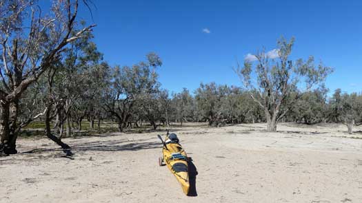
The first major detour took me away from the main river and onto a rather large billabong. It was a rather beautiful oasis that snaked through a sparse forest of grey box and thankfully back towards the main river where a 50 m portage was required to bridge the gap. The second major detour appeared to be a distributary that had no intention in heading back to the main river. The fast flowing stream was a real struggle to back-paddle, so I made the call to portage nearly 500 m back towards the river.
Finally arriving in Louth I popped up to check out the town and meet up with the fishermen that I had seen early in the morning. After a chat, I got some additional water and took off down the river.
Good paddling with minimal shortcuts to gamble with. I got a great up close and personal encounter with an echidna that was searching for food on the river bank. It was cool to get eye to eye with it from on the water. I had another encounter later that day. While trying to get some sleep I heard some rusalling just outside the tent and poked my head out to see another one searching for worms around the guy ropes.
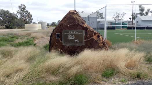
I passed Trilby Station early the next day, much to the interest of many campers that lined the banks. Any conversations were short lived as the current pulled me downstream.
Failing to learn from my mistakes, I continued to attempt shortcuts as I made my way to Tilpa. Those across flooded flats rarely seemed to gain much time and it was the flowing channels that had the most risk yet most reward. I think I chanced my arm a few too many times and lost out overall.
Later in the day at Tilpa, I happened to meet one of the more exuberant camping couples from Trilby Station that were heading down towards Wilcannia. After a chat and my water supplies topped up (gratis from the pub's personal supply), I carried on.
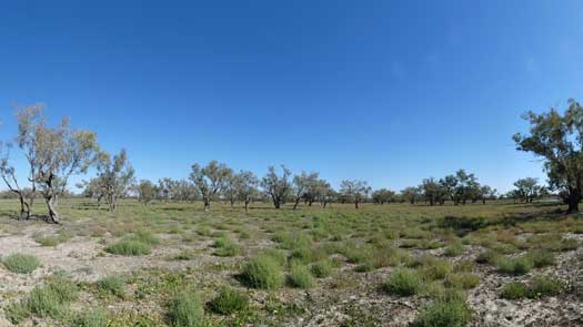
Wanting to get to Wilcanna at a decent time the following day, I decided to push fairly hard. Come sunset, I put on some Radiohead and pushed into twilight. As the light from civil twilight faded away, I was having second thoughts about paddling in the pitch black of night. As luck would have it, the song Exit Music (for a Film) started to play and motivated me to push on.
Breathe, keep breathing,
Don't lose your nerve
It was possibly a bit foolish paddling into the night on a flooded and unknown river but I was relatively confident, even with batteries slowly failing in my touch. I only had about 5 m visibility with that, so I turned it off and used only starlight for assistance.
It was fairly surreal paddling in near darkness. With absolutely no moonlight I had to follow the shadows on the water. The lighter areas on the river were those that reflected the night sky on the water and the darker areas were the shadows created from the vegetation on the shoreline.
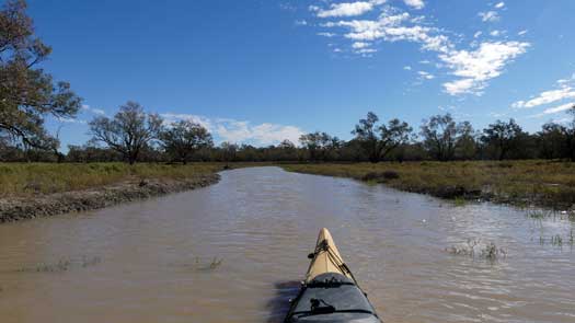
I was expecting much more localised flooding around Wilcannia, but there were only a few flowing shortcuts. It really didn't seem to live up to its name that supposedly means "a gap in the bank where the flood waters escape".
Both camping grounds were filled with Grey Nomads and the town was undergoing a bit of a facelift. It felt like any other relatively poor country town and not one that lived up to the stories you hear about it.
With the high flows, the weir was under water and that also made a quick stop for water and supplies relatively easy.
For the first time on the trip, I was getting condensation issues. I had to stop around midday to allow the tent to dry. As the night time temperatures dropped into the lower single digit numbers, this seemed to become a more common issue and I was having to stop almost daily to dry the tent in the lower Murray. People suggested that camping on dry leaves would help prevent this, but sand, soil, grass and leaves all seemed to have a similar outcome.
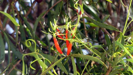
The last couple of days above the Menindee Lakes were rather uneventful with just myself and the birds for company. I stopped on dusk the first night as I was worried about it becoming harder to find a campsite as I neared the lakes. As luck would have it, the site was home to a million ants and with multiple nests everywhere. Thankfully it was late enough and I didn't have too much hassle from them.
The following day I didn't feel like I was close enough to Menindee to make it there before lunchtime, so I pushed into the night again. It's always best to aim for an early supply run in small towns, especially on a Sunday! While I did have a thin crescent moon, it didn't provide much additional light. The cold forced me off the waters just as I closed in on Lake Wetherell. Probably a good place to stop!
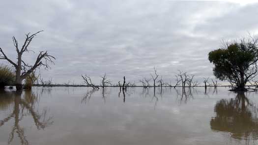
Even as the river spread out into the shallow plains of Lake Wetherell, there was still a decent current along the original river channel. It is difficult to say if staying in the flowing channel would be faster than cutting across, albeit you get a different paddling experience on the flooded plains compared to the river.
Of the few shortcuts taken, I had to wade through a few shallow sections, especially at the start of a traverse of the northern shoreline as I got near the entrance of Tandure Lake.
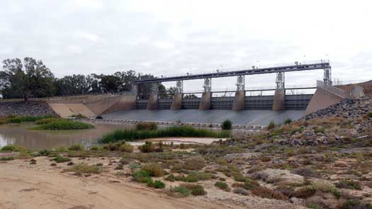
I finally encountered a couple boats as I neared Main Weir. It felt a bit strange having to share the river again. I pulled up the rather steep banks on the left side of the weir. Just after struggling to drag the kayak up, I noticed what I think was a tinnie being launched from the opposite side. That could be an easier portage if there is a boat ramp there, especially if the lake is low.
As I made my way under the weir, my heart sank when I saw that there was no water being released from the weir. I contemplated what this meant for a couple minutes and decided to press on, even if it did mean potentially long dry portages. I've come too far just to stop at the lakes!
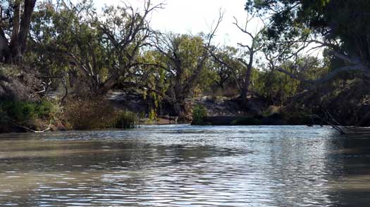
I paddled the still water past a number of fishermen and it was early afternoon by the time I made it to the main town. Thankfully the shop was still open and I was able to stock up on some fresh food and treats.
I was rather relieved to see an inflow from Lake Menindee that must have been close to around 500 ML/day. Soon after this I made it to the flowing Weir 32 late in the day and chatted to a couple fishermen who were camped by the weir for a while before pushing on to find a campsite for the night.
I found a spot right at the 1,050 km mark, giving me a nice even average of exactly 105 km per day. With the benefit of hindsight, I was maybe about 10 days ahead of the ultimate trip down the lower Darling. Within two days of making it to Menindee, the MDBA started releasing more water and by the 28th May this had peaked at around 4,000 ML/day. In saying that, I would have been behind the flood all of the way to Menindee, so I probably timed it fairly well overall.
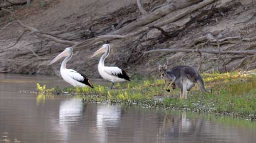
The park was deserted downstream of the main camping areas and there were plenty of emus and kangaroos running around. Feels slightly claustrophobic being back in a small creek with high dirt banks again. I definitely prefer the high flows! The paddling was relatively easy without many strainers nor shallow sections. Short flowing sections quickly gave way to longer deeper still sections. In a few places the reeds nearly choked the river.
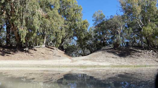
I tried the wet suit for the first time today. It was a bit warmer, but it did get hot and uncomfortable to wear in the heat of the day.
The river felt more devoid of wildlife today, other than for herds of goats. These seem to eat just about everything within reach.
Most of the Red Gums were fairly old along the river, noticeably more so than those upstream. There was no regrowth and with no competition, the remaining gums were fairly old and twisted. This is probably due to farming practices that seem to rely a lot on goats. The river health itself and lack of water in the inland billabongs are definitely big issues of the controlled river and it was sad to see the additional strain on the landscape. Some sections are thick with river gum seedlings and young trees, but these are few and far between.
The Great Darling Anabranch was high and dry and probably hasn't seen water from the lower Darling flowing into it for decades. Any water in that system will almost certainly come from Lake Cawndilla and only when the Menindee Lakes are filled.
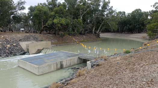
Started to push longer days going well past twilight and into the night. This was still mostly by starlight, though the moon occasionally helped. I've set a target of above 80 km per day to aim for completing the Darling in 16 days.
The banks were fairly bare looking still and minimal wildlife still. There was a slight increase in the number of ducks as I got further down the river that suggested a slightly healthier section of the river.
I reached Pooncarie early on the 20th and had some long chats with the campers. It was surprising to see the camping ground was fairly full. Stopped to check out the store that was really nothing more than a small roadhouse with a limited section of food. Definitely covers all the bases, just very limited choices.
Slightly difficult portage at the Pooncarie weir, having to drag the kayak up the high steep banks. I missed being able to paddle over these...
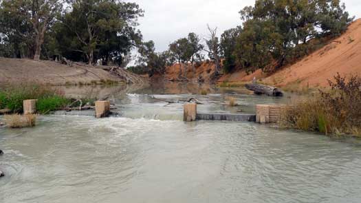
There was a partially removed weir or control a bit further downstream that was paddleable although two abandoned kayaks caught in the small rapids felt a bit ominous. Thankfully I hit this and the two low bridges during the day to easily see the hazards.
Past the Burtundy Weir the following day and continued to push hard to close in on Wentworth. I was fairly knackered when I finally stopped at 9pm in complete darkness, but I had made great distance today. Only 74 km away from the Murray. The only question was will I make it there in daylight or starlight tomorrow?
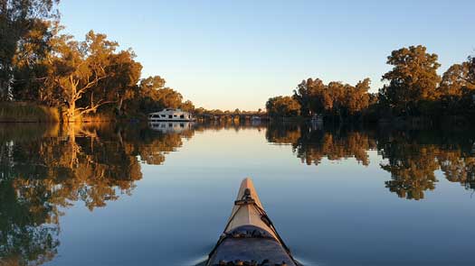
Starting fairly early, I did some quick maths in my head as I got onto the water and realised I wouldn't likely be able to reach Wentworth by sunset. With a rough speed of 6kph I would only just make it to the supermarket before it closed at 7pm. Water was really backed up now from the Murray so I wasn't getting any assistance from the tiny flow.
After a couple hours on the river, I met a group of three paddlers making their morning coffee. One recognised me as the ETA guy, apparently she had used my site for planning their lower Darling trip. After a quick chat that also served as a bit of a rest, I charged on down the river.
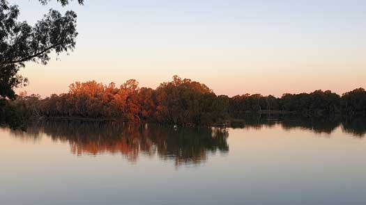
I managed to make steady progress all day and soon my goal changed to aim for Wentworth at sunset. I only just made it. Paddling out onto the Murray in the setting sun felt like an incredibly fitting way to finish the Darling leg that I started only 16 days ago at sunrise over the Barwon.
I had a long chat with one of the local farmers that was taking his kids to the park and it was just beginning to get dark as I started paddling back up the Darling to get to the shops. With a fully laden kayak I paddled back down to the Murray where I camped on the VIC river bank.
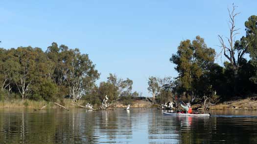
I arrived fairly early to the weir the next day and I couldn't see an easy alternative way around it, other than the lock itself. As I waited for the lockmaster, another paddler paddled up. Paul was paddling the Murray and we paddled together for a couple of hours before parting ways.
After pushing long days on the Darling, I decided to make camp early. While this was primarily due to a complete lack of energy, it was also to have a hot camp shower. It felt so great to be clean again and spent the afternoon relaxing in the sun.
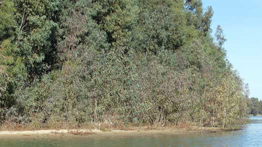
I really didn't time my lock arrivals that well today. I pulled into lock 9 at lunch and portaged rather than waiting for an hour, and as luck would have it, I arrived at lock 8 at sunset after it had closed and done another portage to bypass it.
The river was fairly and found a nice camp on one of the deserted sandy beaches that are usually packed in summer.
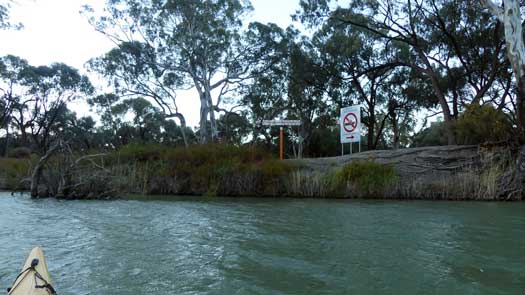
I wasn't sure what woke me in the middle of the night, but I decided to check the news with the weak internet signal. There were covid-19 cases in Victoria and I was still a day or two from the SA border. Fik... Time for a border run!
I was packed and on the water by 3:30am and paddled for 3 hours in the moonlight before having a small rest at sunrise (maybe an hours' kip). Soon I was back on the water and had my head down again. It was nearing sunset as I finally made it to MacCabe Corner and I paddled a few extra km downstream and set up camp on the SA side of the river. With no reception, I hoped I had made it in on time and that I wasn't going to be turned around at lock 6. At least I didn't have to portage lock 7 today!
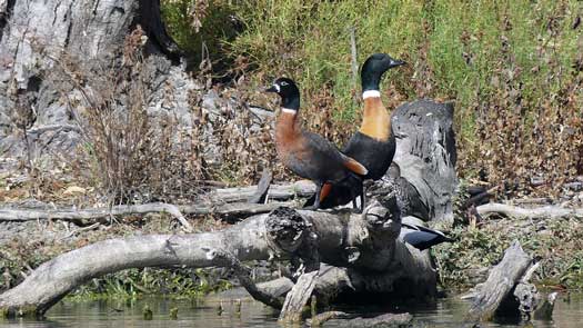
No news was good news when I made it to lock 6. During the first national lockdown, police officers were manning the lock checking travellers. During the next lockdown, the lock masters would simply ask if you had the permit. Today, the guy didn't have a clue what was happening.
Approaching Renmark at dusk I decided to continue on to one of the nice beaches below lock 5. With a full blood moon and calm conditions, it was a great night to be paddling. I docked at the main wharf and walked across town to the supermarket.
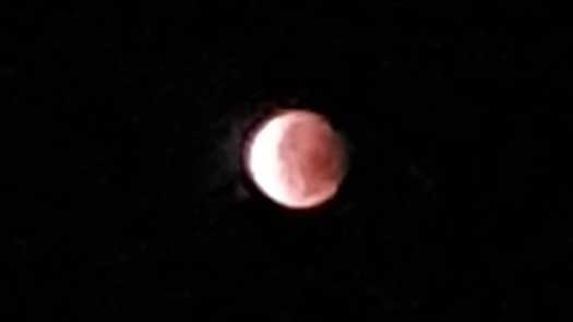
It was darker as I left the mall, albeit the street lamps obscured what was happening above. It wasn't until I was walking past an old church and noticed what appeared to be an Isamic crescent moon that I finally realised what was happening. There was a lunar eclipse starting! By the time I returned to the kayak, the moon was completely dark. I was back to using starlight on a cloudy night...
Renmark weir was interesting. There was a gap beside the small boat ramp at the lock and I pulled out there. It wasn't until I strapped the trolly onto the kayak and started walking when I noticed I was behind a 2m fence with what looked like razor wire on top. I had to backtrack into the river and paddle upstream to find a spot to take out. This was where the strapping on the trolley decided to give out and everything collapsed onto the ground. I managed to make it movable with some spare decking line I had in my repair kit. It took close to an hour before I finally make it back into the river. Getting late, I only paddled a small way down before setting up camp on the river bank.
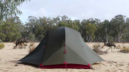
Having done the Katarapko Creek shortcut the first time down the Murray, I decided to go past Loxton and to take a rest day at Whirlpool Bend, the "best beach" on the murray according to the lockmaster on lock 4.
Unsure of the exact location, I actually paddled past the bend and had to backtrack upstream to return to the main beach. With only a few gum trees, the beach is over 400 m across and 100 m wide. Plenty of space that would accommodate multiple campers although I had the entire bend to myself, and a couple emus that were wandering around. A great spot to take my first complete rest day of the trip.
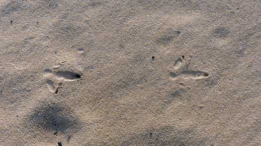
After a day off the water I continued downstream. Loxton was a quaint little country town on the hill and a pleasant place to stop. About 10 km from the town, a houseboat decided to pull out directly in front of me forcing me to give way (unpowered craft have the right of way), but they were definitely on the learners licence underpowered outboards. I powered around them and kept pushing and managed to stay comfortably in front of them all the way to Loxton. It was a good way to keep up a fast pace!
There were a fair number of campers downstream which was surprising after mostly having the river to myself. I camped on the banks just before Moorook towards the end of one of the longest straights on the river.
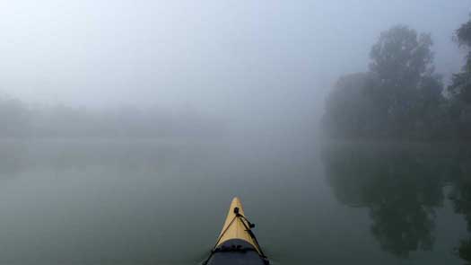
Frosty start to the day created a thick blanket of fog on the river. Thankfully the river was deserted as there was hardly any visibility. Really not liking having to pack a wet tent every morning though.
I didn't make the lock in time, again, and had to portage... again. I don't actually think I'm losing any time but it is definitely harder to portage than sit in a lock!
I made it down to one of my favorite campsites from the first trip and decided to have another rest day to soak up the atmosphere of the river and towering cliffs.
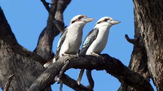
A fairly crusy day paddling past Waikerie. Only a single boat on the water that was in complete contrast to the craziness seen in summer. I only got a small way past Hogwash Bend when I decided to set up camp. While it wasn't the greatest campsite, a slightly overcast and drizly day was enough reason to call for another rest day. Definitely not feeling the need to motor through to the finish line!
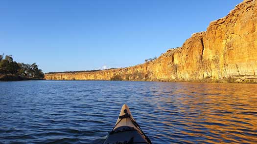
Thick fog greeted me as I paddled down the river that took a couple hours to clear. Fairly dull overcast conditions for most of the day. The river was still fairly quiet compared to the summer peak season.
Fairly overcast day but with no or minimal wind. Even though I was being very conservative with my electronics, I was struggling to keep things charged. My little solar system just wasn't big enough for the cloudy winter conditions. I was lucky to get a quarter phone charged every day.
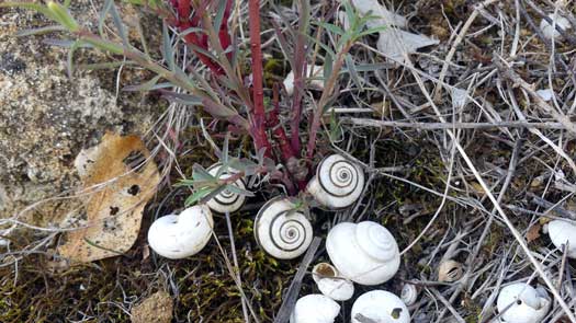
I was greeted by another cloudy day with showers as I paddled past Blanchetown and Swan Reach. These small holiday towns on the river were ghost towns in winter. Pushing a longer day to camp at a known spot I was disappointed to find a couple drunk lads target shooting a small target parallel to the flow of the river. I hugged the bank for half an hour just in case a stray shot did come my way. I did wonder if the house that was ~500 m was getting a few holes in the weatherboards as it was in the direct line of fire. Thankfully they were just using 22s.
At dusk I pulled into the council camping ground at Nildottie to stay the night.
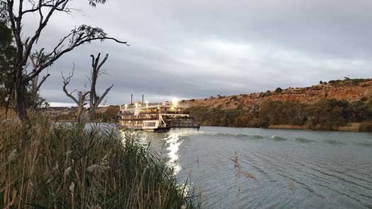
There were an unusual number of houseboats compared to the rest of the river as I passed Bowhill. Maybe from Mannum? Still significantly less than peak season.
Dull cold days were rather uneventful as I retraced my way down, especially after leaving the last of the main cliffs. One of the highlights was to see the PS Murray Princess in full throttle go past my campsite. She is one of the larger paddlewheelers taking tourists up and down the murray and kicks up a fairly decent wake, especially directly behind the boat. Definitely give her a wide berth if you are not comfortable in the waves!
One significant difference along the river I started noticing was a significant spraying program on the willows that are a bad weed along the lower Murray. There is definitely less protection from the cross-winds in the sections that have been sprayed. Hopefully the local councils will replant river gums to help shelter the river and return it slightly back to its original state.
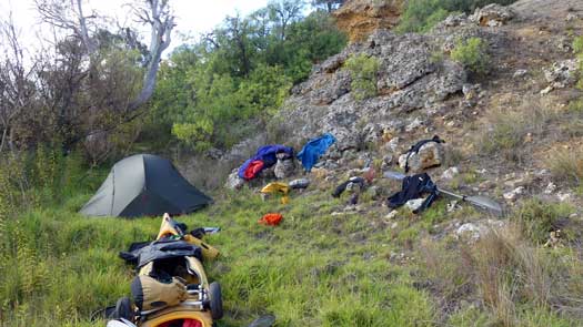
The forecast was rather ominous for the days ahead. 40-50 kph tailwinds, swinging southerly into the evening and presisting for the next three or four days. That would make the lake interesting...
I got a slight push during the first couple hours as the wind slowly increased in strength and a rather strong and nasty cross wind apparching Murray Bridge, especially in the sections where the willows were sprayed. I stopped briefly at the Bunyip to get some water and the wind was getting extremely strong and gusty. I nearly decided to sit it out, but I was still a long way from Pomanda Island. If I didn't capsize, it would be fun. For the next 30 minutes I was riding waves over a metre high with fairly consistent near gailforce tailwind with occasionally stronger gusts that were causing a bit of havoc on the shoreline blowing away tarps and outdoor furniture.
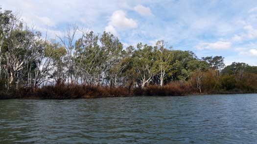
Sadly, the wind swung to the north all too quickly and I was soon fighting through strong crosswinds all the way past Tailem and down to Wellington. I had just made it past the Wellington Ferry when there was a lull in the wind. It was already late in the day and I was still a long way from Lake Alexandrina. Within minutes a strong southerly headwind kicked into gear and was strong enough to quickly push me upstream if I stopped paddling for more than a stroke or two. It took nearly two hours to paddle to the lake and at that point I decided to do an emergency bivy on one of the small beaches just past Brinkley Homestead on the eastern shoreline as twilight faded.
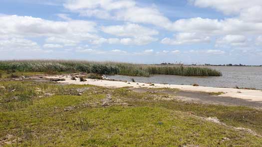
Rain on and off all night and both my bivvy and sleeping bag are fairly wet by morning, though it isn't looking like a good day to try and dry them. I loosely pack the down sleeping bag and set off towards the point in a moderate southerly.
I barely made it to the opposite shoreline by the time the wind had picked up again. I wasn't planning to head directly across in these conditions, rather to hug the western shoreline to have a look. With 1 m choppy waves and a ferrous cold southerly, I decided to call it a day within 30 minutes of starting out. As luck would have it, there was a deserted sandy beach with reeds acting as a shelter to the prevailing winds.
I set up and made the most of the small windows of sun to dry out my gear and sleeping bag.
There was no improvement in the weather the next day and I stayed put. For tea I had my last main full meal and I was down to just a couple of meals that were really just the leftover emergency rations. One way or another, I will have to make a move tomorrow. With high winds still forecast, I didn't know which shoreline I would be heading to or even if I was to run back up the Murray to Wellington or Tailem Bend for additional supplies.
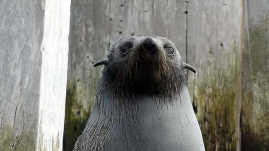
Strong SW winds and stubbornness decided my route the following day. I'd be lucky to make 2-3 kph into the wind that ruled out a direct crossing and I didn't want to backpaddle to Wellington so that left two options, traversing the western or eastern shorelines. I would have 15 km crosswinds and 30 km headwinds going along the western shore and only 8 km crosswinds and hopefully a partially sheltered path along the eastern shore. I chose the latter.
It was a challenging paddle back across to the far eastern edge of the lake. Most waves were crashing across the deck, and the odd wave broke onto my shoulder. It wasn't really the height, but the period that makes the lake tricky, maybe about 1 second between the waves. It probably took the best part of 3 or 4 hours to reach what I hoped was the lee side for shelter, but I still had a moderate headwind as the wind was funnelled around the headland. Thankfully the wind slowly subsided late in the day and I managed to just make it to Narrung ferry campground at dusk.
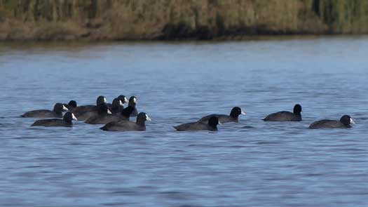
Nearly 10 hours on the water to make less than 20 km, about a 30 km track around the lake. Last summer, it took just 3.5 hours to paddle between the same locations. If only I had a couple additional days of food and I could have waited another day...
Absolutely knackered, I set up camp and made the most of my leftover rations for dinner:
I really need to make Goolwa tomorrow!
This reminds me of an old quote:
On particularly rough days when I'm sure I can't possibly endure, I like to remind myself that my track record for getting through bad days so far is 100% and that's pretty good.
Compared to yesterday's paddle, today was a walk in the park. Muldjewangk was definitely asleep today.
I was up before dawn and felt the crunchy grass underfoot. Definitely a frost. By the time I was packed up a thick fog had rolled in. I had very limited visibility in the fog, especially paddling mostly by star light. With only my handheld GPS unit, I decided against heading directly to Goolwa and stayed within sight of the shadows of the eastern shore. With a deck compass I probably would have taken the direct route, but there were no lights visible in the fog that I could take a bearing off. Without a secondary navigation device, it felt a tad risky.
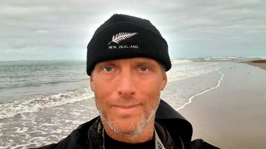
I was on the final crossing at Tauwitchere Barrage by the time the fog had lifted so just continued on directly to the Murray Mouth. There was a large family of seals on the ramp that weren't overly happy about jumping into the water to allow me to pass.
The Coorong was fairly high with the incoming high tide and quiet compared to summer. There were a couple commercial fishermen gill netting for mullet and a handful of recreational fishermen. I had a quick stop at the month before carrying on to Goolwa where I planned to meet Frank and the team from the Inland Rivers National Marathon Register (IRNMR).
With a delay at the Goolwa Barrage that was undergoing repairs, I lost the chance to first make it to the camping ground on the far side of Hindmarsh Island. I had hoped for a shower! So I stopped at the park near the Aquatic Club to both dry my gear and to have a rather refreshing swim as a quick wash. I definitely felt much cleaner by the time I got the photos taken with the IRNMR team!
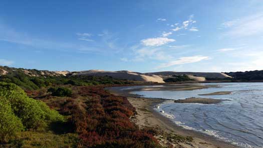
Grey skies but zero wind as I paddled back up past Clayton and towards Pt Sturt. Lake Alexandrina was a perfect mirror. I nearly kept paddling as I got to the Point, but decided against another crossing.
There were what looked like a number of semi-permanent campers at Point Sturt and there was a fair amount of rubbish lying around. I had planned to spend a night here, but being so early in the day I decided to head out to the Coorong instead.
I paddled down and through the reeds hiding the channel down to the Ewe Island Barrage. I portaged the kayak over the rock banks and paddled up into the Coorong. Even with the high tide, I had to take some care with following the navigational markers.
The Coorong has massive sand dunes and it is like playing in a large sandpit. Emus and Kangaroos are common as well as unique and unusual flora. It was a really nice way to finish the trip and definitely one of the highlights. You do get a small taste of the Coorong at Tauwitchere, but I would definitely recommend a night or two in deeper into the lagoon to get the full Coorong experience.
I bused back up to Broken Hill when I caught the red-eye bus to Dubbo and onto Walgett. My intention was to pop home for two nights and to return to SA where I would do a slow trip back to QLD kayaking various bays and rivers in Victoria and NSW. Oh how quickly plans go astray with covid...
While mowing the lawns I had a chat with the neighbour who had a mild case of Bronchitis. As luck would have it, I felt a mild cold coming on the next day. So off for the tests. By the time the results were in, the cluster in NSW was quickly growing and without any firm controls placed on Sydney I knew SA would be closing the border.
I gave SA a couple days to react and as I was about to leave, we had a series of lockdowns in QLD and SA and SA closed its borders with SE QLD.
Nearly three months on I am planning to return via the NT and anxiously waiting for word about the four QLD cases reported today. Thankfully SA didn't react and I was able to drive down. Long way down via the NT and a much faster trip back via the Strzelecki Track.
©2026 Alan Davison // Credit // Disclaimer