Transport Options
Info on buses, etc
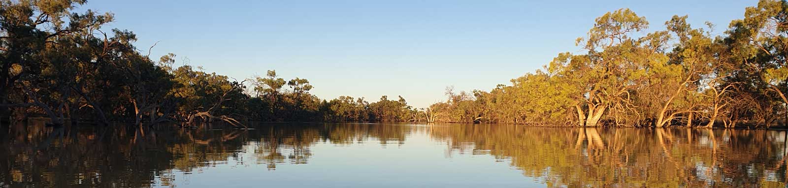
The Great Darling Anabranch section of my 2022 Darling Double adventure
Short blog and trip table from the second leg of my 2022 trip down the Darling River and the Great Darling Anabranch.
The first leg blog and trip table are in the Darling River System section.
As noted in my Darling River blog, I was getting concerned about the trip. The full list of these concerns were:

So I thought it prudent to get more info and I was considering changing my approach to a two way paddle. Upstream and downstream. I figure that if I can't paddle up, well chances were I wasn't going to be able to paddle down... So I popped into the info centre to see of they could make contact with some of the homesteads for me, to act as base camps as I paddled up and down the river. I decided to look at the very top ones first and suggested Tor Downs. The lady knew the owners at Tara (or Toora) and called them up. At this point I just assumed a typo on my map, not remembering about the other homesteads at the time. Whomever she called didn't sound very positive. "No flow and the waters dropping" and "It wouldn't be paddlable". That was some depressing news to hear but it also went completely against both what I had seen and the gauge data that was showing some flow along the entire system, even if that flow wasn't great. That's about as much new info I got. What to do?

As noted, at Lake Cawndilla, the release was dropping, 800 ML/day as of lunchtime, down from 930 ML/day yesterday. The environmental flow had started in September and this was increased to 2,100 ML/day from Dec until 10am Feb 23, the same day I arrived at Wentworth. Great timing again.
This has been the story of all three of my trips, however with each trip that delay has caused slightly harder or worse flows every time. Lachlan was really just a 10 cm drop in the swamp albeit good timing with the Murrumbigee floods. The Darling River was missing riding the peak flows by around three weeks that likely cost me a day's worth of free km riding the faster currents, but this was almost terminal for the trip. But I digress.
I thought that heading back via Broken Hill doesn't add too much driving time, what do I have to lose? Plus I'm a stubborn person and I didn't want to be defeated without at least trying. I stocked up on supplies and also 40 L of water along with the 20 L I was already carrying. I took this much water as I was told that people were living off tank water, so I decided it would be rude to ask for water from any of the homesteads unless it was an emergency. Note that the homesteads are now all on the town supply so don't feel bad if you run out and have to ask for some!

I drove out and checked the river at Bunnerungee Bridge and then Popiltah. Both had deep looking pools with a slight current. Both are totally fine to paddle. So I drove out to Tandou. Any concerns about the roads disappeared quickly. Mostly hard packed gravel and mud sections with a few sandy spots. Hardly no corrogations nor potholes. Total fine for my little Mazda 3. I tried to get in contact with the homestead owners but no one was around. So I parked up at Packers Crossing hoping no one would mind. Here, like in every stop, I left a trip plan, both to let people know my intentions if they are concerned about seeing a car parked out here and as a backup in case of an emergency where I don't have a chance to activate my PLB.
I finally set out late in the afternoon. Tandou Ck isn't really a creek, rather a long narrow weir pool, at least that's what it felt like to me in these conditions. The start was a bit of a maze, but easy enough to navigate with a bit of help with the GPS. There were a small number of houses along this stretch, albeit it was hard to tell if they were occupied. There were none in the upper sections. There was a slight current but this didn't really affect the paddling. There was a constant southerly wind for all of the days paddling the anabranch and that usually was the biggest factor on the pools.

The weir pool didn't really seem to finish at all. This rather surprised me albeit I really didn't know what to expect. It was mainly lined with River Gums and there were a lot of sections with drowned trees from the weir, but no issues with snags. It got narrower upstream and was often a mix of gums and box. The narrow fingerlike section was a bit confusing with the main pool running side by side with a billabong for a while along with a decent shortcut.
One of my biggest concerns about the anabranch was fences and for most of the day these were not a concern. However mid-afternoon I come across the only low bridge on this section and it has not one, but two fences on either side of the road. I had to fully unpack to lift it over the two fences, one had a solid metal panel I could lean it on, the otherside was barbed wire that I had to carefully lift it over to avoid damaging the fence and to avoid getting my clothes caught up.

Knowing my casual 10 day paddle 500 km downstream had turned into effectively a 1000 km flatwater paddle, I would have to continue pushing long days. I started by torch light and found the insects were getting really bad. I was also leaving the main pool right at the end of twilight and it was getting difficult to navigate. The stream was still fairly wide but the flow was channelling around and lignums were becoming common in and around the creek. Without a headnet, I had to stop fairly quickly and decide to make camp.
Sunny with slight southerlies. The southerlies were fairly consistent over the entire trip, keeping temperatures down between 25°C and 36°C.
Release Lake Cawndilla 800 ML/day and at Packers Crossing 1,490 ML/day.

In daylight, the creek was much easier to navigate and the main Cawndilla Channel was only a short paddle upstream. This was rather narrow and fast flowing at around 2 - 3.5 kph. It was quite a workout, especially on a short sharp sprint towards the end. Thankfully I didn't really have to contend with any snags at the same time. This soon opened up into a large pool, most likely an old arm of Lake Cawndilla. It had nice clay cliffs along the sides.
I was rather surprised to see four guys fishing by the outlet. They looked rather hungover, I think it was more of a boys weekend rather than a serious fishing trip. I pop up for a quick photo of the lake and back for the return leg. It was a very quick trip back down the channel, but likely minimal difference in speed as I hit the still pool waters. A solid paddle back to the car at Packers Crossing, where I meet another couple fishermen and see a number of farmers passing by, one stopping to make sure I was ok. So far this doesn't seem that remote!

I had intended to visit Tor Downs next, but the roads were either private or 4wd, definite sandtrap for a low 2wd. So instead I decided to do a big leg, Popiltah to Packers Crossing, 185 km one way or 370 km return. It was getting late in the day, so I decided to stop at Lake Popiltah Rest Area. The roadhouse was closed albeit it was fairly late so that didn't surprise me.
Release Lake Cawndilla 690 ML/day and at Packers Crossing 1,400 ML/day.

In the morning I realised that there was only just enough petrol in the tank to do the next leg and then the drive to Wentworth for supplies, I thought I better fill up at the roadhouse up the road to be safe. Much to my disgust the place was shut because of covid (since 2020) yet still had fill signage up everywhere. This detour meant that I definitely didn't have enough petrol and I had to make an unexpected fuel run. Should have fully topped up before leaving Wentworth. So a couple hours wasted making a round trip for fuel arriving there with just 17 km of fuel left in the tank. That was cutting it a bit close.
While getting fresh supplies, the skies open up and it buckets down. All of the roads are covered in water. This is rather disconcerting since I need to drive on the dry weather roads to get everywhere. Checking the forecast, there is a risk of rain for the next three days too. The radar gave me some hope that Popiltah could be dry, so I headed back with crossed-fingers.

My hunch was right and the roads started to dry as I crossed Bunnerungee Br and the roads were completely dry out to Popiltah. It was fairly much all private property with no recreational use, so I popped into the homestead to make sure they were ok with me parking up. I meet a rather young station owner and he's happy if I park up down by the river, well off the "main road". After a chat, I pop back down and drive down to the mouth of Popiltah Ck that feeds into the Anabranch, or I should say, the anabranch feeds the creek that will fill the lake if the control gates are opened. The anabranch is what I expected it to be here. Long pools, open banks with gum and box trees.

The character definitely changes as I head upstream. I guess most people probably wouldn't notice this, but I was seeing a muddled mix of box and gum trees that seemed to be in turmoil. Some sections were worse than others. Often you would get some old river gums and box that had been clearly flooded but only old box higher up and mixed young gum and box lower down. Older living gums seemed to be rare; a couple that looked like they were around 20 to 30 years old, a small number around 10 years old and a lot around 5 years old. This just felt that the system was in flux or that it was somehow confused. On top of this, I discovered long sections of gum, sometimes box, sapling in the river. Sometimes so thick they were impassible and you had to navigate the flooded shorelines to bypass them. The worst part of these thickets is that many of the trees have drowned and are slowly falling creating snags too.
Just before dark I cover up, long pants, long sleeve shirt, full wrap around Legionnaire style cap with insect net and repellant on. This made it possible to continue in the swarms of insects that seemed to come from everywhere. I get a few hours paddling until I get to a flowing section where I hit a few underwater snags. Thinking to myself I didn't really want a night-time swim, I pulled over for camp.
Stormy skies on and off today, but little rain, just a couple drops.
Flow at Packers Crossing 1,350 ML/day, Wycot 1,420 ML/day and Dam 183 was 430 ML/day.

Good days paddling upstream. Generally the river was better, but I was still hitting a number of sapling thickets midstream and snaggy areas. There was one particularly bad area where the river had changed course twice recently. The two newly formed sections were short (half km) but very snaggy with fallen black box. I initially just thought that the first one was a shortcut, but it was so bad I was seriously considering whether I should be attempting the anabranch. My concern was temporarily compounded when I arrived back at the main river channel and found that water is flowing upstream from what should be the downstream side and no flow from the upstream side. Only thing to do is to go with the flow, or in my case, against the flow. Soon I hit the other fresh cutting that provides all of the current. It too is full of snags but not as bad as the other channel.
Due to the high volume of thickets clogging up the river, I stop early to camp on an island created by a great little shortcut, about halfway between the homesteads on the upper anabranch. It was nice to be set up and fed before the mossies came out.
Flow at Packers Crossing 1,310 ML/day, Wycot 1,410 ML/day and Dam 183 was 427 ML/day.

The long pools and then mixed bag of the shorter flowing sections continues all morning. I think the norm was young gums, especially around the homesteads, but thankfully really snaggy areas were rare. The nature of the river changes fairly quickly around Redbank Ck. The mixed gum/box on the banks becomes predominantly box and the shallower areas resemble a flooded stream with a few box rather than a wide channel choked with gums. The paddling experience overall is significantly better. The tree covered red banks are also nice.
This reminds me of some of the billabongs I accidentally discovered taking some of the shortcuts on the Darling. They probably imprinted the idea of what I thought that the anabranch would look like.

The only real snag I hit today was when I came across a barbed wire fence at the top of a good shortcut. Unpacking to lift the boat over the fence would lose much of the time gained. I spot a double metal strainer post at one side and figure I may be able to use that to pivot the kayak over fully loaded. Lifting up one end onto the posts, I'm able to slide the kayak up and over. I only lost about 10 minutes although it was probably fairly stressful on the kayak, but she is tough and it didn't hint at buckling.
I stopped early again today, this time to enjoy camping on the red sands on the top of one of the higher banks. This is real outback camping for me, remote and having a savanna-like feel. Much of the area around here is right on the boundary between the Darling Riverine Plains that most people will be familiar with along the Darling (river red gums) and the more arid Murray-Darling Depression bioregions.


Flow at Packers Crossing 1,210 ML/day, Wycot 1,380 ML/day and Dam 183 was 426 ML/day.

I get similar and enjoyable paddling for much of the day, however gums become common in the very top section with areas of dense saplings and snags just south of Packers Crossing, which is where I turn and head downstream.
The gentle current assist makes for an even more enjoyable paddle. I avoid the shortcut this time and are rewarded with a number of roos and bird sightings that includes a mature wedge-tail eagle taking a full grown male wood duck in its talons. However I didn't manage to bypass the fence as I discovered it running across the creek too. This time it was just submerged and I tried to carefully drift over it in the middle of the creek. I knew it wasn't deep enough as I heard the barbed wire scratching the boat. They'll create a few new deep scratches in the plastic!

This fence was the only fence that I had issues with on this section. All of the others were submerged, dismantled or otherwise damaged. That trend continued all the way down to the Murray albeit you still need to take care as some have stray wires, etc.
I camped early again on the last of the main pools in Redbank creek that was bordered with tall red sand banks. I noticed I was sharing my camp with a fairly active snake or snakes with all the fresh tracks in the sand. I don't get any visits or sightings. I am a lot more careful where I walk in my short shorts and neoprene paddling shoes though.
Flow at Packers Crossing 1,100 ML/day, Wycot 1,340 ML/day and Dam 183 was 417 ML/day.

I had a good solid paddle today. Snaggy sections are easier with speed and willingness to bump over logs at or just above the water level. I love plastic boats in these conditions... The thick sapling areas seem easier too, albeit maybe because I knew the best path to take on the return trip down.
I push though into the night and camp at the same location as a couple nights ago. I'll easily make Wentworth for supplies again tomorrow.
Flow at Packers Crossing 980 ML/day, Wycot 1,285 ML/day and Dam 183 was 408 ML/day.

Paddling down I see a large current of water flowing away from the river in a northwards path. I stick my nose down to investigate and see that there is a levee bank that has been removed and the majority of the water is being taken out. I would have passed this in daylight on the way up, but I didn't notice it at the time. Was this a newly ruptured wall or was it here a few days ago? I briefly wonder if there will be water still downstream.
A series of yabbie lines flags the path to a couple guys fishing downstream. They have been having no luck with either. One is a local who has been coming to the anabranch since he was a kid and isn't too impressed with the conditions of the river and lack of fish / yabbies. He tells me a bit about the history of the river and what I've been seeing seems to make a bit more sense. The system was converted into a series of weir pools to supply water to the local farmers in the 1960s, but an alternative water supply was built to "save water" around 1990 and the weirs were removed. The system is either not flowing enough to drown the trees or one could argue it is flowing too much and not droughting the trees out. The latter would be fairly fatal for the fish in the system.

I make it down to the car with plenty of time left in the day so decide to paddle downstream for a while. Seeing the removed block banks and open control gates make a lot more sense now. At least that means no one will turn off the water right!? I believe this is the case, but I did paddle the anabranch with the nagging concern about someone closing off either Packers Crossing or Dam 183 control gates effectively turning off the tap.
I drive back down to Wentworth for supplies and camp at the Bunnerungee Br Rest Area for the night.
Flow at Packers Crossing 861 ML/day, Wycot 1,210 ML/day and Dam 183 was 398 ML/day.

I drive up to Windamingle and do a day trip up to yesterday's turnaround point. Even with the late start, I clock 40 km from the total length remaining to do, which translates to 80 km flatwater paddling. The river has a less confused feel, and there are less gums, albeit lots around Windamingle homestead that I tackled in the twilight.
Flow at Dam 183 was 382 ML/day.

After a bivvy at the car, I drive down to Dam 183 and do another day trip leg. This was mostly due to this being an easy put-in place but also as I still had concerns about the levee wall bust that was flowing uncontrolled upstream. It also meant not having as much weight in the boat that made the low flow more paddable, well at least I hoped it did.
While the gates were fully open, there was a very long reach from the block bank or at least this section had a very long natural pool. It was fairly pleasant paddling up until around mid-morning when I saw an older lamb caught in the mud. With the practice from the Darling a week or two before, I quickly get it out but it is still a bit of a muddy job. I removed anything I was wearing that the animal could damage if it struggled, and then reached down to lift one front leg at a time from the mud, grasping it close to its shin / hoof and placing it to the side. The back is harder, but a similar process. This poor thing was in for too long and couldn't really move much, only partial movement in the front legs and none in the back. I drag it up onto firmer ground to ensure it doesn't sink down into the mud again and continue on.

Coming around the corner I see another sheep in distress. This one had only just gotten trapped and was fairly easy to get out. Turning around, a third. FFS... I free that sheep and notice another four just up a small arm of the pool. F... A lamb with different ear tags looks like it was trapped for days. While not heavy, it was trapped deep, more dirty than hard work. A heavily pregnant sheep was the hardest, its waterlogged fleece didn't help. As I rescued the sixth sheep for the day, the other one managed to kick itself free. Most farmers will check on stock at least once a day, but I guess this area must have been missed in today's run. Thankfully I found no more sheep were trapped in the mud today.
Fairly easy paddling up to yesterday's turnaround point and on the way back I walked up one of the large banks to see if I could get a decent look at Yelta Lake but it is partially obscure with trees. Its control gate was never opened and the lake was completely dry.

Back at the dam I head downstream. Initially easy paddling leads to a channelled section that is running fast and shallow. It opens out again, but with dusk approaching I turn back early to ensure I pass the shallow section in the twilight. While the headlamp can easily detect hazards above the water, it's terrible to see the subtle differences that mark the depth of the river. I time it perfectly as I leave this section at the end of civil twilight. I can make most of the journey back without torch light, other than the final small flowing section just below the dam. I camp beside the dam.
Flow at Dam 183 was 372 ML/day.

After a couple day trips on the lower flows I am starting to get more confident on the lower flowing water. This is dropping so I am not confident enough to tackle the remaining river in one hit. I head down to Anabranch hall and plan for an overnight trip. The hall is an important local gathering point and can be busy, but early mid-week I figure it'd be safe enough to park up. I was told it had free camping, but all of the facilities were locked up. A proper shower would have been so good! There is a tap around the back that is likely rain tank water.
It was generally good paddling and mostly box with some gums. I see the highest concentration of arid woodland parrots of the trip including multiple encounters with Pink Cockadoos (Leadbeater's or Major Mitchell’s cockatoo).
I paddle just past the Silver City Highway and camp on the river banks.
Flow at Dam 183 at 363 ML/day and Bulpunga 316 ML/day.

A long pool above the bridge makes for pleasant flatwater paddling to start the day. Generally good with few obstacles. Today I had another close up encounter with three pink cockatoos that decided to hang around for a bit. It's hard to believe that I didn't even know these birds existed just days earlier. Note that while I had four or five encounters paddling upstream, I saw none the following day paddling downstream. I guess there is a lot of luck involved in seeing these guys in the wild.
I pushed a long day today, well into the night. In a wide tree-filled section of a pool in the dark I mistook a slight left as a full left and managed to do a full 180 without noticing albeit something felt off. Another turn a couple hundred metres up the river and I knew something was definitely off. Out with the GPS and I discover my mistake. This is the second time on this trip that I've ended up paddling the wrong way. On a corrected course I keep paddling, I set up camp falling just short of the hall.
Flow at Dam 183 was 349 ML/day and Bulpunga 307 ML/day.

With a short paddle to the car, I head to Wentworth for some fresh supplies and to catch up on the news. No obvious signs of any flood damage in my local area, although we are high on a hill and there was significant flooding around town. Also got the news about Japanese encephalitis, albeit I doubt that it will be that much of an issue where I am. One should always avoid mozzie bites though as the Ross River virus is endemic in the basin.
I drive up to Allanvale and track down the owner who is dagging sheep. With permission to park up, I push out a long day, paddling well into the night. Generally easy paddling up to the hall and back. Heading downstream, it gets thick with trees. I almost make the bridge above Tara Downs but decide to turn back at an extremely thick section of saplings as I paddled in the dark.
Flow at Dam 183 was 346 ML/day and Bulpunga 298 ML/day.

I had planned to tackle this from Camp Courage on the Murray River, but that would have added another hour's paddling so I popped up and organised a park upstream. The owners are really nice and we have a long chat about the trip and river. I discovered the levee at Popio Lake was deliberately taken down to avoid the prolonged flooding around the anabranch. This knowledge definitely makes planning a kayak trip harder as it is a fairly slow river and a high flow is unlikely to be allowed to continue for too long.
Paddling upstream I find myself in the reach of the Murray River, or specifically Weir 9. The banks are lined with old river gums, some drowned out. This becomes worse upstream so I assume that there must have been another dam around here that caused that. While I get the odd short slightly flowing section, it's mostly paddling up the weir's reach, all the way up to where the river meets the Silver City Highway. For here the character is more representative of the upstream sections.

I nearly had to get out of the kayak on one section. The river channelled out and the main flowing section had a small log jam. The side channel had a couple tight turns around logs with fast flowing current that made it almost impossible to turn the kayak. With a lot of brute strength, I managed to use the logs to spin most of the kayak into a small eddy and to power up, ferrying the kayak up and across. Even coming down this little section was tricky, but I made it. Managing to stay in the boat was much harder than doing a portage, but it felt good to do the entire river without having to portage outside of the ones around the weirs and dams.
I push up to Tara Downs at twilight. It was thick with gums in the river. Some short sections have been cleared in the river, but the stumps remain. It's difficult to say if it is an improvement or not.

Paddling past the bridge the nature of the vegetation feels different, although at night it was hard to know the full extent. The banks are lined with Acacia (wattles) and many of these were in full flower making the air full of their fragrance, almost sickly sweet at times. Lignums were also common in places too. This could be a small swampy section, albeit hard to tell the extent of this at night with a headlamp. I turn around and head back. I paddle deep into the early hours of the morning, catching up on the lost time from the previous days. It'll be an easy finish tomorrow, albeit I expect one more night on the river before the drive home.
Flow at Bulpunga 291 ML/day.

Good and fast paddle back down to Oakbank. Just past the homestead is the final control gate. The bank has ruptured here, but that way was fairly snaggy so I paddled through the narrow pipe instead. This section is wide and lined with mostly healthy river gums and has tall red banks on one side. Even before reaching the Murray I decided that I'd be having my final camp on the banks here. I pass a few campers just south of the Ten Mile Br and before the island created by Six Mile Creek (left), Darling Anabranch (right) and the Murray. Literally just metres before the Murray, two tinnies fly around the corner from off the Murray. If I hadn't heard them coming and moved, I'm fairly sure the first would have nearly collided with me. This is one thing I don't miss when I paddle the more remote rivers.
I head back upstream for one last camp.

It doesn't take long to finish. Fairly content with the last six days paddling. Long, hard days but good paddling overall. I've been just a tad under 80 km which is roughly the daily distance that the Murray River Marathon is run at over its' five days. I was effectively on flatwater in a plastic kayak though!
I made a quick stop in Mildura to talk to a local reporter. Even though I've travelled well over 10,000 km in the basin and ticked off a few significant milestones along the way, I've tended to fly under the radar and this is my first media.

It was a rather uneventful drive back, bar for my second close call related to fuel. On one of the longer sections many of the petrol stations in the smaller towns were closed. I was within range of the next major town when I left, but carrying the two kayaks was quickly eating into the spare fuel. Starting with about 35 km of spare range, I was down to around 12 km km at the halfway point even driving at a slower speed. I cut my speed even more to just 80 kph in the 110 kph zone. Thankfully that seemed to be enough to get me into town to fill up. I pulled in late to a rest area just south of Moree to avoid the roos that come out onto the roads at night.
Back home by lunch I assess the house for any damage. Thankfully there was none from the recent floods. I look at the gauges on the Barwon and I realise I'll be too late to paddle the flood down. Time to wait for more rain.

©2026 Alan Davison // Credit // Disclaimer