
Condamine River
Varied journey through farmland and forest areas.
Flat, dry and hot... you will actually be "out the back o’Bourke" in some of the most remote parts of north western NSW.
The Balonne River starts where the Condamine and Dogwood rivers join around halfway between the small towns of Condamine Township and Surat (~200 km) in QLD. This in turn is about halfway between Chinchilla and St George (475 km).
The Culgoa River starts about a day's paddle from St George as a distributary of the Balonne that channels off almost all of the water under non-flood flow. The Balonne technically finishes downstream at the Ballandool - Bokhara split, though often this section is known as the Balonne Minor River. You cross the border while paddling the Culgoa River.
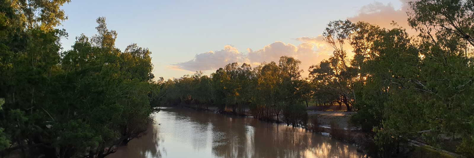
The Barwon and Culgoa Rivers meet to form the official starting point of the Darling River.
Balonne River starts where the Condamine and Dogwood rivers join.
River Red Gum timber survives for decades in the water so old fallen trees are common all throughout the Murray Darling Basin and can be problematic if you have low flows.
My Personal Journey
I paddled this section with a falling flow in the river, and I estimated it was less than 95 ML/day at one point.
There were a small number of particularly bad sections of fallen trees between Chinchilla and Surat. The few kilometers by the confluence of Dogwood Creek was one of these. I estimated that on my worst day, I had to portage about 5 times every hour.

Compared to the first trip, this was a cruise through wide-open flowing river with lower banks.


Surat is a small country town with a general store.
The Balonne River is generally deep and wide with some narrower sections on good flows before a decent day's paddle along Lake Kajarabie. On a low flow, expect to fight through a significant number of log jams. Note while Surat is only 104 km from Dogwood, it is 296 km from Chincilla.
My Personal Journey
I was dropped off late and bivvied by the river before leaving early in the morning. I had great paddling conditions until I met the long reach of Lake Kajarabie about halfway down. The lake had easy paddling but plenty of submerged flooded trees if you left the main channel.
I had managed to cross over onto the tail of the flood flow that I was chasing and I was starting to get some additional water to paddle on, albeit numerous portages over fallen trees and log jams were still required. The lake was fairly full, and its reach marked the end of the portages, at least until I reached the dam itself.
The reach seemed to go further upstream than the previous trips, and it made for what felt like a slow trip down to the dam on still water. But it was fairly easy paddling with just a single partial log jam below the weir at the first left-hand bend.


When Lake Kajarabie is filled, the waters extend a long way up to around Wycombe. Below the dam there are some fairly shallow rocky sections just before the flat waters created from St George Weir. This would likely be impassible with a very low flow.

My Personal Journey
I tried to stay with the flow through the channeled section below the dam that was clogged up with river bottlebrushes. I had to portage a couple of times to move back into the main channel. Easy paddling on the weir pool.
There was no water being released, and I was forced to do a 7 km portage from the dam down to the Carnarvon Hwy, where I was able to re-enter the top of the Jack Taylor weir pool for the final part to St George.
Without any release from the dam, I had to stop here, and I shuttled my kayak to Walgett and continued from there.
This time, rather than trying to pick the biggest flow, I stayed mostly to the right of the 1 km channeled section. This gave me an easy-flowing section, a 100 m Grade I/II boulder scrape through trees, and a gentle channel to finish. Escape left as early as possible in this final section.


Make good use of the two supermarkets in town, a Foodworks and IGA. It is a long way to Bourke! Other possible stores are a long way from the river and could be closed.
Downstream the river becomes channelled with dense stands of river bottlebrush / paperbark(Melaleuca paludicola) that can clog up parts of the river that only see periodic inundation.

What way to go????
I had initially thought the Bokhara River was the best choice as it has multiple small towns that could be used for supplies, but the Culgoa River appears to have the best overall flow when there is water. The Bokhara River appears to be mostly dry outside of flood events.
 wide at places.")
Culgoa River is 443 km long and rejoins the Barwon River to form the Darling River. It did have a store about half way at Weilmoringle but this is now closed. Even after joining the Darling River you still have 84 km to go to get to Bourke. This means that you will be facing a 606 km leg without supplies unless you organise a food drop somewhere along the way.

The Birrie River is the third major river that flows from the Bokhara River back into the Culgoa River and the Narran River is another major river that is a distributary of the Balonne River. This flows into the ephemeral (temporary) and endorheic (closed, no outlet rivers) Narran Lake.
The river lengths are:
Culgoa River 442.7 km
Balonne Minor River 79.1 km
Bokhara River 413.0 km, total of 492.1 km to the Barwon River
Birrie River 266.3 km
Ballandool River 104.0 km c/f staying on the Bokhara River at 110.3 km
Narran River 311.4 km
The combined lengths from the start of the Culgoa to the start of the Darling are:
442.7 km for the Culgoa River
543.1 km for the Balonne Minor (79.1 km), Bokhara (138.0 km),
Birrie (266.3 km) and Culgoa (59.7 km) rivers; 100.4 km longer.
578.4 km for the Balonne Minor (79.1 km), Bokhara (413.0 km)
and Barwon (86.3 km) rivers; 135.7 km longer.
The Ballandool River looks heavily modified around Ballandool station. Use a lot of caution if attempting this. The lower 30.6 km section was excluded from the above length calculations as it appears that the river rejoins the Bokhara before becoming a new anabranch. This lower anabranch has Briarie Creek as a tributary.
Don't forget to include the 79 km from St George to the Culgoa and the 84 km to Bourke when planning supplies, a total of 606 km via the Culgoa; via the Bokhara, 114 km to Dirranbandi where you can resupply before the 627 km leg to Bourke.
There is an interactive map with key rivers marked at the bottom of the page.

If you are paddling along the Culgoa, you could walk over to one of the towns along the Bokhara River. If you are lucky you may even have some luck with a passing car.
Small store. 114.0 km downstream from Dirranbandi if on the Bokhara River. This is 28 km along Woolerbilla Rd if taking the Culgoa River, about 124.5 km from the rivers head.
Both Hebel and Dirranbandi are on the St George to Lightning Ridge bus route.

Gauges at the border, or see the BoM Northwest Rainfall and River Conditions Map.
My Personal Journey
I chased down the high flood downstream on the Culgoa and I was rewarded with magical floodplains around Culgoa National Park.

I took the Bokhara rather than the Culgoa. This only sees a small fraction of the flow that the Culgoa does and is slightly longer.
After a reasonable day's paddling down the Balonne Minor, I had some of my most difficult paddling experiences ever battling to navigate the river bottlebrushes that clogged the river above Hebel. Thankfully, these eased slowly, and I had easier paddling in the floodplains below Goodooga (2.7 m / 2,000 ML/day at Goodwins). However, there were some interesting sections of Lignums that occasionally clogged up the river.
Fences are common but these were mostly flooded out, however, there were difficult portages over three high dog fences.


Tiny indigenous community in the middle of nowhere! The Post Office / general store has been closed from about 2018, so expect up to a 600 km leg without supplies unless you organise a food drop somewhere.

My Personal Journey
The river was classified as being in moderate flood. Paddling conditions varied from snaggy channelled sections to massive floodplains with water as far as the eye could see.
At Weilmoringle, I could paddle across to the flood banks beside the town where I stopped to ask for water from one of the locals and he supplied me with some additional bore water. It was cool hanging out with Luke for 15 to 30 minutes. This was my only social interaction that I would have over 10 days paddling nearly 600 km!

Map of the major rivers and creeks in the Culgoa section.
The map has markers every km starting from 0 at the confluence where the Darling meets the Murray. Zoom in to see all of these markers. These numbers do not correlate with any existing numbering system on the river.

©2026 Alan Davison // Credit // Disclaimer