")


Drinking Water
Treatment guide and known town supply sources along the river

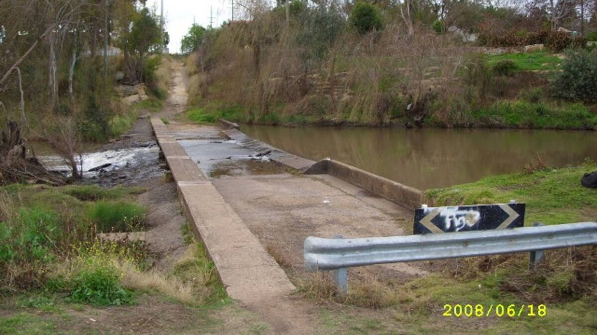
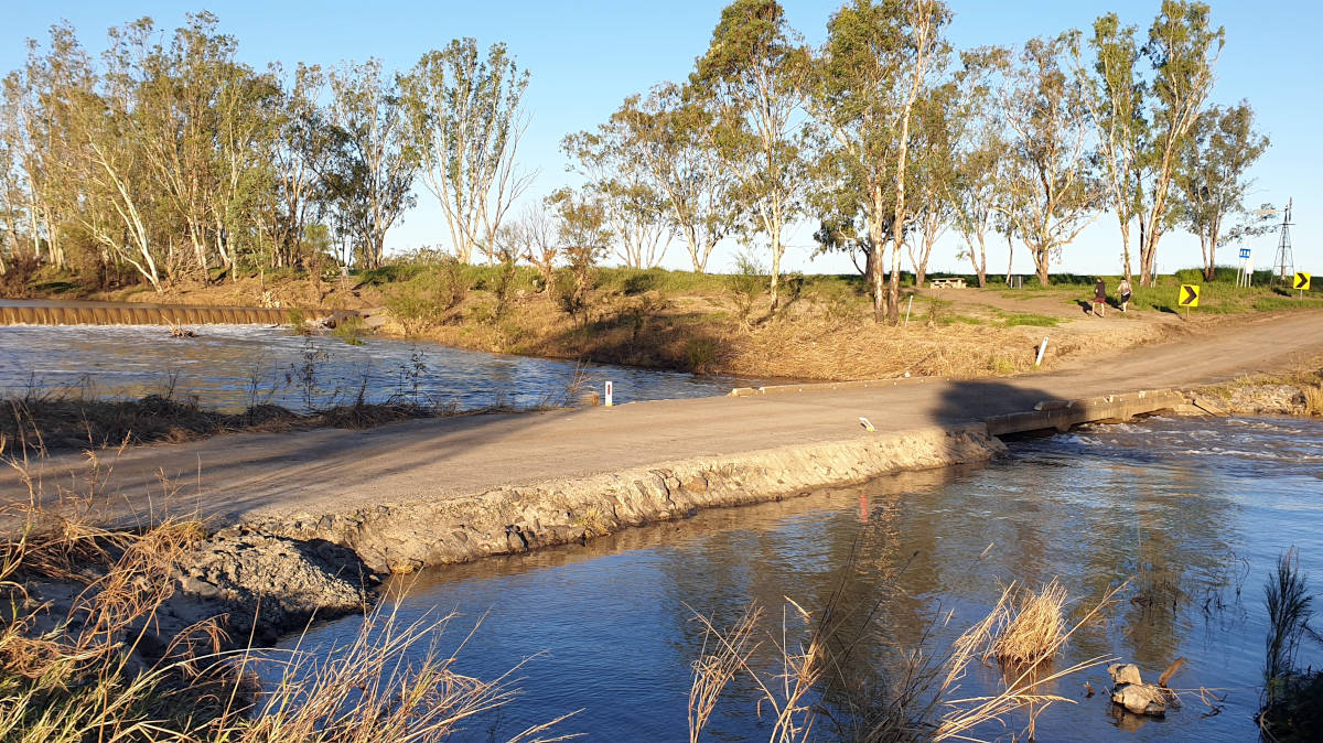
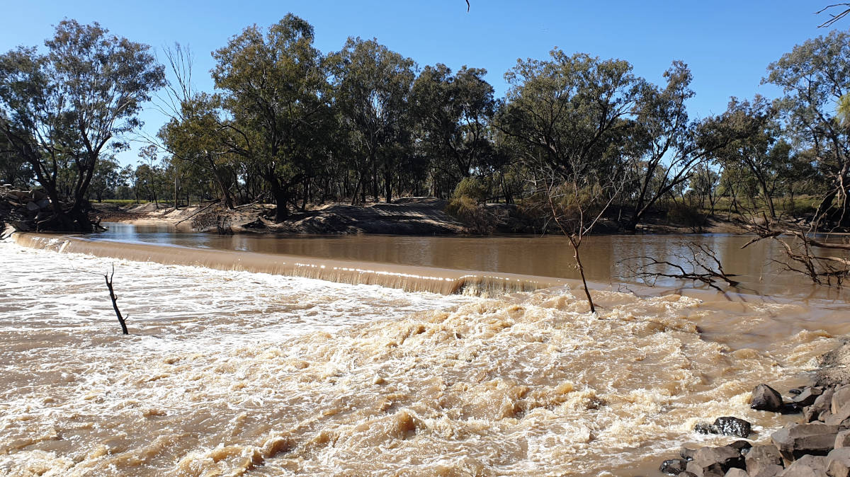
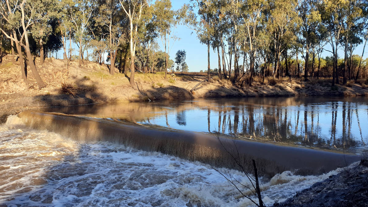
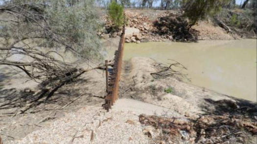
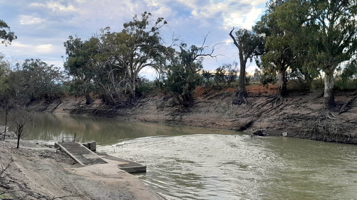
One of the least concerning looking hazards is actually one of the most lethal dangers that you are likely to encounter on the Darling. Unlike most of the weirs in populated centres, the weirs are usually unmarked, especially in the more remote rivers. In the right conditions some weirs can be hard to see from a distance, stay alert.
The dangers posed by a weir are very dependent on the flow. With no flow it is just a hassle to portage over it. With very high flows it may be fully submerged and may not even create a ripple. However, with the right flow many of the weirs can create a perfect hydraulic across the structure that even the most experienced paddler may not be able to escape.

There is only one way to safely navigate a flowing weir, to portage around it. The current can be deceptively strong near the weir, so stay close to the river bank and exit well before the weir. Below the weir wall there will likely be a strong upstream current going back towards the weir as the eddy flow is recirculating back. Finish your portage below well below these currents.

All weirs have been pieced together from misc sources. Some have not been confirmed as I either paddled in high flow or haven't been to some of the areas yet like the upper Barwon River.
Above Warwick there are a dozen or more weirs and crossings. One road crossing had a particularly nasty drop onto shallow rocks. I didn't record those locations.
Over the entire lengths of the Condamine, Balonne and Culgoa Rivers, none of the weirs had any warning signs in the water other than an old warning buoy seen at Talgai Weir and a buoy line at the Chinchilla Weir. Most NSW weirs on the Barwon and Darling from Walgett had an upstream sign that was often easily overlooked, and only a few had warning buoys in the river.
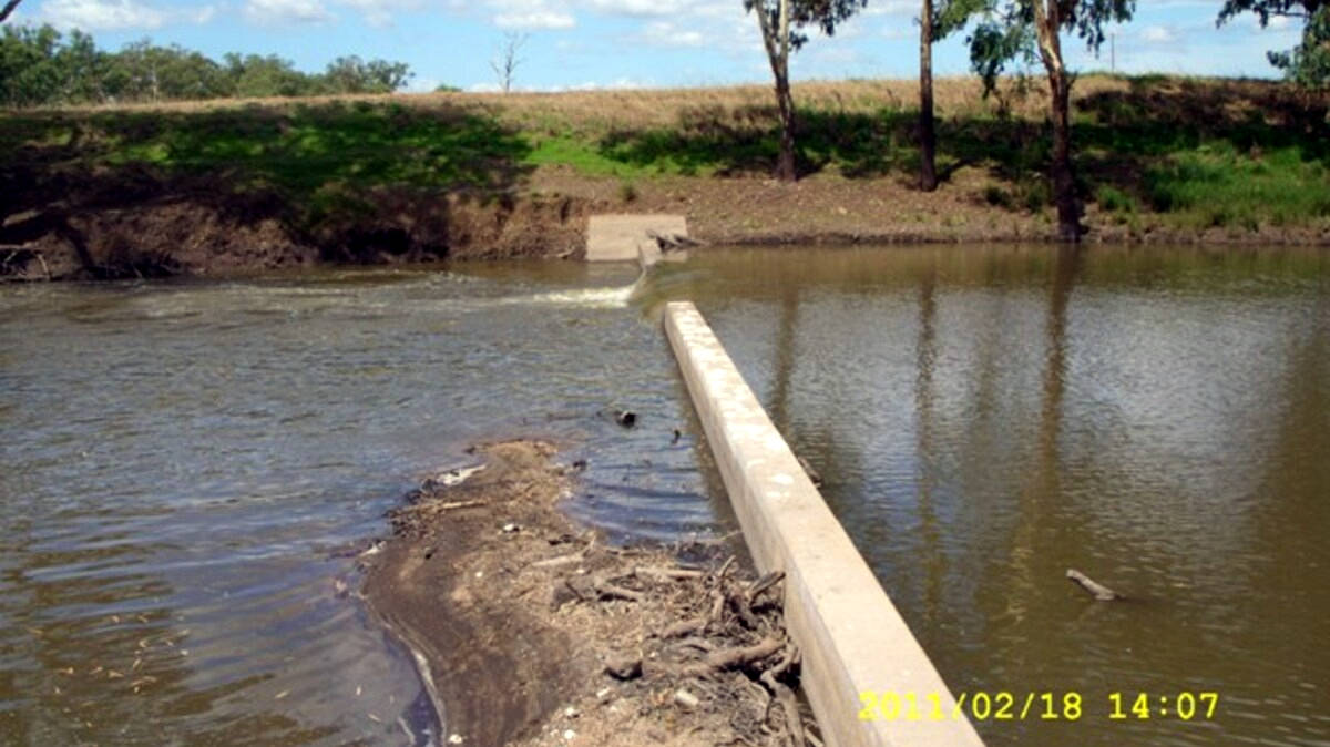
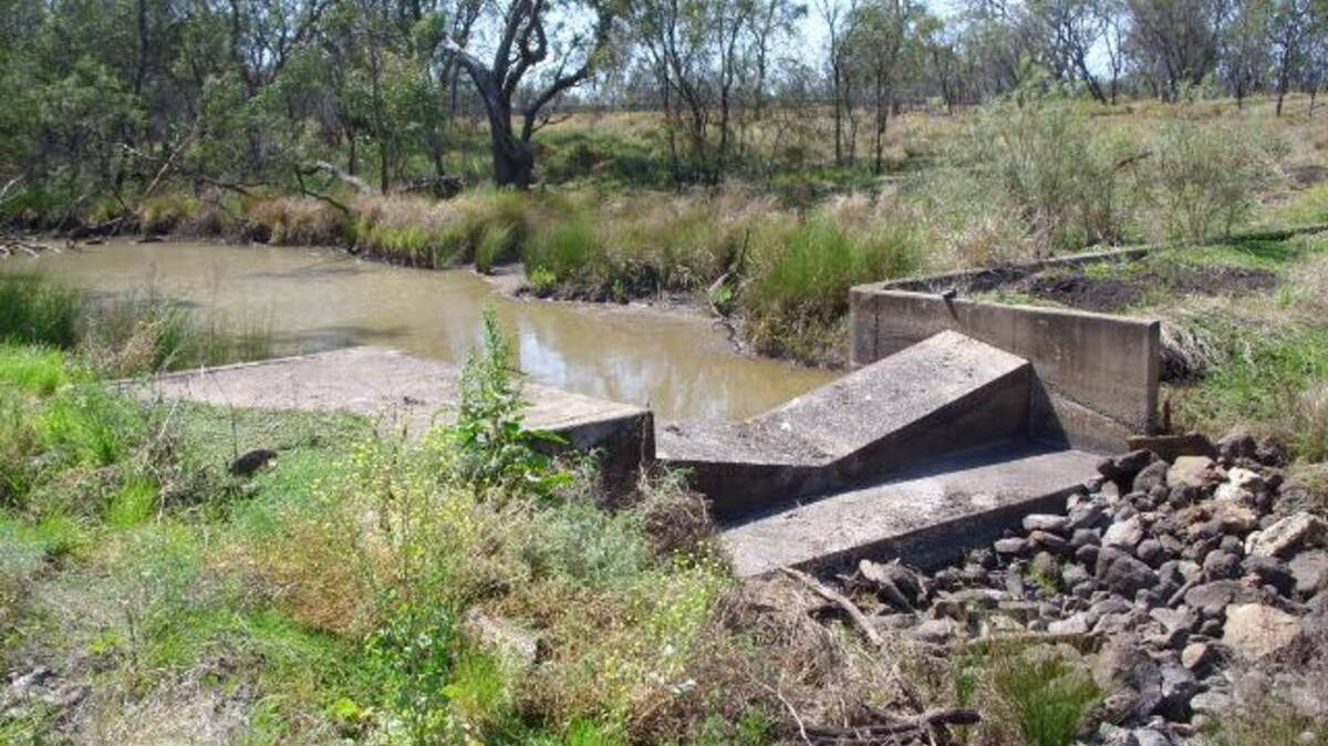
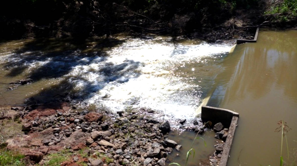
The following is a work in progress collecting up information about the main non-natural hazards on the system. This only includes features that cause a drop of at least 10 cm that I noticed and remembered to record the location as I passed by.
| Name | Hazard | |
|---|---|---|
| Condamine River | ||
 |
Farm Weir | Weir |
Photo taken 2022-05-30 09:00 with a flow of 456 ML/day and 1.27 m at Elbow Valley. |
||
 |
East St Weir | Weir |
Small weir just before Warwick. Additional images: Image Two |
||
 |
Queens Park Weir | Weir |
Photo taken 2020-02-19 11:00 with a flow of 247 ML/day and 0.99 m at Warwick. |
||
 |
Rock Weir | Weir |
Photo taken 2022-05-30 16:45 with a flow of 1303 ML/day and 1.30 m at Warwick. |
||
| Small Loose Stone Weir | Weir | |
Well submerged in higher flows. |
||
 |
Unnamed Weir | Weir |
Photo taken 2021-04-10 08:00 with a flow of 1266 ML/day and 1.29 m at Warwick. |
||
 |
Talgai Weir | Weir |
There is a small gauging control 100 m downstream of the main weir that will likely be washed out. Additional images: Image Two |
||
| North Branch Condamine River (minor rarely flows) | ||
| Neale's Weir | Weir | |
Estimated location on the Nth Condamine. |
||
| Unnamed | Weir | |
Heavily modified section of the river with multiple blockbanks and two large farm dams. |
||
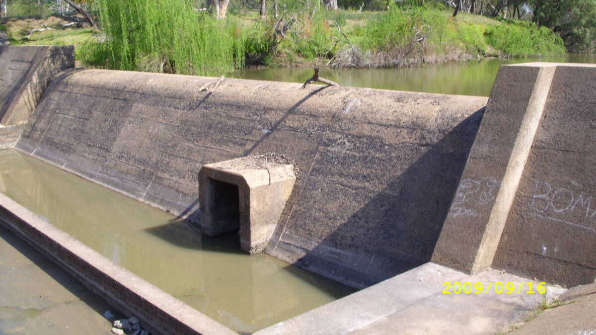
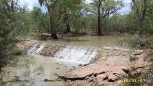
 and Lone Pine Control (top)") |
Melrose Weir | Weir |
Dam that diverts water into the ponds. The image is the control at Lone Pine that is slightly downstream. Additional images: Image Two |
||
| Wondo Weir | Weir | |
Estimated location on the Nth Condamine. |
||
| Nangwee Weir | Weir | |
Estimated location on the Nth Condamine. |
||
| Condamine River (South Main Branch) | ||
 |
Tummaville Control Weir | Weir |
Additional images: Image Two |
||
 |
Yarramalong Weir | Weir |
Weir with a low crossing directly downstream. Additional images: Image Two |
||
 |
Lemon Tree Weir | Weir |
Photo taken 2021-04-12 11:30 with a flow of 1190 ML/day and 4.14 m at Cecil Plains. |
||
| Control or Small Weir | Weir | |
Just downstream of the homestead. Almost fully washed out at 1000 ML/day. |
||
 |
Small Weir | Weir |
Photo taken 2021-04-12 13:45 with a flow of 1123 ML/day and 4.13 m at Cecil Plains. |
||
 |
Small Weir | Weir |
Location unknown, about 2 hr 30 min paddle from upstream weir. Photo taken 2021-04-12 16:15 with a flow of 1110 ML/day and 4.12 m at Cecil Plains. |
||
 |
Cecil Plains Weir | Weir |
Additional images: Image Two |
||
| Condamine River (combined) | ||
 |
Tipton Weir | Weir |
The weir is built either side of a small island. Both pictures were taken on 2021-04-13 11:45 with a flow of 680 ML/day and 4.01 m at Cecil Plains. Additional images: Image Two |
||
 |
Loudoun Br Weir | Weir |
Photo taken 2021-04-14 08:00 with a flow of 629 ML/day and 2.09 m at Loudoun Bridge (Dalby). |
||
 |
Warra Weir | Weir |
Photo taken 2021-04-15 08:15 with a flow of 462 ML/day and 1.59 m at Brigalow Bridge. |
||
 |
Chinchilla Weir | Weir |
Photo taken 2021-04-16 09:00 with a flow of 189 ML/day and 1.08 m at Chinchilla Weir. |
||
| Chinchila DS Gauge Control | Weir | |
A small crump profile weir that is likely to be washed out with most flows. |
||
 |
Stone Weir | Weir |
Photo taken 2021-04-17 10:15 with a flow of 135 ML/day and 0.68 m at Bedarra. With no notes taken, I assume it was washed out on my second trip at 3000 ML/day and 2.75 m. |
||
 |
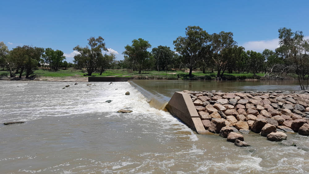
Condamine Weir | Weir |
The weir is built directly under Crawford Bridge, Leichhardt Hwy. Both pictures were taken on 2021-04-18 07:30 12:00 with a flow of 146 ML/day and 0.71 m at Bedarra. The weir was washed out on my second trip at 3000 ML/day and 2.75 m. Additional images: Image Two |
||
 |
Reillys Weir | Weir |
The weir is just downstream of the exit to a flood channel. You should scout the weir before exiting this channel. Additional images: Image Two |
||
 |
Cotsworld Weir | Weir |
Additional images: Image Two, Image Three |
||
| Balonne River | ||
|
Surat Weir | Weir |
Additional images: Image Two |
||
| Weribone Control | Weir | |
I didn't notice this on a higher flow. Additional images: Image Two |
||
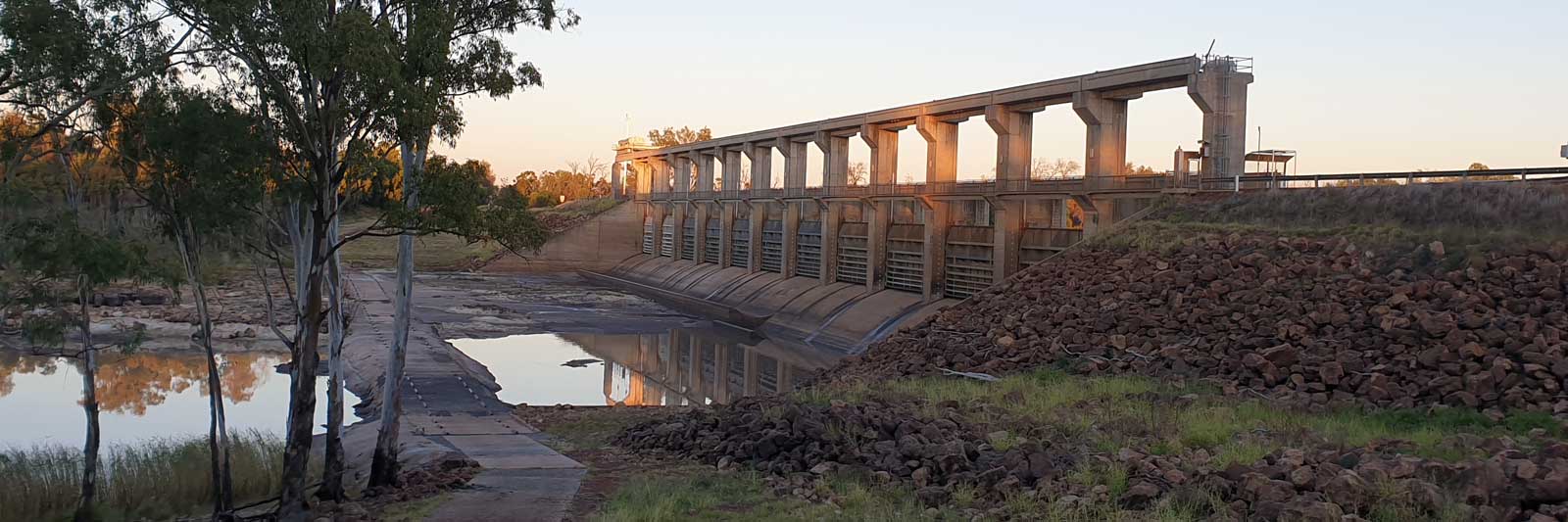
 |
E.J. Beardmore Dam | Dam |
Not a sight that you want to see. The dam was almost full but the gates were fully closed on one of my three trips, forcing a long portage to St George and a detour across to Walgett. |
||
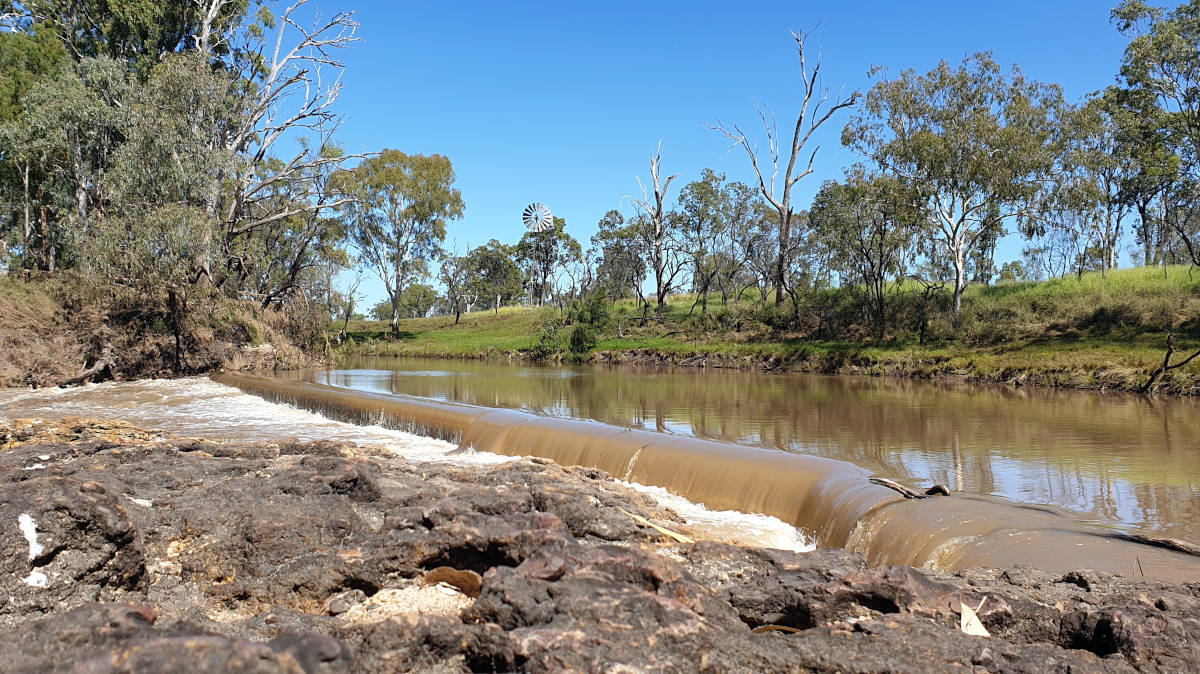
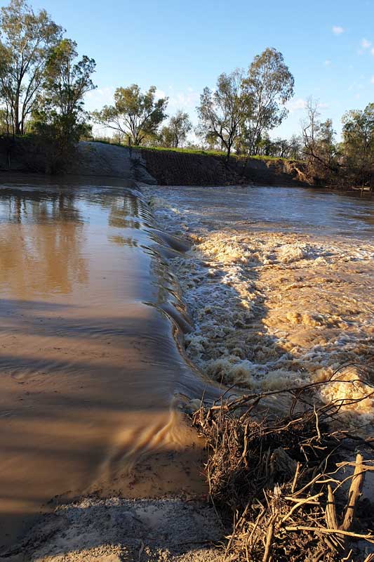
 |
Jack Taylor Weir | Weir |
Photo taken 2020-03-13 17:00 with a flow of 9580 ML/day and 3.02 m at Jack Taylor Weir. |
||
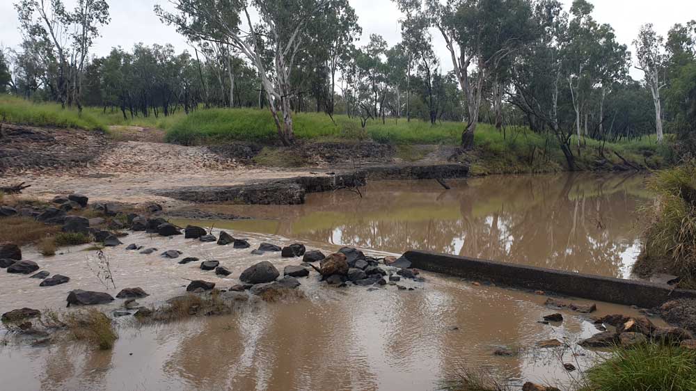
 |
Old Weir | Weir |
Easiest to portage on the right where you may find a small channel depending on the flow. Photo taken 2022-06-14 16:00 with a flow of 5150 ML/day and 2.43 m at Jack Taylor Weir. It was almost washed out at 11100 ML/day and 3.22 m when I paddled this in 2020-03-14 07:30. I erred on the side of caution and portaged. |
||
| Balonne Minor River | ||
| Hastings Weir | Weir | |
This steel sheet-piled weir is one of the two weirs at bifurcation No. 1, controlling flow into the Culgoa and Balonne Minor rivers. Also known as Balonne Minor Weir 1. |
||
 |
Dirranbandi Weir | Weir |
 |
Balonne Minor Weir 2 | Weir |
This steel sheet-piled weir is one of the two weirs at bifurcation No. 2, controlling flow into the Donnegri and Balonne Minor rivers. Additional images: Image Two |
||
| Donnegri Creek Weir | Weir | |
This steel sheet-piled weir is one of the two weirs at bifurcation No. 2, controlling flow into the Donnegri Creek and Balonne Minor River. Donnegri Creek directly feeds into the Narran River Additional images: Image Two |
||
 |
Weir | Weir |
Unknown weir feeding irrigation channel towards Cubbie or another station. |
||
| Bokhara River | ||
 |
Bifurcation 3 Bokhara River Regulator | Weir |
One of the two bifurcation weirs controlling flow into the Ballandool and Bokhara rivers. |
||
| Bifurcation 3 Ballandool River Regulator | Weir | |
One of the two bifurcation weirs controlling flow into the Ballandool and Bokhara rivers. |
||
 |
Weir | Weir |
 |
Weir | Weir |
Small earth dam, exact location approximate. |
||
 |
Weir | Weir |
 |
Hebel Weir | Weir |
Additional images: Image Two |
||
| Small farm weir | Weir | |
Not noticeable in a flow of 475 ML/day and 1.95 m at Hebel |
||
 |
Weir | Weir |
 |
Bokhara Weir | Weir |
The Bokhara Weir of the two Bokhara-Birrie bifurcation weirs. |
||
| Birrie Weir | Weir | |
The Birrie Weir of the two Bokhara-Birrie bifurcation weirs. |
||
 |
Goodooga Weir | Weir |
 |
Dismantled Blockbank | Weir |
Location via satellite imagery. |
||
| Weir | Weir | |
Location via satellite imagery. Fully washed out dam at Warranilla when I paddled past at 2022-06-24 13:15 with a flow of 1960 ML/day and 2.69 m at Goodwins. |
||
 |
Weir, Meadow Plains | Weir |
Fully washed out when I paddled past at 2022-06-26 11:30 with a flow of 2071 ML/day and 2.72 m at Goodwins. |
||
| Culgoa River | ||
| Whyenbah Weir | Weir | |
One of the two bifurcation weirs controlling flow into the Culgoa and Balonne Minor rivers. Additional images: Image Two |
||
 |
Cubbie Weir | Weir |
Photo taken 2020-03-15 15:00 with a flow of 2020 ML/day and 3.32 m at Woolerbilla Rd. |
||
| Brenda Weir | Weir | |
A small homestead weir that was Fully submerged as I paddled past. |
||
| Weilmoringle Weir | Weir | |
Fully submerged as I paddled past at 7000 ML/day. It has a capacity of 600 ML. |
||
| Kenebree Weir | Weir | |
Unconfirmed weir detected in satellite imagery and MDBA dataset that would have been fully submerged as I paddled past. |
||
| Gurrawarra Weir | Weir | |
Unconfirmed weir mentioned in the Northern Basin Toolkit Ecological that would have been fully submerged as I paddled past. Pin is by Gurrawarra Homestead. |
||
| Barwon River | ||
 |
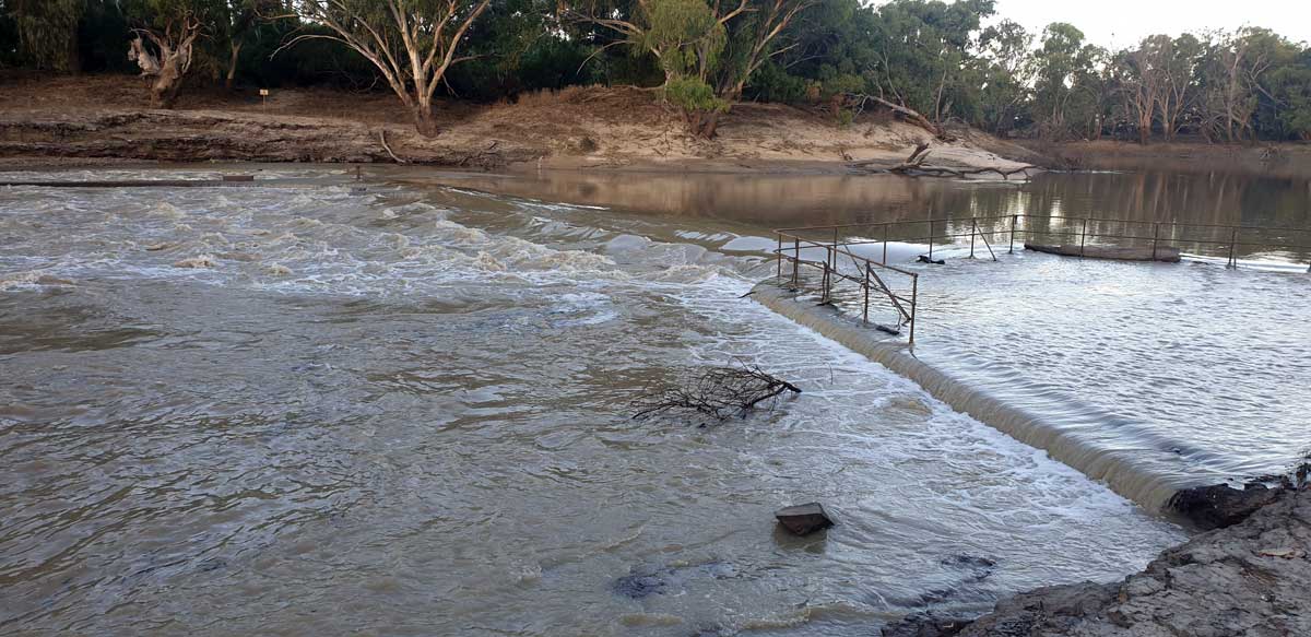
Walgett Weir | Weir |
Also known as Darling River Weir No. 11A It was just washed out enough to paddle with care at 7400ML/day. Additional images: Image Two |
||
 |
Brewarrina Weir | Weir |
Also known as Darling River Weir No. 15 Additional images: Image Two, Image Three |
||
| Darling River | ||
 |
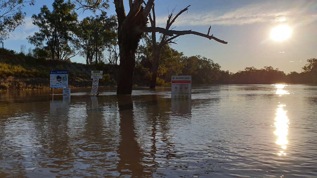
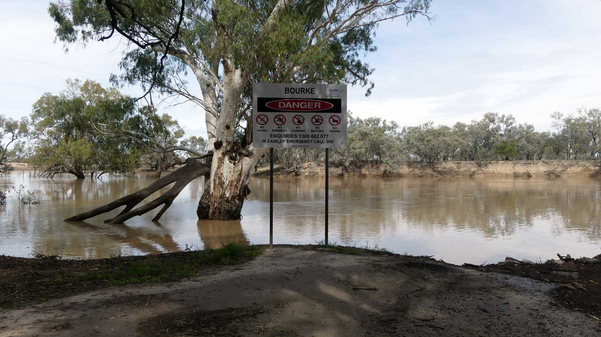
Bourke Weir | Weir |
The remains of the old lock can still be seen on the western side, to your right as you paddle downstream. Additional images: Image Two, Image Three |
||
 |
Dismantled Weir | Weir |
Dismantled Weir? Whatever it is, it will likely be fairly well submerged in the weir pool of 19A. Photo taken 2023-05-10 15:00 with a downstream flow at Bourke Downstream (#19A) Weir of around 1400 ML/day and 2.00 m. |
||
 Weir. Photo taken 2023-05-10 15:45. Flow of 1400 ML/day and 2.00 m") |
Bourke (#19A) Weir | Weir |
Additional images: Image Two |
||
 |
Louth Upstream (#20A) Weir | Weir |
Photo taken 2023-05-12 15:00 with a downstream flow of about 1850 ML/day and 2.25 m at Louth. I've paddled this twice where the weir was fully washed out, including 2021-05-09 12:45 with a flow of 36100 ML/day and 10.17 m. |
||
 |
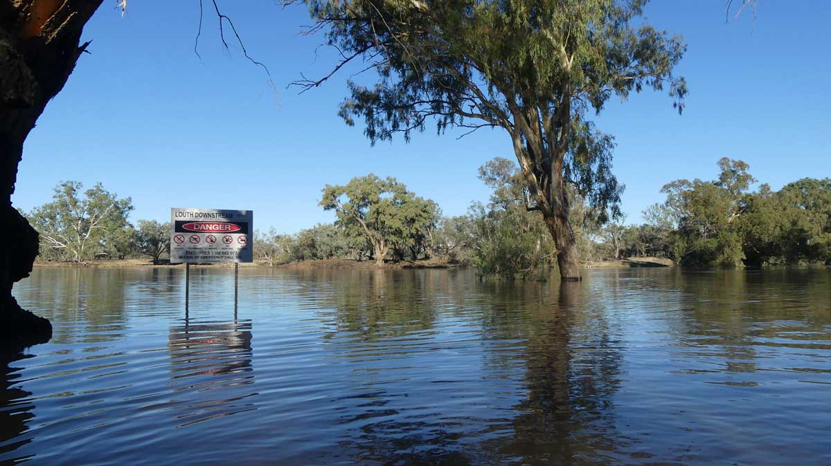
Louth Downstream (#21) Weir | Weir |
I've paddled this twice in minor floods where the weir was fully washed out. Additional images: Image Two |
||
 |
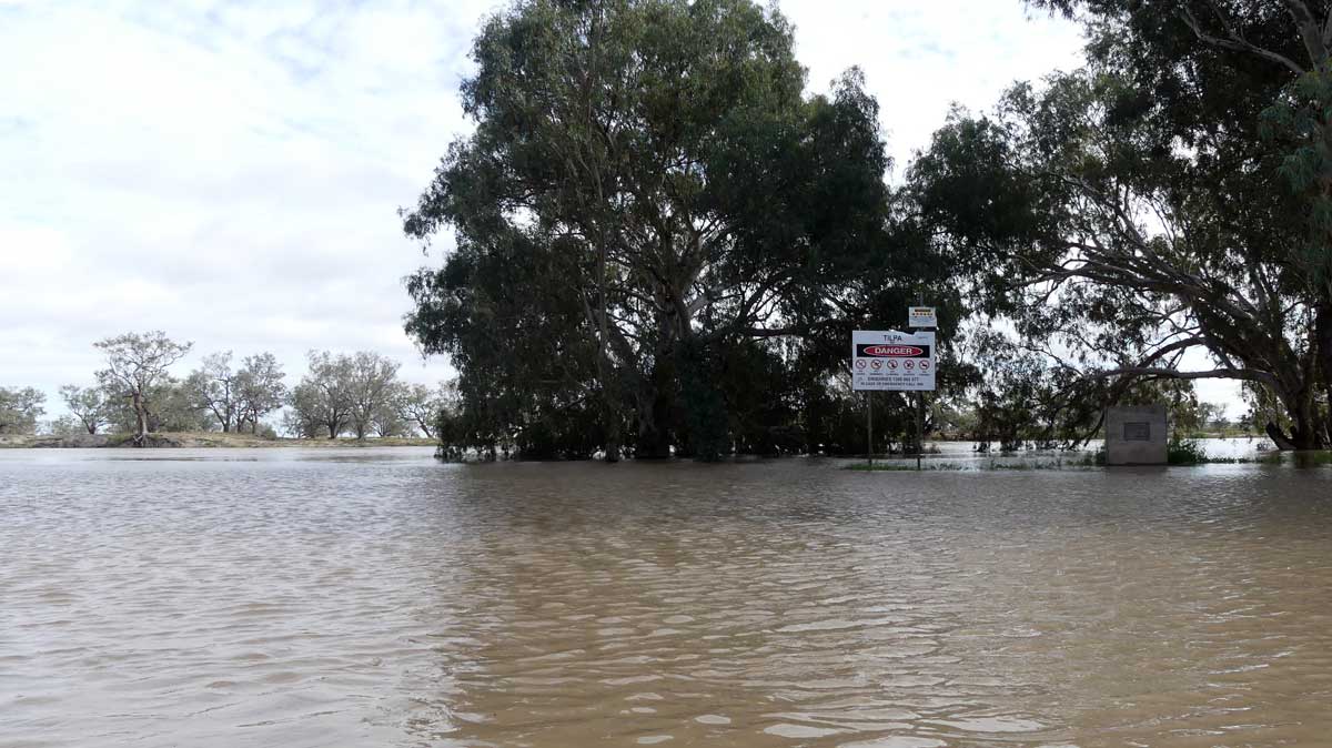
Tilpa Weir | Weir |
I've paddled this twice where the weir was fully washed out. Additional images: Image Two |
||
 |
Old Wilcannia Weir | Weir |
The old Wilcannia Weir. A new one is planned to be constructed around 2025 and will be a few kilometers downstream, flooding out the old weir. Main channel means the main river rather than the smaller channels out across Talyawalka Creek floodplains that rarely flow. Photo taken 2023-05-20 14:45 with a flow of 1672 ML/day and 1.51 m. |
||
 |
Proposed Site for New Wilcannia Weir | Weir |
This is the proposed Site for new Wilcannia Weir, but the exact location may change. Originally planned to be a meter higher than the old weir, this has become subject of debate after the latest plan suggested it wouldn't raise the weir pool height. |
||
 |
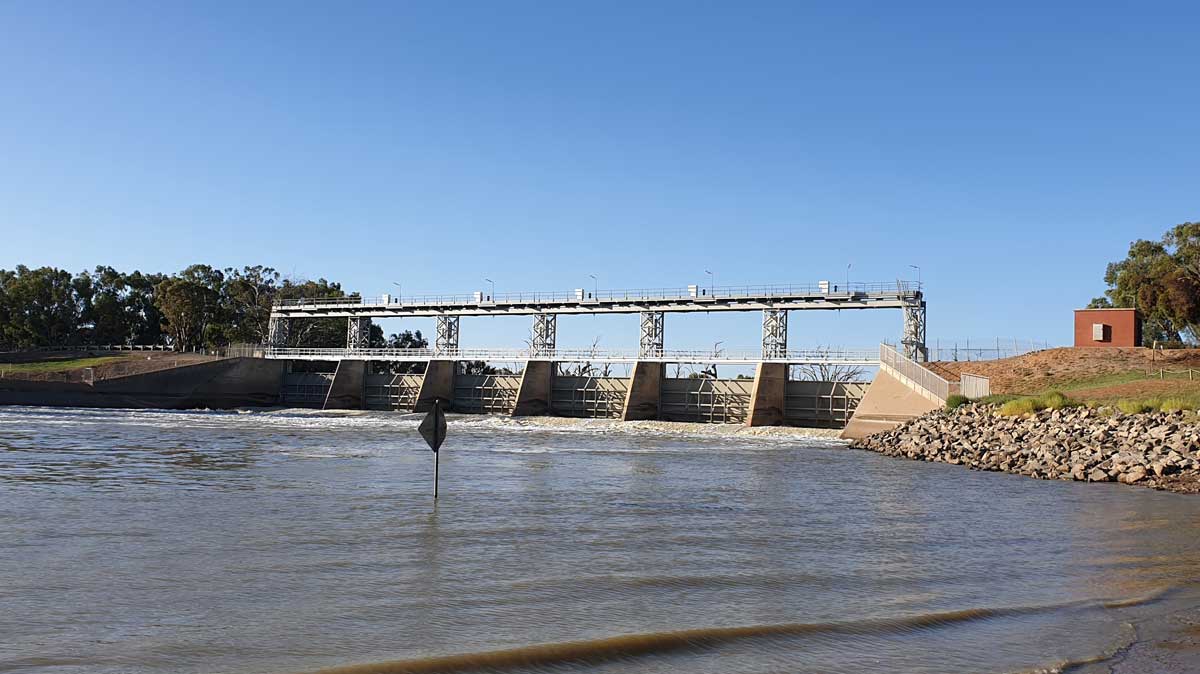
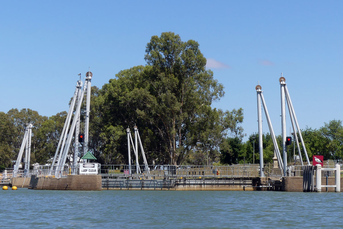
Main Weir | Weir |
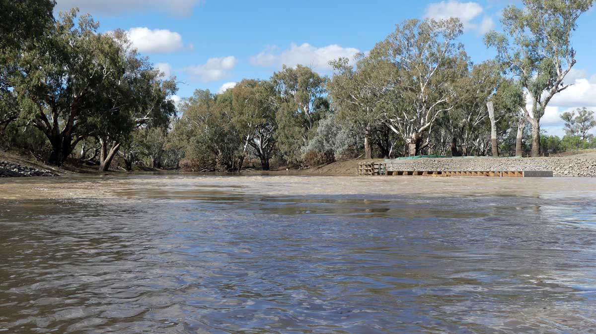
I have always portaged via the left via the boat ramp, albeit I have never investigated the right-hand side of the weir. Usually in low flows, most of the water is diverted to the Menindee Lakes and these return back to the Darling below Menindee. The weir pool from Weir 32 allows you to still navigate this section. Additional images: Image Two, Image Three |
||
 |
Weir 32 | Weir |
Additional images: Image Two |
||
 |
Pooncarie Weir | Weir |
The buoy lines do not seem to get taken out during high flows. Additional images: Image Two |
||
 |
Carstairs Weir | Weir |
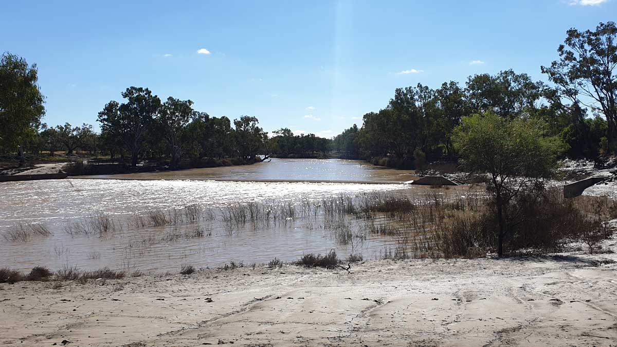
An old low weir built on a rock shelf. This appears to be the location of Carstairs Weir, with no other weirs seen in this section of the river. Photo taken 2021-05-20 16:00 with a flow of 400 ML/day at Pooncarie. |
||
 |
Burtundy Weir | Weir |
Additional images: Image Two |
||
 |
Wentworth Weir | Weir |
Additional images: Image Two |
||
Many of the major weirs in the upper Darling basin are show in the map below:

©2026 Alan Davison // Credit // Disclaimer