Cooper Creek
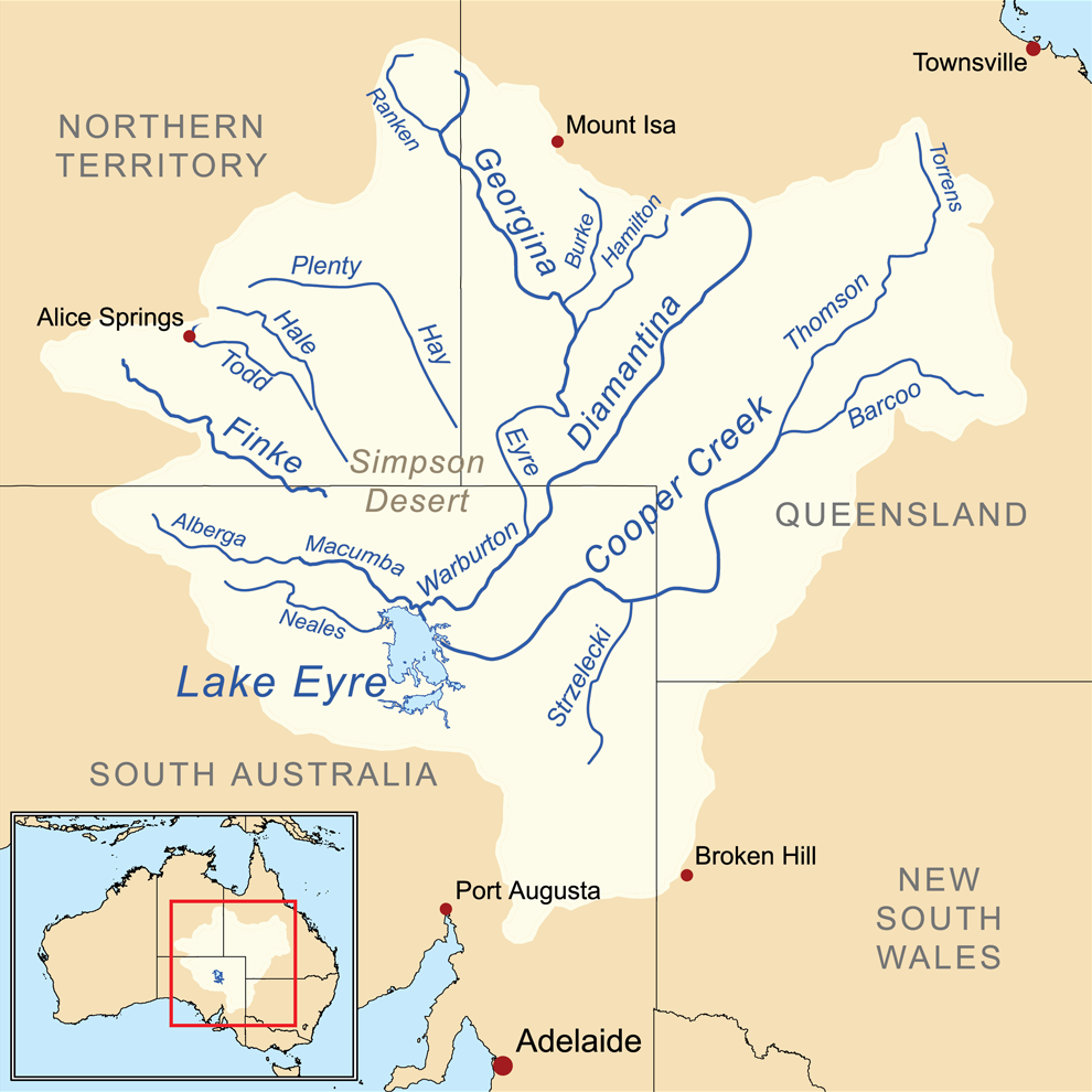
Cooper Creek system is an unregulated low gradient dry-land river system with minimal levels of water extraction, and has very intermittent flows that reduce as you head downstream. It may the only creek in the world that is feed by multiple rivers, the Thomson and Barcoo. The furthest reaches are on Torrens Creek in northern QLD it flows down across the channel country and across the border to SA where is heads west past permanent waterholes and in some years, makes it way west through the Tirari Desert into Kati Thanda-Lake Eyre. However, the normal terminus is the wetlands near Innamincka, mostly to the northern Coongie Lakes system (North-west Branch), southern Strzelecki Creek and western Embarka Swamp (Main Branch).
The area traverses from the tropics into the heart of the country, with lower reaches receivng a modest annual rainfall of around 150 mm, average temperaytures of around 30°C and a mean annual pan evaporation of 3,500 mm. The vast magority of the water that Cooper Creek receives is via the northern monsoonal rainfall from Thomson River and monsoonal and easterly rain systems from the Barcoo River in central Queensland.The channel country a vast network of braided waterways that regularly come alive in “boom and bust” cycles driven mostly by flood events in the headwaters. These form a maze of waterways where the largest may not be the best option in making it down. Any serious attempt should carefully attempt to map the system beforehand to avoid getting stuck in a dead end.
The lower sections are quintessence of the outback. The arid lands with large waterholes of Cooper Creek are entreached in our history with the demise of explorers, Burke and Wills, near Innamincka in 1861. The creek was named after by Charles Sturt in 1845 after Charles Cooper, South Australia’s then Chief Justice.
Guides, Resources and References
Gear
If you are not supported, you will need to take provisions for long distances where there are no supply points.
A sea kayak or canoe is likely the best option for the long leg down from Cunnamulla down to the Darling River. There are possible rapids and frequent snags if low.
Refer to the Murray River Gear Section for a discussion about kayaking and camping gear.
Planning
Information to ensure an enjoyable and successful trip.
The main hazard is the remoteness of the river, difficulty of navigation in the channel country, extreme summer temperatures, along with a number of weirs and snags from submerged trees.
Refer to the Darling River Risk Assessment page that covers the majority of the main risks one will face.
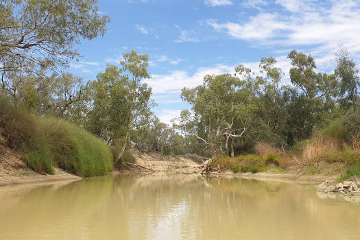
The banner image is of Cooper Creek Crossing in Innamincka, Strzelecki Desert, South Australia.
Klaus-Dieter Liss, CC BY-SA 3.0 (created 16 April 2007)


