Trip Table
My personal trip table from the Darling System Source to Sea 2022.
The Darling River section of my 2022 Darling Double adventure
Short blog and trip table from the first leg of my 2022 trip down the Darling River and the Great Darling Anabranch.
The second leg blog and trip table are in the Great Darling Anabranch section.
After finishing the Lachlan, I had a very long drive home from Balranald, NSW. With no wildlife on the roads north of Moore, I kept driving into the small hours of the morning to make it back to Ipswich. For the next day and a half I did a month's worth of maintenance on gardens to make the place look lived in again, caught up with family / friends and tried to plan the Darling river trip.
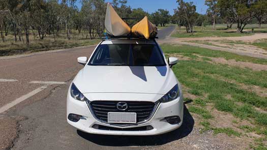
By early Monday evening, I had both my kayaks strapped to the roof of my little Mazda 3 and I started the long drive back to Brewarrina. I only made it past Goondiwindi before meeting a number of kangaroos, wallabies and even foxes on the road. I had to slow right down and car camped in a rest area.
In the morning I continued onto Moree, picking up a fibreglass repair kit on the way. While it was fairly light, it was rather blocky and it didn't fit the smaller rubber deck hatches. With no spare drybags, it had to go into the main hatch. A small oversight but enough to disrupt my normal packing system.
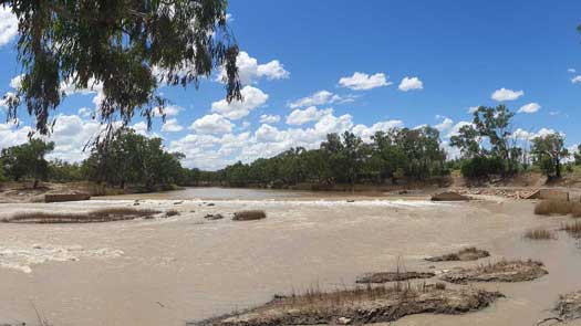
It was late in the afternoon when I arrived in Brewarrina. I drove out to Beds on the Barwon where I had organised to store my car for $50 a week. One of the more expensive places I've had for parking but it was only a quick trip so I didn't spend much time shopping around. The owners are really nice and I got a lift down to the Brewarrina weir. I somehow managed to pack all the gear into the kayak and started a rather casual paddle down at 3:30pm. The kayak was way too heavy and I was rather surprised by the lack of speed compared to my previous trip past Brewarrina. The water level was much lower and while the fish traps weren't visible, there were clear rapids where the traps were. These were well underwater the last time I passed through. This told me I was much further behind the flood waters than I had hoped, and it was the first indication I was going to have harder conditions on the upper section. Without any mobile coverage, I would have to wait until Bourke until I was able to check the conditions. I was still averaging around 8 kph, although I had been hoping for something closer to 10 kph.
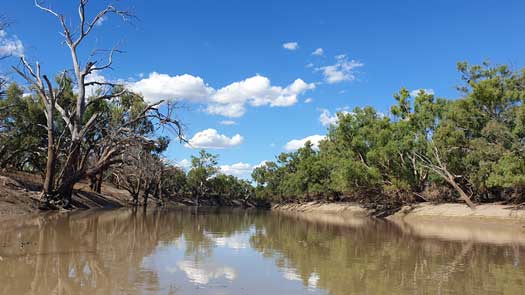
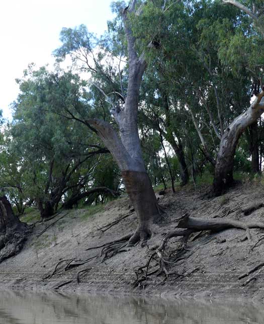
As well as being low, there seemed to be a distinct lack of easy campsites as I made my way down. I'm not sure if this was just this section or if the water level was dropping too far down the banks to reach the mid-height level camps, but not low enough to expose the lower sites. Being behind the flood there was a lot of mud, so these all would be covered in a thick sticky layer of mud. There were also a significant number of fallen trees. While none blocked the river, this gave me some concern about downstream snags and strainers.
It was getting late by the time I got to the Bokhara River confluence. I paddled a short distance upstream to find a low bank that I could pull the kayak up on. I used the stick / branch trick by laying these on the mud before sliding the kayak up on those. The fibreglass boat didn't seem to like it very much with a few disturbing crackling sound as strands of fibreglass break. Not a method to repeat even if there is deep sticky mud... I made camp at the top of the bank, the only flat ground. It is one of the longest kayak to tent walks I've done in a long time.
The water fell around 30 cm overnight. The chase has officially begun.
At Brewarrina, the river was at 2.79 m with a flow of 5,700 ML/day.
A moderate flood peaked here on Jan 4 (35 days ago) at 8.64 m with a 57,800 ML/day.
Weather was warm and sunny with no noticeable afternoon winds on the water, 31.4°C at Brewarrina.
While the river conditions and camp outlook didn't improve during the day, the number of freshly fallen trees had significantly reduced. I had a mob of curious emus on the banks trying to assess if I was a threat or not. I think they actually attempt to hide themselves and then they poke their heads up to watch. However they always underestimate their true size and pick trees or logs that simply are too small to hide their bulky bodies. A boar ran down the banks in front of me and swam its way across the river. I'm unsure if it had seen me or if it simply had no fear of me in my kayak. It struggled a bit to climb out of the water, but eventually found its footings and it ran up the other side.
I also saw a fox that looked fairly emaciated savaging for food along the bank. It must have been in a bad state as it didn't show any signs of running away as I paddled past.
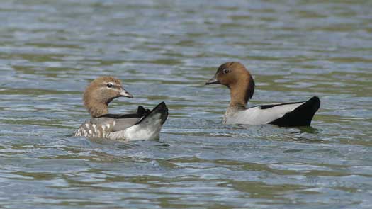
Otherwise it was a relatively quiet day until I met about the 50th pair of ducks with ducklings for the day. Usually one duck will herd the ducklings to safety (usually away from the shore and into your path) while the other duck fakes being a flapper (mature duckling that can't fly yet) to try and lead you away. They usually fly in close before flapping along the water surface away from you in an attempt to lure you away. So as the male Wood Duck flew directly towards me, I barely gave it any notice, until it kept flying straight for my head. I instinctively raised my paddle in front of my face just in time and the duck flew directly into my paddle without slowing. It looked slightly dazed as it recovered from its nose dive into the river behind me before shaking it once and starting another charge. This time it hesitated as I raised my paddle up slightly and decided it was best to abort and it flew off to find its mate.
The heat was definitely becoming an issue. I was through my drinking water by 2pm. Mid-30s by around 11am and it stayed hot until around 4pm. I ended up taking my PFD off and also packed away my main camera to try and get better cooling. There were a few flies at times, albeit not really problematic levels when paddling.
While I made it to the Culgoa confluence with plenty of sunlight left, it felt like a reasonably long day with the heat. The bank that I had moored to on my two previous trips was significantly eroded and was now too steep to easily climb. Time for a new campsite... I popped upstream a small way into the Culgoa and found a low level bank and camped on the dried flood mud. This hadn't been too bad so far, hopefully it stays that way albeit I knew it would be worse as I got closer to the flood.
Today I tried smaller branches and bark strips to slide my kayak out of the water and over the mud, but there was still a faint cracking sound. Maybe just bark and twigs tomorrow? After a slight reorganisation of the gear in the boat I got to bed early for a fresh start to the marathon push down the Darling. I was wondering if a 12 or 13 day trip was still possible.
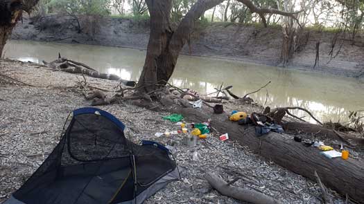
While there was a slight green tinge to the Barwon, the Culgoa wasn't flowing and there were distinct signs of a slight algae bloom. Possibly one of the reasons behind the amber Blue-Green algae alerts for the Darling at Brewarrina and Bourke. Water fell again by around 30 cm overnight. I'd have similar falls all the way until I got close to the peak. While I almost always leave the stern in the water because of the fixed rudder, this fall often means the rudder would get stuck in the mud in the morning but thankfully this never caused issues on my trip.
At Warraweena, the river was at 8.01 m with a flow of 10,300 ML/day.
The flood peaked here on Jan 10 (30 days ago) at 14.40 m with a 84,600 ML/day.
Hot and mostly sunny with no noticeable afternoon winds on the water, 37.8°C at Brewarrina.
26.5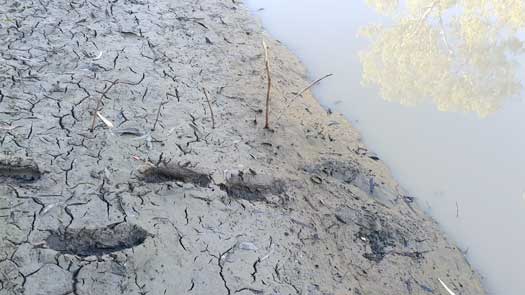
The water levels were in between the levels seen on my previous trips. Definitely seeing less camping opportunities, albeit there are enough. The marks on the trees show that the high flow was up around the bank tops, however not high enough to cause concern if one was trying to find a camp. This did mean there was a lot of potential mud to deal with.
Many of the low sandstone shelves along the river edges were still present and would provide easy takeout opportunities. However, with the pedal to the metal, I wouldn't be doing it myself. Being more focused on the paddle I was likely less observant, but still saw a wallaby, few kangaroos and occasional emus. With the lower water levels I found I couldn't take the two big shortcuts from my previous trip. I worked out I had to paddle an extra 11.6 km more by missing out on four big shortcuts. It was a definite stinker of a day and I was having to water myself down on a regular basis. I'd initially start by just dunking my arms in the water, but in the real heat of the day I would end up pouring about 3 L water over my head, shirt and shorts every 15 minutes, before sponging the excess water out and repeating as my clothes had fully dried.
North Bourke was quiet but there were a few kids playing just upstream of the main township. Some of the girls were doing huge tree climb jumps into the river, well over 5 m high. Fairly impressive!
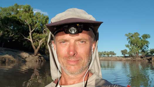
The bank at the wharf was much harder to scramble up with a lower water level, albeit it would likely be easier once the banks dried out from the flood. Just as I moored up and got to the tops of the bank, a couple bored looking local kids arrived with some low level taunts that they probably used on tourists and wanting a dollar for no apparent reason. I make a few short trips back and forth for water to keep an eye on them and my gear. Soon the rest of their friends arrived who were much more mature. We ended up having a big long chat about my trip including what to expect downstream, kayaking in general and even got into a bit of a philosophical discussion about god and bunyips!
I left them to keep playing with themselves and got some supplies for the next leg that I had forgotten to get before Bre. The boys soon got bored and drifted off although a few of the girls hung around waiting to see me off. My quick and mandane supply run ended up being well over an hour in the end, but was fairly entertaining after the long days paddling I've been doing. With a few waves and final jokes about paddling home (upstream), I was off towards the weir.
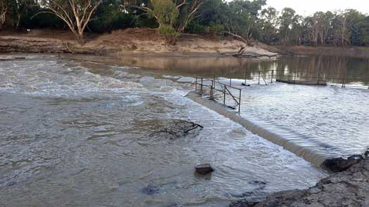
The weir is about an hour's paddle downstream and I knew I would have to portage it this time although I did give it a good scout. There were standing waves about 0.5 m below the lip that would almost certainly cause a deep nose drive but no real eddy. I'm sure that I would likely be fine, even with a capsize, but that would have meant hours drying out gear as the rare hatch cover is bung. I decided against trying. I walked the kayak through the shallows over a concrete ledge and a few rocks before continuing on downstream. Even with the lower flow, lack of shortcuts and long interruption, I finally paddle past my campsite from the first trip. It was a bit demotivating considering I was in my fast boat this year and I was actually slower to this point. I push on for another 2 to 3 hours before making camp by touch light. Insects were problematic paddling by touch light and problematic setting up camp.
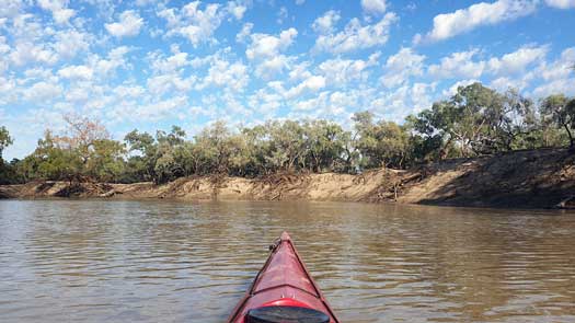
Paddling felt really heavy today. Another very hot day and I was feeling lethargic
from yesterday. Thankfully it was simple straightforward paddling that didn't
need me to be that focused and I podded on, one paddle after another. While the
water level hadn't lifted that much, I must be getting closer. The mud along the
banks was way less dry. A quick pit stop early in the afternoon really emphasised
the point. I popped out onto the bank onto a log near the rivers edge, a hard learnt lesson
from past flood trips. The first step off I was quickly up to my knee in mud, as
was my second and third. Usually the mud quickly reduces in depth as you climb up the
bank, but for some reason it didn't here. Possibly the hardest 10 or so steps I've
ever done in my life to get to the top, and the reverse trip wasn't much easier
even with a few branches thrown down to act as snow mud shoes.
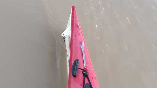
While struggling to clean off the mud while balanced on the narrow log I made a rather surprising discovery. On the very end of the stern was my titanium fork. Sitting there totally unsecured for close to 8 hours. That just shows how gentle the Darling is! I push on even more tired after the exhaustion up and down the bank. I continue doing periodical drenches, albeit I still don't seem to get my energy back so I end up pulling over for a nap. Maybe too soft, but for me a nap means setting up a tent to keep out snakes and more importantly, flies! I set up near the shoreline under the shade of a small box tree and got some sleep.
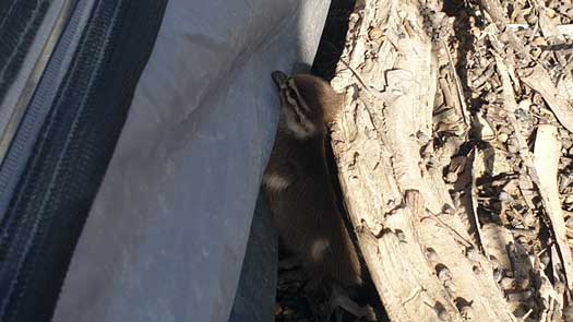
I woke up sweating and saw that the hot afternoon sun was now blazing directly onto me. I needed a wake up call I guess. I notice a strange lump moving under the tent and I gently nudge it towards the side. It was a small duckling that was using my tent to get out of the afternoon sun too. Poor little thing must have been separated from its mother. It scampers off into the water and drives down. Possibly could make it in the wild by itself.
I drag myself into the kayak and move on. Who's silly idea was this to paddle through the outback mid-summer!!!!
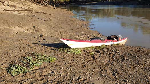
I keep paddling into the early evening and set up camp. The siesta and mud bath really eat into the day and I'm not that much further downstream than I was last year. And it felt that I was a long way behind the flood.
At Bourke, the river was at 5.12 m with a flow of 8,200 ML/day, water temperature of 27.5°C. At Louth, the river was at 8.01 m with a flow of 22,300 ML/day, water temperature of 27°C.
Sunny with slight headwinds, temperature was in the mid to high 30s.
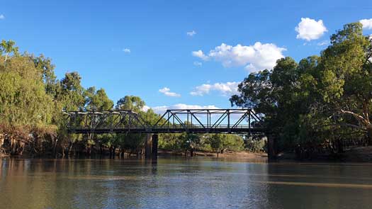
Another long day with three animal encounters of note along with a quick supply stop at Louth late in the day.
The first was when I was paddling along in an almost meditative state listening to one of my favourite songs when I felt a sudden gust of wind around my neck. I spun around to see an angry female wood duck making a fake charge at my head. She made another before backing off after I umm politely asked her to go away, ok not that politely and with only a couple words. What's up with the ducks this year?
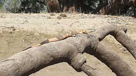
Second encounter was with a monitor lizard that I think was an adult sand goanna (Varanus gouldii). It was sunning itself on an exposed snag and retreated up a branch as I got near, trapping itself. It had an amazingly pattern on its body as if it was the canvas for a skilled Indigenous Australian artist to paint the sacred design belonging to an ancient Barkandji ritual. It was a mix of dot painting swirls and line art. I only managed a couple of poor photos on my phone while drifting with the current before I left it in peace hoping the photos would turn out ok.
I passed Louth early in the evening and got some fresh frozen bread from the pub that does carry some basic supplies like tinned food, spreads, etc. And I also topped up with water from the town hall tank. It was a long leg from here to Wilcannia (439 km) and temperatures were touching 40°C. Also I was still unsure if there was a reliable water source in Tilpa (there wasn't). While I could treat the river water, it was slow and potentially unsafe with the Blue-green algae alerts that I had seen issued before I had started. So I topped up with 25 L water, significantly weighing down the kayak before sluggishly setting off again. Note for any fellow travellers, the public toilets are just behind the town hall. The tank is untreated rainwater.

My final encounter was with a small slithering guy. It was on the path between the kayak and my intended campsite. Since I didn't want to accidentally stand on the poor little fella, I gave the soil beside a slight poke that usually makes them move off. It didn't budge. So I spent 5 minutes herding it away with my paddle by trying to scope it up gently but it would just slide off every time I got my paddle bland under it. It was an extremely chilled little thing, so chilled I was wondering if I should just pick it up and move it... With help, I discovered that it was the De Vis' banded snake (Denisonia devisi), also known as the mud adder. It is a moderately venomous snake.
Mosquitoes were insanely bad and I decided against cooking, snacking instead inside my tent. For those that haven't experienced this, they start to make a constant humming noise. It's actually kinda pleasant to fall to sleep with, as long as they aren't biting anything that is!
At Louth, the river was at 7.2 m with a flow of 19,100 ML/day, water temperature of 27.4°C.
The moderate flood peaked here on Jan 23 (20 days ago) at 11.96 m with a 69,700 ML/day, just 4 cm below major flood levels.
Sunny with slight headwinds, around 36°C.
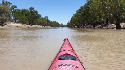
Boat setup and possibly a lack of rest was starting to make my back playup today. This eventually got too bad late in the afternoon and I set up camp before sunset. At least I wouldn't have to battle mosquitoes tonight and was able to cook tea.
Two shortcut today... 2.97 km saved, the first of the trip. Every km counts!
At Louth, the river was at 6.65 m with a flow of 17,000 ML/day.
At Tilpa, the river was at 10.57 m with a flow of 32,500 ML/day.
Sunny with slight tailwinds, 37.4°C at Wilcannia.
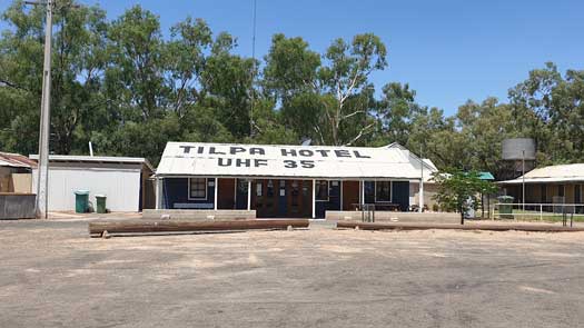
I stopped in and tried to see if I could find water at Tilpa even though I still had plenty left from Louth. New toilets and sports facilities but no public drinking water. The pub was closed and talking to one of the locals, he suggested to Hall tanks. However, these only have large taps and would likely cause a lot of spillage and be extremely wasteful of the precious commodity. So if you are planning to get water here, prearrange it with the pub. When I passed through in winter the pub was open, but they only stocked bottled water.
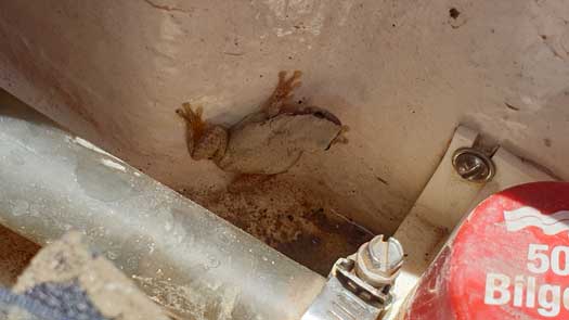
Getting back into my boat I discovered a small passenger. My third amphibian guest in four days. The other two frogs had made themselves known by deciding to climb up onto me after dark. You always pause for thought as you feel something unknown climbing up your leg... Along with abundant frog populations along the river, I was also noticing there were lots of small fish fry feeding on the surface. Anytime a bird would fly over, the surface would often ripple as 100s of these all drived down at the same time.
Mid afternoon I stopped due to back pain again. This time I managed to walk it
off while looking around for a good mud-free, flat and ant free campsite. I adjust
the seat slightly and cautiously continue on. I managed to get about 5 km
further than last year's campsite before calling it a day night and set
up camp. Mossies are terrible and I accidentally breath one in through my mouth,
before three more up my nostles. Time for the fly net!
It was a big day's paddling to reach the same campsite as last year. While I had to stretch occasionally, no real back issues today. Either getting better core strength (mmm.. this is week four) or more likely, the minor seat adjustments are helping.
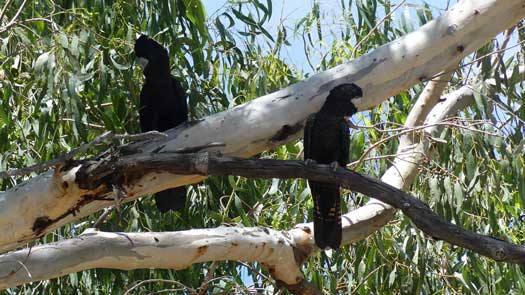
Stopped to watch a few red-tailed black cockatoos, but mostly today I had my head down and was pushing hard to match last year's time. Even with the 5 km head start, I pulled into last year's campsite about 1 hr later than last year. There were tiny little black ants everywhere but I was too tired to really care and I found a spot that was mostly ant free. Even with tiny jaws less than a mm long, the little buggers occasionally hit a nerve. I was starting to regret my decision. After cooking and eating tea I crawl into my sleeping bag and eventually get some sleep after eliminating about 4 dozen ants.
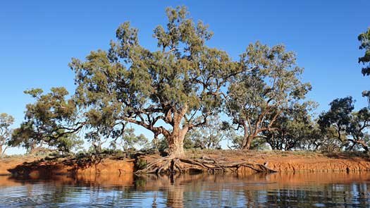
Last night's decision to stay put really came back to bite me this morning. The little critters had found their way into every nook and cranny of the kayak other than the hatches with the rubber covers. It took me close to 45 minutes washing them out. Even then I couldn't get them all and I had five days of playing whack-an-ant as they appeared from nowhere.
Even with the slow start and frequent disruptions killing ants, I managed to make a great time today. The river was high enough for the same shortcuts as last time, and a new one. These were also deeper and flowing more freely. It was still not high enough to submerge the block bank on one shortcut, but almost.
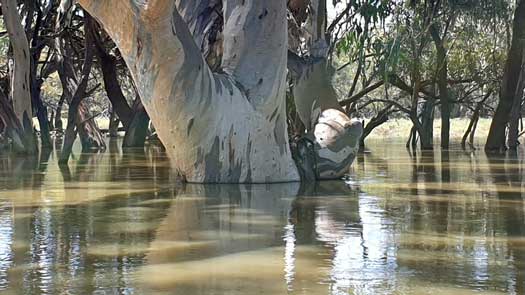
Just before Wilcannia I noticed that I was completely up with the flood peak from the marks on the trees. Due to wind ripples you tend to get a 10 mm mark just above the waterline. You see that when you are ahead of the main peak and at the peak itself. It was a relief to finally make it.
As a side note, I was actually just behind at this point. It had peaked at 9.929m a day before I paddled through at 9.924m, so it was 5 mm lower. I would have reached the real peak slightly downstream of Wilcannia.
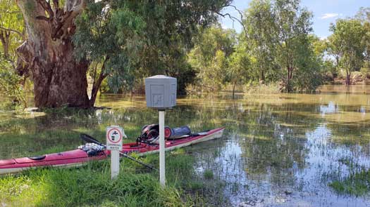
As I reached Wilcannia, I was able to paddle straight into the camping ground. I had planned to have excess water when I left Louth, but I only had a litre left. I was hesitant to take water from submerged taps, but this was the only real easily accessible point. At least it appeared to be running clear, so I topped up. I noticed some SES walking around so I paddled over for a chat and update since my phone doesn't work in Wilcannia. They were only there on a precautionary basis and no major flooding issues were being seen around the local area. Popped up for some supplies and I must have hit the general store right on rush hour with a 15 minutes queue. Busy small town!
Just as I was getting back into my kayak some guys were launching a jet ski. The first boat seen on the water over the entire trip. They took off upstream leaving me to my peaceful paddling enjoying the flood flow.
As noted already, the river hadn't changed much at Wilcannia being at 9.92 m with a flow of 29,400 ML/day, but I was definitely riding a faster current already.
Hot and sunny with no wind, 39°C at Wilcannia.
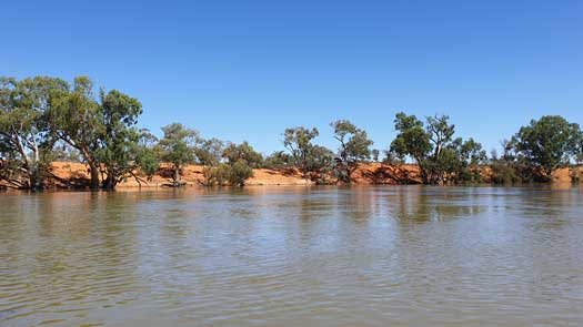
Early morning thunderstorm at 3 am and a small shower. Heavy enough to force me to get out and throw on the tent fly. Rude way to be awakened at night, I should have really paid more notice to those clouds forming on the horizon yesterday.
It was a day of great flows and shortcuts. I recorded 25 good shortcuts and only 1 bad one by the time I reached my campsite. Most were floodplains and it was usually impossible to tell if I was paddling over channels or just paddocks. My one bad one wasn't that bad either, I just had to pull myself over some logs as I exited but since it was a very short corner cut it probably cost me some time. All up, I saved 26.2 km off the 140 km segment of the Darling.
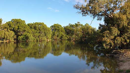
It was also the second time I chickened out of a good looking shortcut on this segment. Like last time I was fully committed just as it turns hard west away from the river. Studying satellite maps, I could have potentially saved another 3.1 km or ended up in a shallow billabong that only saved 100 m. Definitely a small risk worth taking if I ever go to the river again for a third time!
I should have taken more head of the water I had gotten from Wilcannia, definitely slightly contaminated. Thankfully it's only mild and I decide to keep using it rather than wasting time treating the remainder.
Lake Wetherell was at 61.09 m, 77.5 GL (68.1%) and rising. The lakes combined were at 1,707 of 1,731 GL (98.6%). It peaked on Feb 27 at 61.46 m, 100.5 GL (88.4%).
Sunny with headwinds, around 35°C.
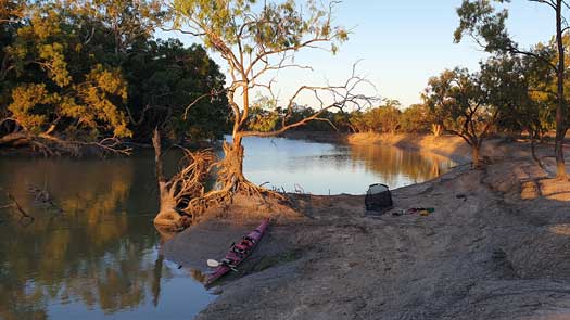
I had camped just upstream of Happy Jack Island, which is roughly the top end of the reach of Lake Wetherill when it is full. It marked the end of the fast flowing flood waters but in saying that there was still a good flow. Less shortcuts but after paddling mostly straight across the lakes flatwater I had saved 23.8 km
I followed the central path through the lake like last time, but altered my path this time and followed the flowing lake river channel to the southern edge to try and get some protection from the southerly winds. This resulted in what was more like traversing a small creek than a lake, but eventually I popped out onto the main body of water. Fairly easy navigation, albeit you should give fences a wide berth. I had the bad luck of hitting an underwater metal fence post that made a large scratch in my gelcoat.
Main weir was still flowing, but I was greeted with a muddy shoreline. This was a bit perplexing as the main flood water was yet to reach the lakes but NSW Water was reducing the flow downstream. Someone suggested this was because of water quality issues to prevent brackish water being let out or something. I camped early to avoid reaching Menindee really late at night and I wanted to talk to the locals in the morning about transport options for the Darling Anabranch. In hindsight this was a bit of a mistake costing around 5 hours paddling time. There is some fairly unadvertised free camping just in Menindee () that would have allowed me to get much closer, saving the 21 km paddle in the morning. Camp was on a low shelf on the bank, probably the worst of the trip.
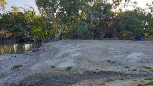
After what seemed to be an exceedingly long paddle, I finally made it to town. I visit the pub, shop, servo, and info centre to try and find a way to get from Wentworth to Menindee. No direct ideas but I do find out the road from Poncarrie and Menindee is in a rough state and would be very difficult to cycle. Roadworks should mean it is sealed by 2023. But for me right now that rules out the idea of cycling... I also hit people out about the anabranch and mostly get a very negative view of the river being an impassable tangle of weeds, with one positive account suggesting it was like a small running stream when it did run. So apart from some fresh bread and fruit, it was a rather unsuccessful and demotivating stop. It was lunch time before I got back onto the river. Definitely lost around a half day's paddle because of the stop.
I pass weir 32 and there is only a ripple. Almost completely under the water bar from some of the bank stabilisation structures. I knew the other weirs below me would be well under. Just like Wilcannia, I had no reception here, I was paddling blind. Fairly uneventful paddle down. I've had the river to myself since Wilcannia.
At Weir 32, the river was at 4.25 m with a flow of 10,600 ML/day, water temperature of 25.5°C. The high environmental flow peaks just on minor flood level on Jan 27 (23 days ago) at 6.06 m with a 18,400 ML/day.
Sunny with westeries, 32.4°C at Menindee.
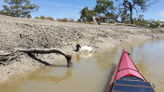
I'm disliking having to deal with more mud chasing yet another high flow, but it is nice being able to paddle near the bank tops and see the world. A stark difference to last time when I was paddling a small flow at the bottom of tall banks. While I was below the main peak, I was fairly high and the water level was only just under the red clays that marked the edge of the floodplains. It definitely gave the lower section a completely different feel that I was loving.
I happened to glance to my right and notice a lamb on the bank. I quickly realised that the poor thing is trapped in mud and paddle over to help it. I easily picked up the small thing that quickly ran off and thankfully found its mother. I've forgotten how cute these little guys are.
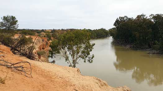
I stop at some cliffs for a photo and walk. These are just upstream of the anabranch and they are the only ones that don't have any homesteads built on top of them. The overcast skies aren't the best for photos but it is somewhere to aim for as a camp for another trip.
Just a couple km downstream is the anabranch and it is flowing freely. I paddled down it for a while to see what it was like. I was in a fairly narrow channel, but it was flowing deep enough to submerge most of the snags. There were signs of the recent high flow that covered the banks with a lot of mud. It would be trivial to paddle the high flow. I was tempted to keep going, but I knew it would be snaggy and I had nowhere near enough supplies for the trip. Wisely I turned around and headed back upstream to the Darling.
Definitely noticing a lack of wildlife down the river after leaving the national park. Very few waterbirds.
Just towards dusk I see another sheep caught. This one looked like it had been trapped for days and it turned into a struggle to get it out. In the end I had to use my spare paddle as a shovel to dig the poor thing out. It couldn't even crawl once free, all feeling was lost in its legs. It was nearing dark as I finally finished washing the mud off myself, and I turned around to see the sheep had made it to its feet and had wandered off. Maybe easier just to let the farmer know next time... I talked to a couple different farmers and there is really no easy way to help other than getting down and dirty pulling out the individual legs from the mud and dragging them off the mud.
At the Great Darling Anabranch offtake, the river was at 7.37 m with a flow of 14,000 ML/day plus 335 ML/day into the anabranch.
The environmental flow peaked here on Feb 9 (11 days ago) at 8.36 m with a 17,900 ML/day plus 1,205 ML/day into the anabranch. A flow of 2,000 ML/day was being released from Lake Cawndilla from Dec 3 2021 up until Feb 24.
Overcast with slight headwinds, 32°C.
Fairly uneventful paddling day other than a swimming monitor lizard. Lack of bordlife still apparent, albeit I get a small distant look at three Pink Cockatoos flying off, though not knowing these even existed, I put the sighting down as some exceedingly pink Long-billed Corellas and sun angle.
I am still just behind the peak but the mud is much easier to navigate setting up camp.
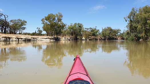
Easy paddling today but it was slowing with the backup from the Wentworth Weir and Murray. I'm not going to be able to catch the peak flow this time.
There are definitely more signs of life coming back around the river, both birds and humans. A chance encounter with a friendly farmer gave me a low down on the conditions on the Anabranch. It was still flowing well from water from the lakes but it wouldn't be getting anything from the Darling.
The river has a more scenic feel today with lots of low level clay and occasional sandstone sections above Burtundy.
I made camp on the same channel as my last trip, however my dusty site from May was now about 2m underwater on a fast flowing channel that saved me 4 km paddling. An excellent way to finish the day! I'm now exactly two days ahead of where I was last time.
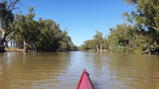
Feeling relaxed about the final day I had a small sleep in and hit the water about 40 min later than usual. After an hour or so I get mobile reception and I'm able to check the bus timetables. I realised I had mixed up the timetable for the services for Wilcannia and Wentworth and rather than a bus every weekday, it was a bus once a week. And that was today at 4:30pm and my ETA was around 6pm. Was it possible to make it? I put my head down and started pushing hard. Even though the water is backed up there is still some assistance from the flow to help me along.
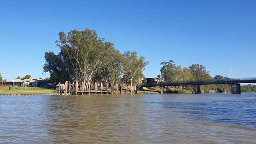
By around 2:30pm I realise it could be just possible but I doubt I'll have time to shower at the camping ground beforehand. I have a quick rise off in the river and push on. At 3:00pm I ring the camping ground to book only to get redirected to the info centre. It's closed for renovations. Crap... Thankfully the ladies at the centre are extremely helpful and were able to find me a place to store my kayak just beside the Wentworth bridge with one of the locals. I reach land at 3:20pm. I quickly sort out my gear to take and head up to the bus stop. What a way to finish.
Total time for the Darling River (Culgoa and Barwon confluence) to Wentworth Bridge: 13 days 8 hrs 20 min; two days faster than last time, albeit I wasn't finished yet!
At Burtundy, the river was at 5.99 m with a flow of 13,900 ML/day, water temperature of 25.3°C. Wentworth Weir was at 29.3 m
Sunny with slight headwinds, around 35°C.
Fairly uneventful bus trip from Wentworth to Broken Hill. A quick glance at the anabranch at Bunnerungee Bridge gave the appearance of a really green river. I wondered if it was just the angle of the sun or a really bad algae outbreak. I would just have to wait and see. I kill time wandering around Broken Hill, this time I actually have some light to see what the place looks like. Finally I was able to get some sleep on the bus as it left at 3:15 am AEST.
Reaching Brewarrina on golden hour in the evening I regret finding a place so far out of town as I do the long walk out with my heavy gear. Maybe best to try the main camping ground in town? I get onto the road just before sunset and make my way just past Bourke where I decide it's getting unsafe to drive with multiple goats on the road. I pull over to a rest area to get some sleep.
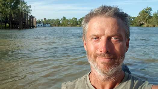
It was a full day's drive to get back to Wentworth. I surprised the local where I stored the kayak with a half dozen beers to say thanks, although the info centre was closed by the time I arrived.
I paddle from the bridge to the Murray to actually finish the complete river. It takes me less than 15 minutes down and paddling upstream at a leisurely pace took 17 minutes. So ignoring the bus interruption and using the slower upstream paddling time, the trip along the Darling River took 13 days 8 hrs 37 min.
I head out to the anabranch to have a look and assess the trip. Being fairly late I end up car camping on the river bank.
There was a slight flow down the anabranch at Bunnerungee Bridge and the water quality was better than what I thought I saw from the bus window. There was also a slight flow here too. The weekly report from the MDBA had the warning of dropping the flow down to just 200 ML/day which I considered too unsafe to paddle. No timeline given for this reduction but it is usually staggered but as it was already down from 2,100 ML/day to 900 ML/day. Not much left to stagger. Would there even be enough flow to paddle? Adding to my concern is that water is still not arriving at Dam 183 from the high flows. That should have arrived over a week or two ago. Is that water being diverted? Is there any way to Menindee other than the Friday bus with a two night stopover in Broken Hill? So many questions...
At Burtundy, the river was at 5.82 m with a flow of 13,300 ML/day. At Wentworth I got a 1.7 kph assist from the current.
Sunny with slight headwinds, around 36°C.
If you are interested in reading about the Great Darling Anabranch section of the trip, you can read the blog here.
©2026 Alan Davison // Credit // Disclaimer