Hervey Bay
A grampus of the middle size leapt with his whole body out of water several times making a splash and foam in the sea as if a mountain had fallen into it.
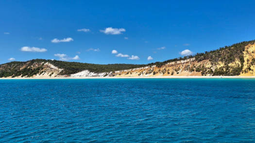
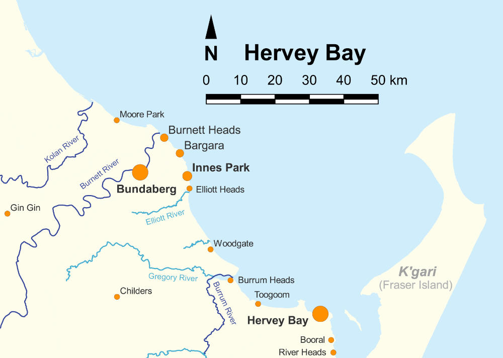
Hervey Bay's crystal blue waters, white sands, and abundant wildlife make for a captivating and memorable destination. It is known as the gateway to K'gari (formerly known as Fraser Island). There are a number of paddling options along both the mainland and K'gari sides of the bay. The sheltered channels, rivers, creeks, and estuaries host a wealth of wildlife, including whales, turtles, dugongs, grey nurse sharks, fish, corals, birds, and more.
K'gari protects the bay, and it usually has fairly calm waters, but it can get rough in bad weather. Aside from a seemingly endless stretch of white sand beaches, there are a number of rocky promontories and reefs found along the way. A number of creeks make for enjoyable paddling, though note that crocs are occasionally found in the area.
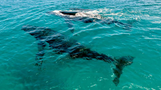
The sheltered bay behind K'gari is visited by migratory humpback whales that visit between July and October to raise their young calves over winter before returning to the Southern Ocean over summer. They are commonly seen saluting with their flippers and breaching their 40-tonne bodies. They are regularly close to shore around Platypus Bay, and you can use the movement of the various boats on the water to help guide you to the waters. Remember to stay a clear distance away from the large mammals.
K'gari protects the bay, and it usually has fairly calm waters, but it can get rough, especially in bad weather. Once outside the bay at the top of K'gari, you are fully exposed to the Pacific Ocean.
Care should be taken if you are considering paddling in any of the estuary rivers, as occasionally crocs do make it this far south, though these are rarely an issue on the K'gari side of the bay. This is around the southern range of Irukandji, and Bluebottle jellyfish can be blown in toward the bay. And be dingo safe on K'gari, keep all food and rubbish inside your hatches or strong tubs.
The bay is part of the Great Sandy Marine Park, and a number of sections classified as Marine National Park Zones where fishing is prohibited, including Burkitt’s Reef and Hoffmans Rocks (Bargara), Barolin Rock (Coral Cove), Marsh Creek (south of Burrum Heads), as well as most of the area between Rooney Point and Sandy Cape. There are a number of Conservation Park Zones that allow fishing, but these have a range of restrictions.
Mainland Coastline
- Length
- 99 km
- Time
- 3 to 4 days
- Trip
- One Way
- Technical difficulty
- Open Water I
- Rating
- Classification
- Coastal waters
Wathumba Creek
K'gari (Fraser Island)
- Length
- 96 km
- Time
- 4 day
- Trip
- Return
- Technical difficulty
- Open Water I - II
- Rating
- Classification
- Enclosed waters
The Moha Moha is a mythical Aboriginal creature that was reportedly seen by early settlers in the area.
Quick Stats
- Coastline
- 200 km
- Width
- 75 km
- Type
- Sheltered Bay
- Technical difficulty
- Open Water I - II
- Ocean Water Classification
- Enclosed to coastal waters
- Dangers
- Open water, tidal currents, other boats.
- First Nations
- Kabi Kabi
Northern and inland western areasButchulla
K'gari and southern areas up to around the Burrum River - Directions To
- Burnett Heads
Elliott Heads
Burrum Heads
Point Vernon
Urangan


