High multicolour sand cliffs

Key Waypoints

Key Waypoints

  • 0 km

    Burnett Heads

    Looking down at coastal marina
    Coordinates 24° 45' 31.1" S, 152° 24' 4.0" E
    Population 2,900 Supermarket(s)

    Burnett Heads is a small coastal town at the mouth of the Burnett River. There are two historic lighthouses on the head, the oldest is in the town itself.

    The river was discovered and named after James Charles Burnett in 1847.

    There is an IGA along with a number of other stores in the town.

  • 10 km

    Bargara

    Looking down at coastline with built up apartments
    Distance between locations 10.4 km
    Coordinates 24° 48' 54.9" S, 152° 27' 55.7" E
    Population 8,900 General Store

    Small coastal town that is known for the Mon Repos Conservation Park that is an important turtle rookery. About 300–400 females of the endangered loggerhead turtles use the beach to nest between mid-November to February with hatching returning to the ocean between January to March. Green and flatback turtles also nest here.

    There are two supermarkets in town, Woolworths and Aldi, both located in the Bargara Central Shopping Mall, about 1 km inland from Turtle Park.

  • 24 km

    Elliott Heads

    Looking down at coastline
    Distance between locations 13.9 km
    Coordinates 24° 55' 21.1" S, 152° 29' 29.3" E
    Population 1,160 General Store

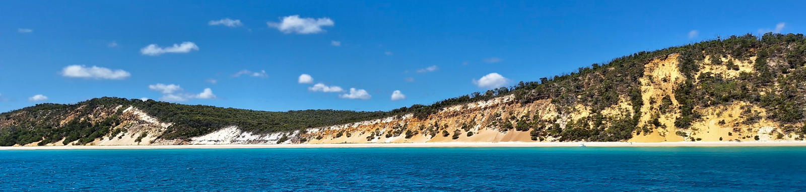
    Elliott Heads is picturesque white sand beach with effervescent blue waters. Elliott Heads Holiday Park is located beside the beach and there is a small general store in town.

    The Mermaid rock pools can be found at the mouth of the Elliott River. There is a boat ramp Riverview, which is located 1.4 km up the river.

  • 45 km

    Woodgate

    People walking along the beach
    Distance between locations 20.4 km
    Coordinates 25° 5' 30.8" S, 152° 33' 14.9" E
    Population 1,500 General Store

    Another small coastal town beside Theodolite Creek that itself is a pleasant afternoon paddle.

    Woodgate is nestled in Burrum Coast National Park and has a number of camping opportunities.

  • 60 km

    Burrum Heads

    beachscape
    Distance between locations 15.3 km
    Coordinates 25° 11' 2.1" S, 152° 36' 25.3" E
    Population 2,500

    There are boat ramps on both sides of Isis River, at Burrum Heads and Walkers Point.

  • 73 km

    Toogoom

    Wide creek surrounded by mangroves
    Distance between locations 12.5 km
    Coordinates 25° 14' 50.3" S, 152° 39' 56.7" E
    Population 2,500

    Marks the northern end of the main built up areas of Hervey Bay along the coastline. The greater urban area of Hervey Bay has a population of around 58,000 people.

  • 87 km

    Point Vernon

    Distance between locations 14 km
    Coordinates 25° 14' 43.7" S, 152° 48' 44.0" E
    Population 5,700

    Point Vernon is the largest rocky promontory on the coast between Noosa and Bundaberg. Tidal rock pools and small reefs with corals and subtropical fish can be found around the rocky coastline.

  • 95 km

    Torquay

    Beach
    Distance between locations 8.2 km
    Coordinates 25° 17' 0.4" S, 152° 52' 15.3" E
    Population 15,000

    Torquay is a beachside suburb nestled in the middle of Hervey Bay beachside suburbs.

  • 99 km

    Urangan

    View from high above Hervey Bay
    Distance between locations 4.1 km
    Coordinates 25° 17' 45.4" S, 152° 54' 32.4" E
    Population 15,000

    The whale-watching capital of Australia during July to November season and the northern gateway to K'gari.

  • 110 km

    Sandy Point

    Small sand island
    Distance between locations 11 km
    Coordinates 25° 13' 42.3" S, 152° 59' 31.8" E

    It's a 11 km paddle directly across from Urangan to Sandy Point, with options to island hop between Round Island, Big Woody Island and Pelican Bank. The longest leg is between Big Woody Island and Pelican Bank at 4.8 km, and this section is subject to the main tidal flow.

    White sandy beach
  • 147 km

    Wathumba Creek

    View from above of white sands and crystal blue water
    Distance between locations 36.7 km
    Coordinates 24° 59' 0.6" S, 153° 13' 27.8" E

    Picturesque camping area. The estuary is a popular all-weather haven for boats.

    Wathumba to Sandy Cape Lighthouse is closed to vehicles.

  • 172 km

    Rooney Point

    Boats anchored in bay
    Distance between locations 24.5 km
    Coordinates 24° 49' 0.9" S, 153° 7' 6.6" E

    Platypus Bay is the wide open bay that stretches from Wathumba Creek to Rooney Point and is where the whales mostly hang out in winter.

    The point marks the end of the main sheltered coastline.

  • 192 km

    Sandy Cape

    White lighthouse on forested hill
    Distance between locations 20.5 km
    Coordinates 24° 41' 48.3" S, 153° 15' 14.0" E

    Northern tip of K'gari.