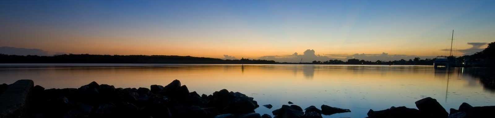
Coomera River
Coomera is known for its theme parks, but the Coomera River offers a completely different experience with semi-urban paddling and great fishing.
Coomera River is a large tidal river, and a popular destination for many boating activities. Being the second largest river on the coast, it also has a number of tributaries to explore including Saltwater and Coombabah Creeks as well as the lower Southern Moreton Bay Islands.
What to expect
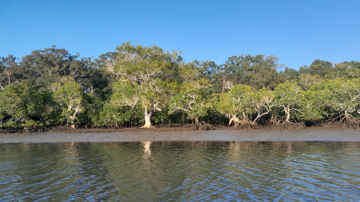
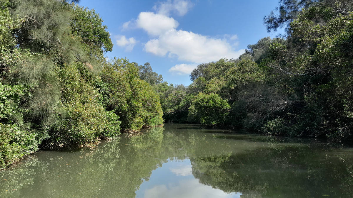
The bottom section is a wide tidal river with sections of untouched mangroves, especially in the northern branch that is nestled in Southern Moreton Bay Islands National Parks. The remaining lower sections are a mix of built up areas and parks with multiple canals running off either side of the river. The majority of the canals on Hope Island are private. The upper tidal section is a mix of urban areas and parks to the causeway.
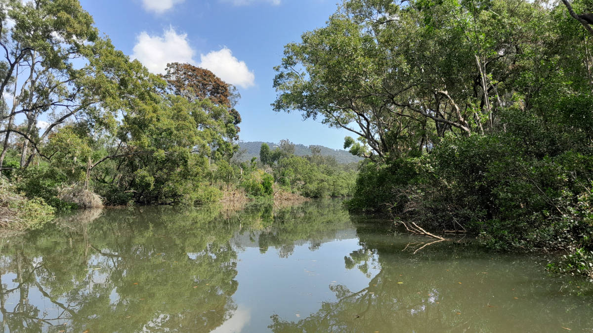
Directly above the causeway is a small lake used for ski jumping before the stream starts to flow with a mix of riffles and pools before the river becomes stepper and rockier. The source is found high above in Lamington National Park.
Paddling Options
There are multiple paddling options from short trips based at one of the put-in locations, to longer trips of the main river itself noting that a full return trip of the tidal section from the Broadwater to the Causeway is 37 km.
Two longer circumnavigation trips are those around Hope Island and Coomera Island. Hope Island is a fairly urban trip along Saltwater Creek and back via the Coomera River, and Coomera Island loop traverses the north and south lower branches of the Coomera River that circumnavigate parts of Moreton Bay National Park with a 4 km leg through The Broadwater.
Both these trips can be done on a low tide, but they are more enjoyable around high tide, particularly when timed to paddle with the flow. Wasp Creek can be paddled at higher tides to shorten the Coomera Island loop slightly.
Coomera Island
- Length
- 17.2 km
- Time
- half day
- Trip
- Circumnavigation
- Technical difficulty
- Grade I
- Rating
- Type
- Tidal
- Elevation Loss
- N/A (tidal)
- Sections
- 3.6 km Coomera River South
6.2 km Coomera River North
4.0 km The Broadwater
3.4 km Coomera River South
Hope Island
- Length
- 17.4 km
- Time
- half day
- Trip
- Circumnavigation
- Technical difficulty
- Grade I
- Rating
- Type
- Tidal
- Elevation Loss
- N/A (tidal)
- Sections
- 1.5 km Coombabah Creek
6.4 km Saltwater Creek
0.8 km Saltwater Cutting
8.7 km Coomera River
Logistics
There are a few put in spots along the river operated by Gold Coast City Council.
The following are likely the better spots to put in, but there are some other locations that you can use too. Parking is not an issue in general but many can get busy during holiday periods.
Most of the ramps are on the southern side of the river and there are none in the lower Northern Branch.
Boat Ramps
- 2.2 km
- Boat Harbour
- 3.4 km
- Banksia Park
- 7.4 km
- Colman Family Park
- 9.0 km
- Charles Holm Park
- 14.0 km
- Watersports Lane
- 17.6 km
- John Siganto Park
Jabiru Island Boat Ramps on Coombabah Creek is a good alternative close to the river if the other areas are too busy.
Refer to the Distance Table and the Interactive Map for additional details.

Quick Stats
- Length
- 89 km
- Navigable
- 18.5 km
- Catchment
- 456 sq km
- Elevation Loss
- Council Areas
- First Nations
- Bundjalung
- Directions To
- Boat Harbour
Charles Holm Park
Causeway Park
Tides
There is likely moderate tidal influence for most trips, with enough flow to provide a noticeable current in the tidal sections.
No current tide details for port: BQ011, low_offset=96, high_offset=70, "format=datum,days", title=Coomera River Mouth, key_locs_title=Tides for selected locations on the lower Coomera River for {day}, "key_locs=Boykambil Esplanade:108:80,Colman Family Park:128:96,Charles Holm Park:132:98,Saltwater Cutting:141:104", loc-classes=col-12 col-sm-6, day-classes=col-12 col-sm-6 pb-3, container-classes=tides-block mb-3#0: core/debug.inc, line 285, dpr()
#1: core/filters/tides.inc, line 235, print_filter_error()
#2: core/base.inc, line 299, filter_tides()
#3: core/base.inc, line 264, process_page_filters()
#4: docroot/index.php, line 41, process_request()
This could be from a parental filter such as meta
Distances
Some key locations up until Causeway Park, are listed below.
| Location * | Features † | Distance (km) § | |||
|---|---|---|---|---|---|
| Leg | Total | ||||
| Coomera River (North Branch) | 0.0 | ||||
| L | Jewel Creek (#1) | 0.4 | 0.4 | ||
| L | Jewel Creek (#2) | 1.6 | 2.0 | ||
| L | Bullock Head Creek | 0.3 | 2.3 | ||
| R | Wasp Creek | 0.6 | 2.9 | ||
| L | Coomera Waters | 2.5 | 5.4 | ||
| Coomera Junction | 0.7 | 6.1 | |||
| Coomera River (South Branch) | 0.0 | ||||
| R | Boat Harbour (Donald Avenue) Boat Ramp and Finger Pontoon, Paradise Point | 2.1 | |||
| R | Coombabah Creek | 1.3 | 3.4 | ||
| R | Bert Hood Street Boat Ramp, Banksia Park, Hope Island | 0.0 | 3.4 | ||
| R | Sands Park, Boykambil Esplanade North | 0.1 | 3.5 | ||
| Coomera Junction | 3.5 | 7.0 | |||
| Coomera River | 7.0 | ||||
| L | Colman Family Park, Tallawood Road, Coomera | 0.4 | 7.4 | ||
| R | Charles Holm Park Boat Ramp, Hope Island, Santa Barbara | 1.6 | 9.0 | ||
| L | Oaky Creek | 0.8 | 9.8 | ||
| R | Saltwater Cutting | 2.1 | 11.9 | ||
| Coomera Connector and Rail bridges | 0.4 | 12.3 | |||
| Pacific Motorway bridges | 1.6 | 13.9 | |||
| R | Watersports Lane (Coomera) Boat Ramp, Oxenford | 0.1 | 14.0 | ||
| L | Koala Town Road Pontoon, Coomera | 0.1 | 14.1 | ||
| L | Yaun Creek | 0.3 | 14.4 | ||
| L | Brygon Creek | 1.6 | 16.0 | ||
| L | Old Quarry Lake | 0.8 | 16.8 | ||
| L | John Siganto Park Boat Ramp, Gawler Place, Upper Coomera | 0.8 | 17.6 | ||
| Coomera River Causeway Park, Oxenford | 0.7 | 18.3 | |||
| John Muntz Bridge | 1.0 | 19.3 | |||
| Low Bridge | 0.4 | 19.7 | |||
* Side represents either the left / port (L) or right / starboard (R) sides when facing downstream of the main river or the specified direction of travel for bays or lakes (usually anticlockwise).
† Most of the features were taken from local council pages.
§ Distances have been manually calculated from the river mouth.
Map
Explore the key locations in the map below. Most locations will have a photograph that can be seen by clicking on the icon or number in the map itself.
The map also has markers every kilometer that start at 0 at where the river meets The Broadwater all the way to the source.
You may need to zoom in to see all of these kilometer markers. These do not correlate with any existing numbering system on the river.
- Coomera River (North Branch)
- Jewel Creek
- Bullock Head Creek
- Wasp Creek
- Coomera Waters
- Coomera River (South Branch)
- Coombabah Creek
- Saltwater Creek
- Coomera River
- Oaky Creek
- Saltwater Cutting
- Yaun Creek
- Regatta Waters Lake
- Brygon Creek
- Old Quarry Lake
- Boat Ramps
- Bridges
- Causeway
- Access Points
- Viewpoints
- Pontoons
- Weir or Low Head Dams
Tributaries
Jewel Creek
Small cutting that joins the Pimpama and Coomera rivers at high tide.
It's about a 1.3 km paddle using the shorter upstream channel, a 1.8 km paddle on the longer downstream channel.
Quick Stats
- Length
- 1.3 km
- Navigable
- 1.3 km
Bullock Head Creek
Mangrove wetlands.
Wider estuary entrance where you can paddle deeper into a smaller tidal channel on a high tide.
Quick Stats
- Length
- 1.7 km
- Navigable
- 1.4 km
Wasp Creek
Creek cutting through the northern side of Coomera Island.
Only accessible on the higher tides and makes for a small shortcut if circumnavigating the island.
Quick Stats
- Length
- 2.0 km
- Navigable
- 2.0 km
Coombabah Creek
Important fish breeding habitat and nationally significant wetlands.
A wide deep estuary waterway leads to a large shallow lake.
See the Coombabah Creek section for more details.

Quick Stats
- Length
- 22.7 km
- Navigable
- 9 km
Saltwater Creek
Third largest waterway in the Coomera catchment that almost allows you to paddle up to Movie World.
A cutting between Saltwater Creek and Coomera River forms Hope Island.
See the Saltwater Creek section for more details.

Quick Stats
- Length
- 21 km
- Navigable
- 10.5 km
Oaky Creek
Another short paddle through a small mangrove wetland.
The entrance is hidden behind Foxwell Island.
Quick Stats
- Length
- 8.1 km
- Navigable
- 2.1 km
Yaun Creek
Quiet side creek.
A ibis and bat colonies were seen on my trip up the creek.
Quick Stats
- Length
- 8.0 km
- Navigable
- 1.3 km
Brygon Creek
Quiet side creek.
The last of the short minor tidal tributaries to explore.
Quick Stats
- Length
- 2.9 km
- Navigable
- 0.7 km
Regatta Waters
Small recreational lake off the main river at Damian Leeding Memorial Park.

Quick Stats
- Shoreline
- 3.8 km
