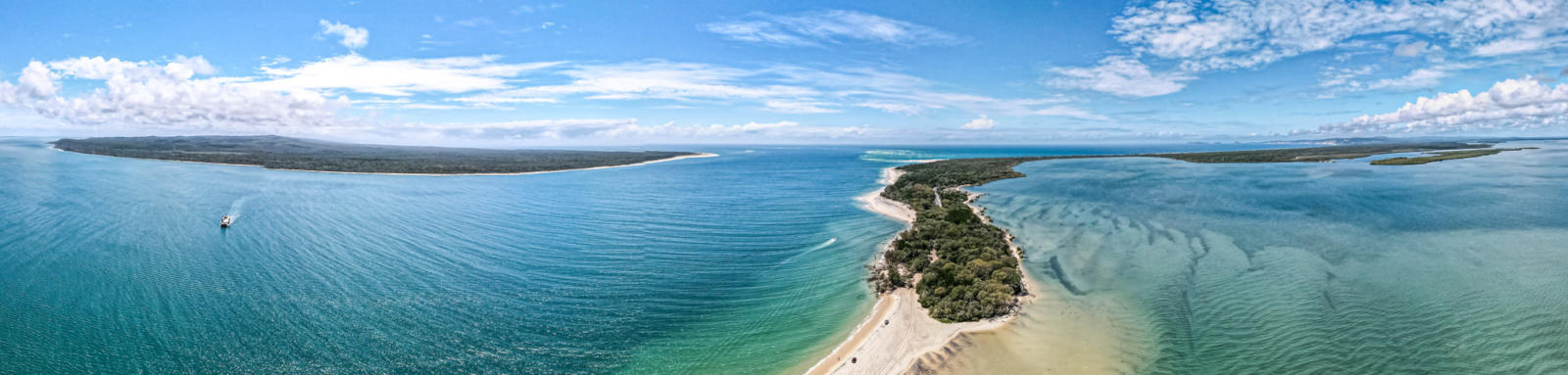

Great Sandy Strait
The Great Sandy Strait separates K'gari from the mainland and is the second largest protection area in Queensland for the dugong. There are over 80 km of waterways between the two tidal inlets at either end of the strait with multiple channels and islands to explore along the way, over 100 km if you start from Tin Can Inlet.
The calm, clear turquoise waters of the estuary provide an excellent paddling experience, with the world's largest sand island sheltering the strait. Dugongs, turtles, and rare Indo-Pacific humpback dolphins are all found within the waters and the marine park and surrounding areas contain almost half of all Australia's bird species.


Quick Stats
- Length
- 100 km
- Navigable
- 100 km
- Type
- Estuary
- Time
- Multiple days

- Technical difficulty
- Open Water I - II
- Ocean Water Classification
- Enclosed waters
- Dangers
- Open water, tidal currents, tidal flats, occassional crocs, other boats.
- Council Areas
- First Nations
- Butchulla
K'gari and most of the straitKabi Kabi
Southern areas including Tin Can Inlet - Directions To
- Urangan
River Head
Maaroom
Inskip Point
Tin Can Bay
