Looking down at a tidal channel

Key Waypoints

Key Waypoints

  • 0 km

    Hervey Bay

    View from high above Hervey Bay
    Coordinates 25° 17' 45.4" S, 152° 54' 32.4" E
    Population 52,000
    Urangan Boat Ramp

    The whale-watching capital of Australia during July to November season and the northern gateway to K'gari.

    Photo from a boatramp and wharf

    Kingfisher Bay Resort on K'gari (pictured above) is opposite and slightly north of River Head. The first of the two landing points for ferries leaving River Head.

  • 17 km

    River Head

    stream view from boatramp Google Street View

    Distance between locations 16.5 km
    Coordinates 25° 25' 45.8" S, 152° 55' 26.6" E
    Population 1,500
    RiverHeads Ferry Terminal

    The ferry from River Head services both Wanggoolba Creek and Kingfisher Bay Resort.

    island in bay surrounded by mangroves

    A photo from the Venture Ferry of one of the mangrove lined islands in the bay.

  • 24 km

    Wanggoolba Creek

    Ferry
    Distance between locations 7.3 km
    Coordinates 25° 26' 48.1" S, 152° 59' 21.3" E

    The second of the two landing points for ferries leaving River Head.

    Photo from a plane

    The picture above is looking southwards to the channel between Thomas and Slain Islands on the left, with the channels around Butcher Creek on the right.

  • 49 km

    Maaroom

    Distance between locations 24.8 km
    Coordinates 25° 36' 46.2" S, 152° 52' 32.0" E
    Population 220

    Maaroom is a small, friendly and tranquil town on the waters of the Great Sandy Strait. The small inlet has an all-weather boat ramp.

    A shop can be found at the caravan park, a 500 m walk from the boat ramp.

  • 56 km

    Boonooroo

    Coastal tidal creek
    Distance between locations 7.3 km
    Coordinates 25° 39' 45.4" S, 152° 54' 13.2" E
    Population 320

    Boonooroo, and neighbouring Tuan, are two small fishing hamlets. There is a small convenience store at the Boonooroo-Tuan Caravan Park that can be found on the northern side of the entrance to Little Tuan Creek.

  • 62 km

    Poona

    Distance between locations 6 km
    Coordinates 25° 42' 43.6" S, 152° 55' 19.7" E
    Population 480 General Store

    The peaceful hamlet of Poona is one of the larger towns in the main section of the strait.

    It is serviced by a small general store, cafe and caravan park.

  • 68 km

    Tinnanbar

    Distance between locations 6.2 km
    Coordinates 25° 45' 27.5" S, 152° 57' 19.7" E
    Population 125

    A small hamlet with a narrow beach along the coast.

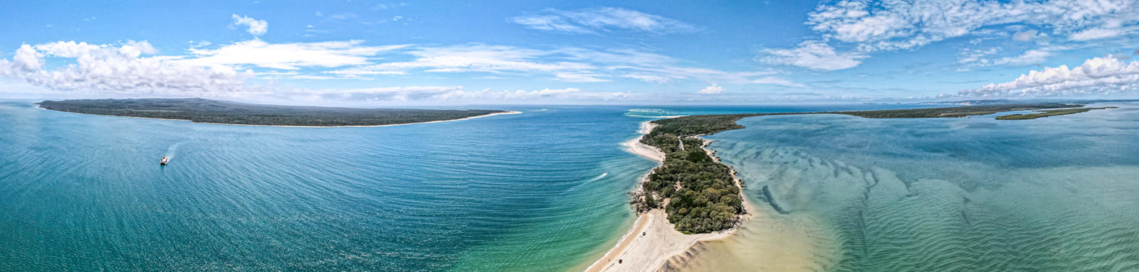
    The area south between Kauri Creek and Snapper Creek is the Wide Bay Military Reserve where access is prohibited and this area may contain unexploded ordnance. Keep out!

  • 80 km

    Inskip Point

    Looking down on large tidal passageway
    Distance between locations 11.4 km
    Coordinates 25° 48' 29.2" S, 153° 2' 38.1" E

    Inskip Point is one of the main access points to K'gari with regular ferries to the island.

  • 93 km

    Tin Can Bay

    Close-up of a dolphin
    Distance between locations 13 km
    Coordinates 25° 54' 5.6" S, 153° 0' 49.0" E
    Population 2,250

    The largest of the towns can be found up Tin Can Inlet. It's famous for the rare Indo-Pacific humpback dolphins that can be hand fed with supervision of the Barnacles Dolphin Centre.

  • 101 km

    Poverty Point

    Distance between locations 8.6 km
    Coordinates 25° 57' 32.6" S, 153° 1' 26.5" E

    A 4WD only campsite in Cooloola Recreation Area that has a maximum capacity of 24 people. Bookings required.

    It is possible to access to / from the inlet via Mullens Creek Park at Cooloola Cove. Expect to walk over the tidal sand flats at low tide, though trying to stick to the shallow Mullen Creek that crosses the flats may help.