Mooloolah River
Tidal paddling up though a busy community port and maze of urban canals into a tranquil Mangrove and Melaleuca woodlands.
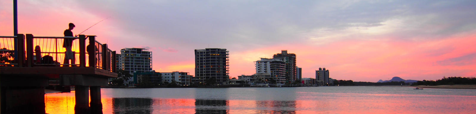
What to expect
The lower Mooloolah River is wide and has a lot of boat traffic with yachts and powerboats lining the shore and marinas with plenty of parks to stop and enjoy the laidback atmosphere.
Kawana Water and Tuckers Creek have extensive network of canals that provide an interesting urban paddling with a number of beaches where you can pull out and relax. Lake Parrearra and Lake Brightwater are both separated from the main waterways.
Mountain Creek provides a quieter backwater with much of the creek surrounded by reserves, and the upper tidal areas of the Mooloolah River run alongside the Mooloolah River National Park. You'll struggle to get far past the tidal reach, but upstream on Ewen Maddock Dam, Addlington Creek, provides excellent lake paddling on a stocked lake that only allows non-motorised vessels.
Paddling Options
Kawana Water Canal
- Length
- 10 km
- Time
- half day
- Trip
- Circumnavigation
- Technical difficulty
- Grade I
- Rating
- Notes
- Urban paddling
Mooloolah National Park
- Length
- 10 km
- Time
- half day
- Trip
- Return
- Technical difficulty
- Grade I
- Rating
Mountain Creek
- Length
- 5 km
- Time
- half day
- Trip
- Return
- Technical difficulty
- Grade I
- Rating
- Notes
- Tide permitting you can try to paddle further
Point Cartwright
- Length
- 6 km
- Time
- half day
- Trip
- Return
- Technical difficulty
- Open Water II
- Rating
- Notes
- Only attempt in very calm conditions.
Logistics
La Balsa Park Buddina (south) and Parkyn Parade Mooloolaba (north) Boat Ramps provide convinent access to the lower section and Outrigger Park Boat Ramp provides the easist access to the upper tidal sections.
Wyuna Canal has a lock but requires a key, so a portage across the weir is needed. Weirs at both ends of Lake Parrearra / Wyuna Canal have steps to allow paddle craft to portage the weir. Do not attempt if in flood.
Parks and boar ramps are operated by Sunshine Coast Council.
The following are likely the better spots to put in, but there are some other locations that you can use too. Refer to the Distance Table and the Interactive Map for additional details. Parking is not an issue in general.
Boat Ramps
- 1.0 km
- La Balsa Park. Buddina
- 1.6 km
- Parkyn Parade, Mooloolaba
- 3.5 km
- Outrigger Park
Kayak Carry
- 2.0 km
- Mooloolah River Park, Mooloolaba
- 2.2 km
- Charles Clarke Park, Mooloolaba

Quick Stats
- Length
- 49 km
- Navigable
- 16 km
- Type
- Coastal River
- Council Areas
- First Nations
- Kabi Kabi
- Directions To
- Mooloolaba
Buddina
Outrigger Park
© Thomas and Olivia Williams
Tides
There is a moderate tidal influence in the lower section, with care required near the mouth, and enough flow to provide a noticeable current that is best paddled with the current.
No current tide details for port: BQ019, title=Mooloolah River Entrance, "format=days,datum", day-classes=col-12 col-sm-6 pb-3, container-classes=tides-block mb-3, key_locs_title=Tides for selected locations on the Mooloolah River for {day}, "key_locs=Point Cartwright:-1:-1,Mooloolaba Boat Ramp:14:7,McKenzie Bridge:33:17,Parrearra Weir:44:23"#0: core/debug.inc, line 285, dpr()
#1: core/filters/tides.inc, line 235, print_filter_error()
#2: core/base.inc, line 299, filter_tides()
#3: core/base.inc, line 264, process_page_filters()
#4: docroot/index.php, line 41, process_request()
This could be from a parental filter such as meta
Distances
Some key locations on the main waterways are listed below.
* Side represents either the left / port (L) or right / starboard (R) sides when facing downstream of the main river or the specified direction of travel for bays or lakes (usually anticlockwise).
† Most of the features were taken from local council pages.
§ Distances have been manually calculated from the river mouth.
Map
Explore the key locations in the map below. Most locations will have a photograph that can be seen by clicking on the icon or number in the map itself.
The map also has markers every kilometer that start at 0 at where the creek meets the ocean all the way to the source.
You may need to zoom in to see all of these kilometer markers. These do not correlate with any existing numbering system on the river.
- River Mouth, Point Cartwright
- Kawana Water Canal
- Tuckers Creek
- Wyuna Canal
- Mountain Creek
- Lake Edge Park
- Mooloolah River National Park
- Ewen Maddock Dam, Adlington Creek
- Boat Ramps
- Access Point
- Pontoon
- Weir or Low Head Dams
