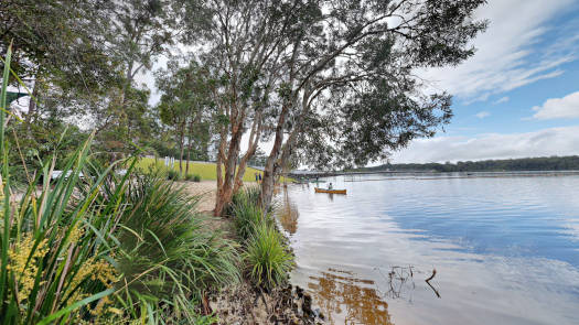
Ewen Maddock
Ewen Maddock Dam is located 5 km north of Landsborough on the Sunshine Coast.
Only non-motorised vessels suck as canoes, kayaks, row boats and sailing boats are allowed on the water.
It is an un-gated dam, so water flows over the spillway at 100 percent capacity.
What to expect
Pleasant lake paddling surrounded by forested terrain. Restricted to unpowered vessiles, the lake provides a break from the bustle seen in more popular areas during the summer months.
Logistics
There is a single put-in point, a sandy beach near the main car park of Maddock Park.
It is operated by SEQWater.
Map
Explore the key locations in the map below. Once visited, most locations will have a photograph that can be seen by clicking on the icon or number in the map itself.
The map also has markers every 100 metres that start at 0 from the put in area.
You may need to zoom in to see all of these kilometer markers. These do not correlate with any existing numbering system on the lake.
- Maddock Park
- Spillway
Trip Details
Circumnavigation
- Length
- 8.7 km
- Type
- Flatwater
- Time
- half day
- Trip
- Circumnavigation
- Technical difficulty
- Grade I
- Rating
Quick Stats
- Lake / Reservoir
- Ewen Maddock Reservoir
- Dam / Weir
- Ewen Maddock Dam
- Waterway
- Addlington Creek
- Perimeter
- 8.7 km
- Catchment
- 21 sq km
- Type
- Lake
- Council Areas
- First Nations
- Kabi Kabi
- More Info
- Seqwater
QLD DAF
Directions
© Thomas and Olivia Williams


