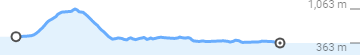
Distance Markers
A look at the blue signs along the water way
From Mt Kosciuszko down to Bringenbrong Bridge
The journey of a thousand miles begins with a single step.
I highly recommend the 1:25,000 maps for any non-standard treks in the area. I was using a 1:100,000 that proved inadequate with low visibility conditions. However, if you are staying on the main fire trails, these are very easy to follow on the NSW parks side.

Stay on this trail, past Cascade Hut (9.7 km), past the Tin Mine Trailhead (21.9 km) down to the Tin Mine Huts (25.6 km).
I did not notice the Ash Fire Trail that heads west as the Cascade Trail turns east at about 20.5 km mark. This trail was part of a track that led to a now abandoned BOM water gauge and is likely overgrown / non-existent now.
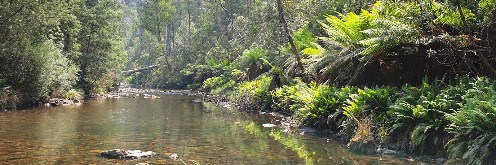
Water should be easily obtainable from the Thredbo and Cascade creek crossings as well as from nearby streams around both the Cascade and Tin Mine huts. Less reliable water can be found in a few streams about the 13 km mark.
The Cascade Trail ends as it diverges at Tin Mine Huts. Take the Cowombat Trail that heads south west, not the Ingeegoodbee Trail that heads south east following the Ingeegoodbee River.
At 7.7 km the Snow Gums Trail heads off to the right / west. Keep left traversing around The Pilot (1,828 m) on its western flank down to Cowombat Flat, 17 km along from the Tin Mine Huts.
Water should be easily obtainable from the Tin Mine Creek crossing. The only other water source I found under the dry conditions was a poor seep that crossed the road before the start of the Snow Gums trail. This would be unreliable in drier conditions. A decent enough seep was flowing at the track crossing of the Murray River at Cowombat Flat. This quickly dried up going upstream.
This is an alternative trail on the Pilot or Cowombat Ridge (the proper name given by GEO Australia). This provides nice views of The Pilot, before also heading down to Cowombat Flat via the Pilot Creek Firetrail.
The Snow Gums trailhead is at 7.7 km from the Tin Mine Huts and clearly marked. It heads right (west) across a small saddle.
About 850 m, the Murray River Fire Trail heads N along the Pilot or Cowombat Ridge, but stay on the Snow Gums Trail heading SW along the same ridgeline. This had an unreadable sign marking this old firetrail.
The Snow Gums Trail continues on about 2 km from the Pilot Creek Trailhead along Pilot or Cowombat Ridge. This firetrail terminates at a small rocky outcrop with thick surrounding bush.
I found no water sources along this trail. Following the ridgeline down off trail, the first water of significance was the Murray River itself at the bottom of the valley, approx 5 km of rough off trail hiking in dense bush.
This 17 km historic bridle trail stretches along the Murray River from Tom Groggin to Bunroy Station. The walk is steep and challenging at times. This trail terminates before exiting the gorge and is also popular with horse riders.
You rejoin the Murray River near Hermit Ck, the last of the Grade III/IV sections is just downstream of the Hermit Ck confluence, maybe one of the most difficult rapids in the gorge. The easier, shorter, mostly Grade II sections could be tackled with a packraft from below this particular rapid.
You can access this from the footbridge at Tom Groggin Station entrance, following close to the river frontage, fording Omeo Ck (~1km from footbridge), down to the Stoney Ck track (at 3.75 km) that leads to the start of the Harrington's track (combined distance 5.1 km). Alternatively, start from Tom Groggin camping area, crossing the ford to Dogmans Hut. Follow Tom Groggin Track to Mt Pinnibar Track that joins up with Stoney Ck track. (10km total). A third option is to swim across from Grassy Flats Rd directly to the start of the track at Stony Ck camp.
Exiting the track via Bunroy and Upper Murray Rds.
I was warned from fellow hikers to avoid sleeping in the huts as they often have healthy mouse populations that may be problematic. However there are ample flat grassy spaces for a tent at either location.
Majority of my camping sites were by the trails or the river itself. Remember to:
There may be an easy escape trail on the VIC side using Davies Plain track to Tom Groggin if the river is impassable below the Poplars.

©2026 Alan Davison // Credit // Disclaimer