
The Source of the Murray
History and logistics of finding the source of the Murray.
Wild rivers are earth's renegades, defying gravity, dancing to their own tunes, resisting the authority of humans, always chipping away, and eventually always winning.

The river has four distinct sections between Tom Groggin and Bringenbrong Bridge.
Above Grassy Flat, there is one notable harder drop, Grade III Riley's Ride (Japanese Bend) with a hidden rock stopper.
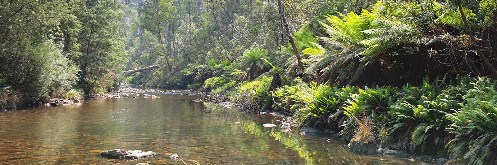
From Grassy Flat you enter the gorge proper and you will be facing up to a ~15 km swim if you can not handle the Grade III+ to IV rapids. Below Hermits Creek the river eases from a series of Grade III+ rapids, to easing Grade I-II rapids before exiting out into farmland and flattening out.
Walking the main gorge is not an option. There is a hiking trail that bypasses the gorge if you do not want to paddle this section of whitewater. The track rejoins the river at Hermits Creek just before the final Grade IV rapid near Surveyors Creek. You can continue walking or you could tackle the lower sections with a packraft.
More details about walking this track can be found in the Hiking and Camping page.

Inflatable kayaks and / or rafts. Bespoke guiding on the upper sections including the top 150 km mixed hike / kayak of the Murray River.

Guided rafting trips down the Murray Gorge starting from Tom Groggin Station
by Whitehorse Canoe Club
Single page guide for the Murray Gates whitewater section between Tom Groggin and Bunroy Creek
This is a summary of the rapids taken from various whitewater guides.
Starting from the Grassy Flats Track:
Note that the Murray Gate grades are dependant on the water level and this section is very dangerous in flood. With a water level above 1.6m there will be minimal scouting opportunities.
Distances are from Tom Groggin Campground.
| Distance | Grade | Name | Description | ||
|---|---|---|---|---|---|
| 0 | Tom Groggin Campground. | ||||
| 1.2 km | Track down to an old ford to Dogman's Hut. | ||||
| 1.3 km | III | Japanese Bend | A 1 m drop with a hidden stopper in the wave. Also known as Riley's Ride. | ||
| 2.0 km | Tom Groggin Horse Camp | ||||
| 3.0 km | Low Bridge to Tom Groggin Station. You may be able to duck under this with water levels under 1 m. | ") |
|||
| Numerious easy grade II rapids lead down towards Grassy Flats. | |||||
| 8.1 km | Grassy Flats | ||||
| 9.1 km | II+ - III | The Wall | It is recommended to stop if you have difficulty here. | ||
| 11.8 km | Murray Gate Track | ||||
| Gates | ~1-2 km downstream. Two cliffs on either side of the river, Baxter Creek on the right. | ||||
| 13.8 km | II+ - III | Headbanger | 1st Rapid before short pool. Also known as Bobsled. | ||
| III | Guides Mistake | ||||
| III - IV | South African Swim | 150 m downstream. Easily scouted on the left. | |||
| III - IV | Sharks Tooth | 150 m downstream. This 100 m section is hard to scout and finishes with the abrupt drop and undercut rock of "The Thing". | |||
| III+ | The Thing | Ending of Sharks Tooth. Drop and undercut rock. | |||
| Easier 400 m section with the following 3 rapids: | |||||
| III | Long Island | ||||
| II+ | Rock Garden | This can be a bony scrape in low water. | |||
| III | Himalayan Wrap | ||||
| A couple more pools bring you to a classic section of whitewater. | |||||
| III - III+ | Nutty’s Garage | Also known as Tanks Garage. | |||
| III - III+ | Hole in the Head | ||||
| 15.5 km | III+ - IV | Hermits Creek | A small campsite can be found between Little Hermits and Hermits Creek on the left. | ||
| III | Easy Over | ||||
| Another pool before: | |||||
| III - III+ | Swimmers Delight | Also known as Swimmers Joy. | |||
| III - III+ | Gorgeous George | Also known as Gorgeous Gorge. | |||
| III-III+ | Roller Coaster | ~200 m downstream. There is a nasty sieve on the right. | |||
| 17.4 km | III | Jellyfish Rock | ~450 m downstream. Last rapid of note in the gorge | ||
| Another 9 km of fun II+ and III getting easier as you go down the gorge. | |||||
| 26.5 km | Bunroy Station, at Little Bunroy Ck ("Little Niche"). This is a privately owned farm so get permission if you want to take out here. Don’t trespass! | ||||
| 32.4 km | Bunroy Creek take out. | ||||
| 36.5 km |
Exit from the national park and into sections that are often lined with willows passing through farmland. In higher flows, some of the following bridges may require portages. |
||||
| 37.8 km | Damms (Maguires) Bridge. There were fairly high overgrown banks here in 2019. |  |
|||
| 45.4 km | Biggara Bridge |  |
|||
| 55.9 km | Indi Bridge and Reserve |  |
|||
| 61.4 km | Private farm bridge |  |
|||
| 61.8 km | Private farm bridge |  |
|||
| 65.9 km | Swampy Plain River | ||||
| 68.4 km | Bringenbrong Bridge |  |
|||

©2026 Alan Davison // Credit // Disclaimer