sunset

Key Waypoints

Key Waypoints

  • 0 km

    Bongaree

    Coordinates 27° 5' 1.3" S, 153° 9' 35.3" E
    Population 8,200 Supermarket(s)

    Bongaree is a small less touristy location at the southern end of the Pumicestone Passage.

  • 2 km

    Sandstone Point

    Distance between locations 2.0 km
    Coordinates 27° 4' 54.1" S, 153° 7' 33.2" E
    Population 4,100 Supermarket(s)

    Sandstone Point proper is on Moreton Bay, but stretches out east to the waterway.

  • 3 km

    Bellara

    Distance between locations 1.0 km
    Coordinates 27° 3' 41.0" S, 153° 8' 40.2" E
    Population 3,300 General Store

    Quiet coastal suburb on Bribie Island.

  • 5 km

    Banksia Beach

    satellite imagery
    Distance between locations 1.4 km
    Coordinates 27° 2' 42.4" S, 153° 8' 4.2" E
    Population 7,200 Supermarket(s)

    Banksia Beach, Pacific Harbour and White Patch mark the last of the built up areas on Bribie Island before the main national park.

  • 9 km

    Toorbul

    Distance between locations 3.6 km
    Coordinates 27° 2' 1.0" S, 153° 5' 53.5" E
    Population 1,000 General Store

    A small picturesque township on the passage itself.

    Meldale is a small locale between Elimbah and Bullock Creeks with a population of 230.

  • 13 km

    Donnybrook

    Distance between locations 4 km
    Coordinates 27° 0' 1.4" S, 153° 4' 13.1" E
    Population 700 General Store

    The last of the southern coastal towns.

  • 25 km

    The Narrows

    Distance between locations 12.4 km
    Coordinates 26° 54' 29.2" S, 153° 4' 32.9" E

    A channeled section of the passageway that marks the tidal meeting points between Caloundra and Bongaree.

  • 36 km

    Bells Creek

    Distance between locations 10.2 km
    Coordinates 26° 50' 35.2" S, 153° 6' 48.2" E

    The creek marks the start of the urban build-up of the Sunshine Coast proper. Pelican Waters is just off the Pumicestone Passage proper, on the northern edge of Bells Creek with a population of 7,000.

  • 38 km

    Golden Beach

    Distance between locations 2 km
    Coordinates 26° 49' 8.0" S, 153° 7' 6.2" E
    Population 6,000

    Golden Beach hugs the shoreline of the northern Pumicestone Passage with parklands along most of the waterway.

  • 41 km

    Caloundra

    Distance between locations 3 km
    Coordinates 26° 48' 14.4" S, 153° 7' 46.6" E
    Population 4,000 Supermarket(s)

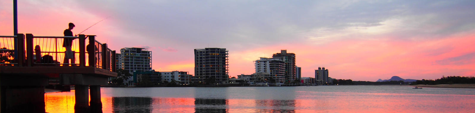
    Caloundra also refers to the major southern builtup area of the Sunshine Coast south of the Mooloolah River and has a combined population of nearly 100,000.