Eudlo Creek
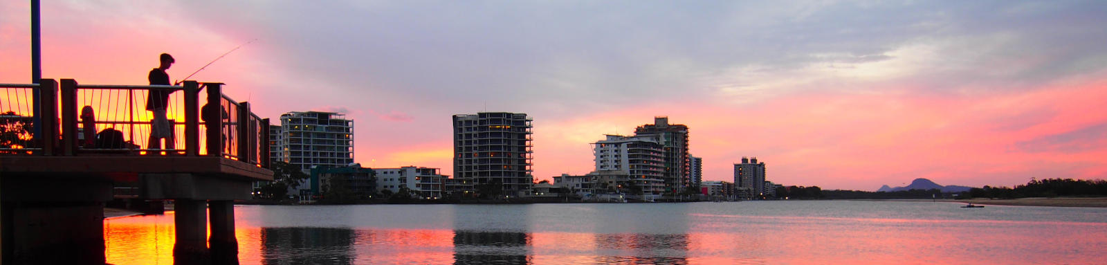
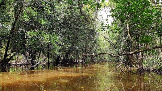
Eudlo Creek is a quiet and calm tributary of the Maroochy River, tucked behind Maroochydore. It travels past a number of conservation areas and provides multiple wildlife view opportunities. Lined by woodlands, you can easily forget you are a stone throw away from one of the largest built-up areas of the coast.
What to expect
Calm paddle through wooded areas. Once past the tidal areas, expect a small creek with plenty of tree hazards.
Logistics
Maroochy Lions Park Boat Ramp on Fishermans Road is the best put-in spot, although this can be busy with the farmers markets on Sundays. Bradman Avenue Boat Ramp is also close to the creek entrance. All are operated by Sunshine Coast Council.
Refer to the Distance Table and the Interactive Map for additional details.
Tides
There is minimal tidal influence for most trips, though high tide will allow exploration further up the creek.
No current tide details for port: BQ019, low_offset=130, high_offset=78, title=Eudlo Creek Entrance, container-classes=tides-block mb-3, day-classes=col-12 col-sm-6 pb-3
#0: core/debug.inc, line 285, dpr()
#1: core/filters/tides.inc, line 235, print_filter_error()
#2: core/base.inc, line 299, filter_tides()
#3: core/base.inc, line 264, process_page_filters()
#4: docroot/index.php, line 41, process_request()
This could be from a parental filter such as meta
Distances
Some key locations on the main Coolum and Yandina Creek navigable sections are listed below.
* Side represents either the left / port (L) or right / starboard (R) sides when facing downstream of the main river or the specified direction of travel for bays or lakes (usually anticlockwise).
† Most of the features were taken from local council pages.
§ Distances have been manually calculated from the river mouth.
Trip Details
Lower Creek
- Length
- 8.4 km
- Type
- Return
- Time
- half day
- Technical difficulty
- Grade I
- Rating
- Elevation Loss
- N/A (tidal)
Quick Stats
- Length
- 26 km
- Navigable
- 5.0 km
- Catchment
- 84 sq km
- Elevation Loss
- Council Areas
- First Nations
- Kabi Kabi
© Thomas and Olivia Williams
Map
Explore the key locations in the map below. Most locations will have a photograph that can be seen by clicking on the icon or number in the map itself.
The map also has markers every kilometer that start at 0 at where the creek meets Maroochy River. You may need to zoom in to see all of these kilometer markers. These do not correlate with any existing numbering system on the river.
- Eudlo Creek
- East Eudlo Creek
- Boat Ramps
© Thomas and Olivia Williams
