Albert River
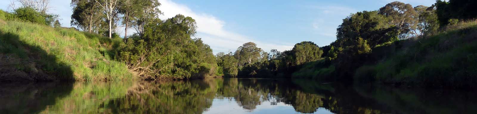
The Albert River is feed from the headwaters of the border ranges that separate New South Wales and Queensland, where you will find the sources of the Albert River, with the left and right branches split between Mount Razorback and Worendo. These flow through the World Heritage-listed subtropical Gondwana rainforests of Lamington National Park and down into the Albert Valley where they merge to form the Albert River proper. From here the river heads north through farmlands and eventually into the built up areas around Logan.
Without having paddled the river, it appears to be an easy paddle from the Logan all the way up to the Alan Wilke Bridge at Stanmore Road, where you will encounter a stone weir that likely acts as a barrage keeping the tidal water from flowing upstream. Upstream expect a small weir pool and pools that are interrupted by shallow riffles.
| Location * | Features † | Tides ‡ | Distance | Total | |||
| Low | High | ||||||
| Mouth | 1:19 | 0:42 | 0.0 km | ||||
| L | Albert River Park Pontoon | 2:29 | 1:30 | 5.5 km | 5.5 km | ||
| R | Paterson Rd Boat Ramp, Yatala | 2:58 | 1:55 | 9.9 km | 15.4 km | ||
| Alan Wilke Bridge | 2:17 | 1:32 | 2.9 km | 18.3 km | |||
| Luscombe Weir, Yatala | 4.4 km | 22.7 km | |||||
* Side represents either the left / port (L) or right / starboard (R) sides when facing downstream.
† Most of the features were taken from Logan
or Gold Coast City Council pages.
‡ Tide times are offset from the river mouth (27° 41' 38.4" S, 153° 20' 48.1" E)
that are in turn offset by
BoM tide tables.
§ Distances have been manually calculated from the river mouth.
Distance markers
The online map has markers every kilometer that start at 0 at Logan River Junction up to the north and south branches.
Zoom in to see all of these markers. These do not correlate with any existing numbering system on the river.
- Logan River Junction
- Five bridges, Henry Hester Rd Bridge, Pacific Mwy Dual Bridge, Rail bridge and Martens Street Bridge
- Stanmore Road Bridge and Rest Area
- Chardons Bridge Park
- Nth / Sth Branch
- Boat Ramp
- Bridges
- Kayak Ramp or Path
- Water Feature
- Weir or Low Head Dam
No current tide details for port: BQ003, title=Albert and Logan Rivers Junction, low_offset=134, high_offset=82, key_locs_title=Tides for selected locations on the lower Albert River for {day}, "key_locs=Albert River Park:149:90,Yatala Boat Ramp:178:115,Stanmore Road:187:125", container-classes=tides-block mb-3#0: core/debug.inc, line 285, dpr()
#1: core/filters/tides.inc, line 235, print_filter_error()
#2: core/base.inc, line 299, filter_tides()
#3: core/base.inc, line 264, process_page_filters()
#4: docroot/index.php, line 41, process_request()
This could be from a parental filter such as meta

Trip Details
Tidal Section
- Length
- 25.8 km
- Type
- Return
- Time
- full day
- Technical difficulty
- Grade I
- Rating
- Elevation Loss
- N/A (tidal)
Quick Stats
- Length
- 105 km
- Navigable
- unknown
- Elevation Loss
- Council Areas
- Logan City Council (west)Gold Coast Council (east)Scenic Rim Regional Council (upper)
- First Nations
- BundjalungYuggera (Jaggera)
- Directions To
- Albert River Park
Paterson Rd
Stanmore Rd
