Behm Creek
A rarely visited creek just north of Jacobs Well.
What to expect
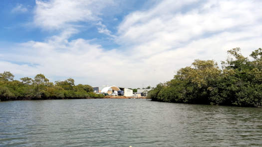
A wide shallow estuary lined by mangroves up to a tidal barrage at Stapylton Jacobs Well Rd.
This lower section may fully dry out during low tides.
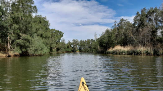
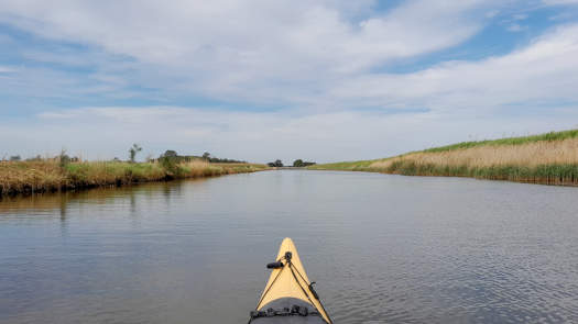
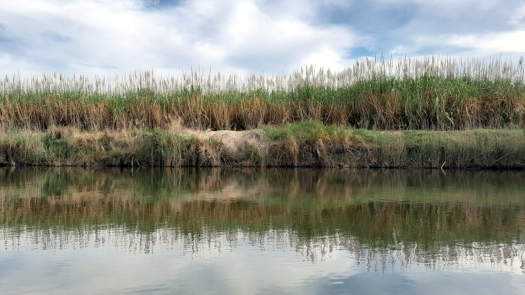
Above the barrage, a short section lined with trees gives way to mostly agricultural land dominated by sugar cane and the further upstream you go, the more heavily modified the channel becomes until you are simply left with agricultural canals.
This section may not be fully navigable in dry conditions.
Note that the channels in the southern section of Moreton Bay are susceptible to wind waves.
Paddling Options
The creek has two very distinct sections above and below the tidal barrage.
Tidal Section
- Length
- 19 km
- Time
- half day
- Trip
- Return
- Technical difficulty
- Grade I
- Rating
- Type
- Tidal
- Elevation Loss
- N/A (tidal)
- Notes
- Mid to high tide only
Upper Section
- Length
- 10.4 km
- Time
- half day
- Trip
- Return
- Technical difficulty
- Grade I
- Rating
There are a couple small tidal channels to explore in the lower section to extend a trip to the lower section:
- Just north Jacobs Well at the southern end of the islands. Up to 0.7 km one way.
- A short channel just downstream of the barrage. Up to 0.5 km one way.
Logistics
There are a few put in spots along the river operated by Gold Coast City Council.
The likely best spot to put in is at the boat ramp at Jacobs Well that is 2.4 km south of Behm Creek, which would allow you to explore the islands and the other unnamed tidal channel in the Edward Corbould Reserve about halfway between the boat ramp and Behm Creek. Cabbage Tree Point boat ramp is slightly further away, about 3.6 km to the creek mouth.
To avoid the portage, I'd recommend people paddling the upper section to start above the bridge.
Parking is not an issue in general, but single car spots may be hard to find at Jacobs Well during peak holiday periods.
This area is still on tank water rather than the main water grid, so be prepared to bring or buy water.
Refer to the Distance Table and the Interactive Map for additional details.
Tides
The trip should be done between mid to high tides, with higher tides being preferred.
No current tide details for port: BQ003, title=Behm Creek Entrance, "format=datum,days", low_offset=22, high_offset=28, loc-classes=col-12 col-sm-4 pb-3, day-classes=col-12 col-sm-6 pb-3, container-classes=tides-block mb-3
#0: core/debug.inc, line 285, dpr()
#1: core/filters/tides.inc, line 235, print_filter_error()
#2: core/base.inc, line 299, filter_tides()
#3: core/base.inc, line 264, process_page_filters()
#4: docroot/index.php, line 41, process_request()
This could be from a parental filter such as meta
Distances
Some key locations up until Gold Coast Highway bridge are listed below.
* Side represents either the left / port (L) or right / starboard (R) sides when facing downstream of the main river or the specified direction of travel for bays or lakes (usually anticlockwise).
† Most of the features were taken from local council pages.
§ Distances have been manually calculated from the river mouth.
Map
Explore the key locations in the map below. Most locations will have a photograph that can be seen by clicking on the icon or number in the map itself.
The map also has markers every 100 metres that start at 0 at where the creek meets the bay all the way to the source.
You may need to zoom in to see all of these markers. These do not correlate with any existing numbering system on the river.
Quick Stats
- Length
- 7.0 km
- Navigable
- 7.0 km
- Type
- Tidal
- Elevation Loss
- N/A (tidal)
- Council Areas
- First Nations
- Bundjalung
- Directions To
- Jacobs Well
Tidal Barrage


