Red clay banks along the river

Lower Murrumbidgee

Key Waypoints and Information
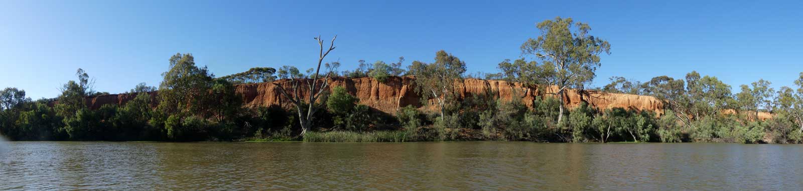
The main section of the river. This starts off in the lower inland slopes of the Great Dividing Range but is mostly on the flat expansive alluvial plains of the Riverina that provides fertile agricultural land for many farms. As the river meets the Murray, you are at the boundary of the Riverina and the arid far western areas of NSW.

The average time it takes for water to flow down the Murrumbidgee from Jugiong to the River Murray confluence is approximately 25 days, or 45 km per day.

Key Waypoints

  • 0 km(466 km)

    Jugiong

    Elevation 239 m
    Coordinates 34° 49' 30.2" S, 148° 19' 55.6" E

    There is a singular Grade I/II rapid otherwise this section should be fast flowing flat water where the main concern is tree strainers on the outside banks, although a strong swirl in the outside of the right bend 2km from Gundagai was noted on Waterways Guide.

    Landscape
    Jugiong Creek
    Distance note 3.9 km upstream from Jugiong Elevation 242 m
    Tumat River
    Distance note 46.2 km from Jugiong Elevation 217 m

    This will likely significantly increase the flow of the river from here.

  • 65.3 km(531 km)

    Gundagai

    Distance between locations 65.3 km Elevation 209 m
    Coordinates 35° 4' 6.2" S, 148° 5' 42.5" E Date Hume Hwy Bridge
    Population 1,900 Supermarket(s) Climate
    Gauge: Gundagai, BOM; WaterNSW
    Flood: minor: 6.1 m, moderate: 7.6 m, major: 8.5 m
    Flow: no flow: 0 m, recommended: above 0.5 m

    According to the SMH, Gundagai is the iconic Australian country town.

    The river flattens out now and the main concerns are snags in low flows or strainers when the river is in flood.

    Landscape
    Adelong Creek
    Distance note 7.1 km from Gundagai Elevation 206 m
    Billabong Creek
    Distance note 35.8 km from Gundagai Elevation 195 m
    Hillas Creek
    Distance note 45.3 km from Gundagai Elevation 193 m
    Tarcutta Creek
    Distance note 82.7 km from Gundagai Elevation 181 m
    Kyeamba Creek
    Distance note 98.9 km from Gundagai Elevation 175 m
    Landscape

    My Personal Journey

    Tumut River to Wagga Wagga

    Date 23-24 Nov 2020 Flow 3.37 m 15,750 ML/day @ Gundagai

    High non-flooding flow provided fairly fast flowing big water with some minor swirls. Felt almost sedate compared to the Tumut but you still needed to stay alert. Flow speed decreased along this stretch.

  • 188.5 km(654 km)

    Wagga Wagga

    Distance between locations 123.2 km Elevation 171 m
    Coordinates 35° 5' 59.0" S, 147° 22' 4.4" E Date Hampden Ave Bridge
    Population 56,000 Supermarket(s) Climate
    Gauge: Wagga Wagga, BOM; WaterNSW
    Flood: minor: 7.3 m, moderate: 9 m, major: 9.6 m
    Flow: no flow: 0 m, recommended: above 0.3 m

    Wagga Wagga is one of NSW largest inland cities.

    River
    Houlaghans Creek
    Distance note 19.6 km from Wagga Wagga Elevation 168 m

    This creek appears to be usually dry from aerial photographs seen.

    Beavers Creek outflow
    Distance note 47.2 km from Wagga Wagga Elevation 164 m
    Berembed Weir (3 GL) outflow
    Distance note 145.4 km from Wagga Wagga Elevation 151 m
    Weir
    Old Man Creek outflow
    Distance note 167 km from Wagga Wagga Elevation 145 m
    Bird nests on a bank

    My Personal Journey

    Wagga Wagga to Narrandera

    Date 25-27 Nov 2020 Flow 3.2 m 15,000 ML/day @ Wagga Wagga

    Easy paddling with hot and windy conditions. Wind waves weren't an issue. Good flow assist but felt realitively gentle compared to upstream.

  • 386.6 km(852 km)

    Narrandera

    Distance between locations 198.1 km Elevation 139 m
    Coordinates 34° 45' 20.8" S, 146° 32' 53.7" E Date Newell Hwy Bridge
    Population 3,750 Climate
    Gauge: Narrandera, BOM; WaterNSW
    Flood: minor: 6.7 m, moderate: 7.3 m, major: 8.2 m
    Flow: no flow: 0.65 m, recommended: above 1.0 m

    Narrandera is a river town with a rich heritage. It stands on the land of the Wiradjuri nation and was once home to the Nharrangura Clan. There is a Coles and Mitre 10 in town.

    Bright cliffs beside the river
    Yanco Creek outflow
    Distance note 18.8 km from Narrandera Elevation 137 m

    Yanco Creek is one of the main distributaries that channels water off to the Murray River, albeit this is now controlled artificially by a system of weirs. The Yanco Weir is another 2.4 km downstream.

    Yanco Weir
    Distance note 21.2 km from Narrandera Elevation 135 m
    Gauge: Yanco Weir (Downstream), BOM; WaterNSW

    Note that there is still 12.6 km of river before the Euroly Rd Bridge that leads to Yanco.

    Weir

    My Personal Journey

    Narrandera to Darlington Point

    Date 27-28 Nov 2020 Flow 3.65 m 10,000 ML/day @ Narrandera
  • 423.4 km(889 km)

    Yanco

    Distance between locations 36.8 km Elevation 132 m
    Coordinates 34° 38' 19.6" S, 146° 22' 25.8" E Date Euroley Rd Bridge
    Population 500 General Store Climate

    Yanco is a small country town with a small general store that is 6.2 km north of the river.

    Coleambally Main Canal outflow
    Distance note 11.3 km from Yanco Elevation 132 m
    Sturt Canal outflow
    Distance note 14.9 km from Yanco Elevation 132 m

    The canal starts 1.6 km down a side arm of the river that branches off 340 m before the weir.

    Gogeldrie Weir (7 GL)
    Distance note 15.2 km from Yanco Elevation 129 m
    Gauge: Gogeldrie Storage, BOM; WaterNSW
    Weir
  • 489.1 km(955 km)

    Darlington Point

    Distance between locations 65.7 km Elevation 119 m
    Coordinates 34° 34' 1.2" S, 146° 0' 9.9" E Date Bridge St Bridge
    Population 1,000 General Store
    Gauge: Darlington Point, BOM; WaterNSW
    Flood: minor: 5.5 m, moderate: 7 m, major: 7.3 m
    Flow: no flow: -0.5 m, recommended: above 0.7 m

    Small town with a variety of small stores

    River

    My Personal Journey

    Darlington Point to Hay

    Date 28 Nov-1 Dec 2020 Flow 2.0 m 4,500 ML/day @ Darlington Point

    Gradual decline of flow continued but still high enough to avoid any snags.

  • 615.4 km(1,081 km)

    Carrathool

    Distance between locations 126.3 km Elevation 98 m
    Coordinates 34° 26' 57.6" S, 145° 25' 2.4" E Date Carrathool Rd Bridge
    Population 300
    Gauge: Carrathool, WaterNSW
    Flow: no flow: -0.6 m, recommended: above 0.1 m

    Carrathool is a small village 5.2 km north of the bridge along Carrathool Rd. Google suggests Glenda's General Store is permanently closed so you need to be prepared for a 224 km leg between Darlington Point and Hay.

    Bridge
  • 733.1 km(1,199 km)

    Hay

    Farm
    Distance between locations 117.7 km Elevation 87 m
    Coordinates 34° 30' 58.3" S, 144° 50' 32.4" E Date Cobb Hwy Bridge
    Population 1,900 Supermarket(s) Climate

    Foodworks and IGA in town.

    Hay Weir (13 GL)
    Distance note 23.2 km from Hay Elevation 80 m
    Gauge: Hay Weir (Downstream), BOM; WaterNSW
    Flood: minor: 7.7 m, moderate: 8.7 m, major: 9.2 m
    Flow: no flow: 1 m, recommended: above 1.78 m
    Weir
    Uara Creek outflow
    Distance note 69.1 km from Hay Elevation 73 m

    Could this be a possible shortcut if water is very high? There seems to be only a marginal reduction in distance with high snag potential.

    Short-beaked Echidna

    My Personal Journey

    Hay to Maude

    Date 1-2 Dec 2020 Flow 2.7 m 3,000 ML/day @ Hay Weir
  • 836.9 km(1,302 km)

    Maude

    Distance between locations 103.7 km Elevation 70 m
    Coordinates 34° 28' 39.8" S, 144° 18' 3.3" E Date Maude Rd Bridge
    Population 160 General Store
    Gauge: Maude Weir (Downstream), BOM; WaterNSW
    Flow: no flow: 0 m, recommended: above 0.5 m
    Maude Weir (5 GL)
    Distance note 350 m upstream of Maude Elevation 72 m
    Weir
    Lachlan River
    Distance note 67.3 km from Maude Elevation 67 m

    Rarely flows outside of very high flow periods.

    North Redbank Channel outflow
    Distance note 99.9 km from Maude Elevation 67 m

    This irrigation channel feeds the inland lakes of Pitarpunga and Tin Tin just to name two. In high floods, these will spill over and feed water back into the river via the usually dry Waldara Creek.

    The channel is 450 m above Redbank Weir.

    Redbank Weir (5 GL)
    Distance note 100.3 km from Maude Elevation 66 m
    Gauge: Redbank Weir (Downstream), BOM; WaterNSW
    Flow: no flow: -0.48 m, recommended: above 0.1 m
    Weir
    Uara Creek
    Distance note 166 km from Maude Elevation 58 m

    Uara Creek rejoins after separating out 143.4 km upstream.

    My Personal Journey

    Maude to Balranald

    Date 2-6 Dec 2020 Flow 1.25 m 1,300 ML/day @ Redbank Weir D/S

    Losing most of the flow assist but high enough that snags are not a significant issue. Unable to paddle very far up the Lachlan River (no flow).

    Date 3-4 Feb 2022 Flow 5.67 m 9,300 ML/day @ Redbank Weir D/S

    Right at minor flood flow that provided a fast and enjoyable ride from existing the Lachlan via a large floodplain and down to Balranald. Fast flowing but fairly gentle big water and easy enough to find dry camp sites.

  • 1,031.3 km(1,498 km)

    Balranald

    Distance between locations 194.4 km Elevation 58 m
    Coordinates 34° 38' 47.3" S, 143° 33' 56.6" E Date Sturt Hwy Bridge
    Population 1,200 Supermarket(s) Climate

    Sitting on the edge of the Riverina, Balranald is a fairly remote, semi-desert area bordering the arid far west areas of NSW. An IGA in town.

    Weir
    Balranald Weir
    Distance note 17.1 km from Balranald Elevation 56 m
    Gauge: Balranald Weir (Downstream), BOM; WaterNSW
    Flood: minor: 6.7 m, moderate: 6.9 m, major: 7.1 m
    Flow: no flow: 0.03 m, recommended: above 0.43 m
    Fallen trees

    My Personal Journey

    Balranald to the Murray

    Date 6-7 Dec 2020 Flow 1.82 m 1,400 ML/day @ Balranald Weir D/S

    It felt like I had lost most of the flow but was mostly able to paddle this section without too many issues as the fishermen have cut a path thought most of the fallen river gums.

  • 1,132.8 km(1,598 km)

    Murray River

    Distance between locations 101.5 km Elevation 50 m
    Coordinates 34° 43' 43.9" S, 143° 13' 9.0" E
    River mouth surrounded by trees

    Refer to the Murray River guide if you intend to keep paddling down towards SA, though the first two towns that you could take out from are noted below.

    Boundary Bend (VIC)
    Distance note 14.6 km from the confluence Elevation 50 m
    Population 130 General Store

    You could organise a ride from the town or even maybe the rest area on Murray Valley Highway, VIC (B400) that is only 9.2 km downstream from the confluence if you are struggling with tired arms!

    V/Line's "River Express" bus stops here.

    Mirror surface on wide river
    Robinvale (VIC) / Euston (NSW)
    Date 9 Dec 2020
    Distance note 107.6 km from the confluence Elevation 48 m
    Population 4,100 Supermarket(s)

    This final section will likely add 2 or 3 days to your trip if you aim for these towns with the faster flowing waters of the Murray River.

    There is an IGA in Robinvale which is the largest of the two towns.

    Both V/Line and NSW TrainLink have services departing from Robinvale and / or Euston.

    Houseboats on the river

    My Personal Journey

    Murray

    Date 8-9 Dec 2020 Flow 2.7 m 12,500 ML/day @ Boundary Bend

    It was good to get some more flow after entering the Murray and it was a pleasant paddle down to Robinvale.