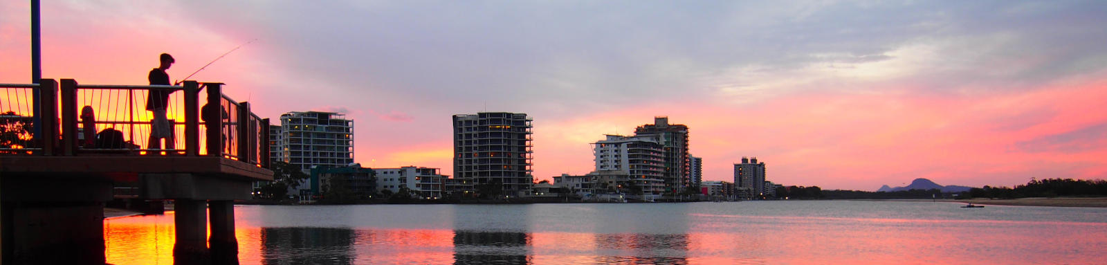
Maroochy River
The Maroochy River is mostly tidal and has a long paddlable section between the Bruce Highway and Maroochydore.
What to expect
The estuary at the river mouth can be up to 500 m wide, but as you head upstream this reduces to around 100 m for much of the journey up to Yandina. Due to the tidal reach, the current will significantly hinder progress unless you paddle with the tide.
Paddling Options
There are multiple options from short trips based at one of the put in locations, to longer trips of the main river itself noting that a full return trip of the tidal section from Maroochydore to the Bruce Highway is over 50 km, reduced slightly if you start at Bli Bli at 40 km.
Goat Island
- Length
- 6.1 km
- Type
- Circumnavigation
- Time
- half day
- Technical difficulty
- Open Water I
- Rating
- Elevation Loss
- N/A (tidal)
- Notes
- Southern side can be shallow at low tide.
Lower Maroochy
- Length
- 10.2 km
- Type
- Return
- Time
- half day
- Technical difficulty
- Open Water I
- Rating
- Elevation Loss
- N/A (tidal)
Middle Maroochy
- Length
- 13.5 km
- Type
- Return
- Time
- half day
- Technical difficulty
- Open Water I
- Rating
- Elevation Loss
- N/A (tidal)
- Notes
- Turnaround is at the creek junction. It's another 1.0 km to Coolum Creek Boat Ramp.
Upper Maroochy
- Length
- 11.1 km
- Type
- Return
- Time
- half day
- Technical difficulty
- Grade I
- Rating
- Elevation Loss
- N/A (tidal)
- Notes
- Turning around at the north south branch junction cuts 1.5 km off the trip.
Logistics
There are multiple spots along the river to put in, mostly around the lower sections and operated by Sunshine Coast Council.
The following are likely the better spots to put in, but there are some other locations that you can use too. Refer to the Distance Table and the Interactive Map for additional details. Parking is easier away from the main built up areas.
- 1.0 km
- Cotton Tree Park
- 3.0 km
- Bradman Avenue (Eudlo Creek)
- 7.5 km
- Bli Bli
- 21.8 km
- Lake Dunethin
For those paddling solo trying for a longer trip, Translink provide a couple of options:
- Bus Route 612 runs between Maroochydore and Bli Bli before heading up to Nambour. Bus Route 610 runs directly to Nambour.
- Both the train and bus route 631 go between Yandina from Nambour, although access to the river at Yandina appears to be very difficult.
Tides
There is a significant tidal influence for most trips, with care required near the mouth, and enough flow to provide a noticeable current in the tidal sections that are best paddled with the current. Tidal flows can peak around 3-4 kph in places.
No current tide details for port: BQ019, high_offset=-1, title=Maroochy River Entrance, "format=days,datum", day-classes=col-12 col-sm-6 pb-3, container-classes=tides-block mb-3, key_locs_title=Tides for selected locations on the Maroochy River for {day}, "key_locs=Picnic Point:112:62,Eudlo Creek\nBradman Av Boat Ramp:128:76,Bli Bli:145:94,Coolum Creek:170:115,Lake Dunethin:188:133, Nth/Sth Junction:192:138"#0: core/debug.inc, line 285, dpr()
#1: core/filters/tides.inc, line 235, print_filter_error()
#2: core/base.inc, line 299, filter_tides()
#3: core/base.inc, line 264, process_page_filters()
#4: docroot/index.php, line 41, process_request()
This could be from a parental filter such as meta

Quick Stats
- Length
- 26.2 km
- Navigable
- 26.2 km
- Catchment
- 638 sq km
Current Flow
- Yandina
- 0.36m / 3 MLD
- Eumundi
- 0.34m / 39 MLD
- Dunethin Rock
- No Data
- Stoney Wharf
- No Data
- Dangers
- Other boats
- Council Areas
- First Nations
- Kabi Kabi
- Directions To
- Cotton Tree
Bradman Avenue
Bli Bli
Lake Dunethin
Yandina
© Thomas and Olivia Williams
Distance Table
The very bottom section is wide and you can take either the northern or southern route around Goat Island. Both are about 4.3 km from the mouth to the Maroochy River Bridge and are separated in the table below.
At Yandina, the river splits into a north and south branch.
- The North Maroochy River is paddlable to Ninderry Crossing (~4 km) fairly easily, but it is extremely unlikely that one could make it to Eumundi (~15 km) or above without significant effort.
- The South Maroochy River becomes shallow just past the Bruce Highway around high tide (0.9 km). Wappa Dam that is 7 km from the bridge but no paddling is allowed on the reservoir.
The following distance table has some key locations. Distances are shown from the river mouth and also Bli Bli, along with tidal offsets.
| Location * | Features † | Tides ‡ | Distance (km) § | |||||
|---|---|---|---|---|---|---|---|---|
| Low | High | Leg | Bli Bli | Total | ||||
| Southern Shoreline | ||||||||
| River Mouth | 0:00 | 0:00 | -7.7 | 0.0 | ||||
| R | Cotton Tree Park Boat ramp, Maroochydore | 0:40 | 0:21 | 1.0 | -6.7 | 1.0 | ||
| R | Cornmeal Creek, Maroochydore | 0:50 | 0:28 | 0.2 | -6.5 | 1.2 | ||
| R | Picnic Point Esplanade Canoe Ramp, Maroochydore Toilets and BBQ upstream |
1:36 | 0:54 | 1.1 | -5.4 | 2.3 | ||
| R | Picnic Point Boat Ramp, Maroochydore | 1:52 | 1:03 | 0.4 | -5.0 | 2.7 | ||
| R | Maroochy Water Canal, Maroochydore | 1:53 | 1:04 | 0.2 | -4.8 | 2.9 | ||
| R | Bradman Avenue Ramp, Maroochydore | 1:54 | 1:05 | 0.1 | -4.7 | 3.0 | ||
| R | Chambers Island Footbridge, Maroochydore | 1:56 | 1:06 | 0.2 | -4.5 | 3.2 | ||
| Northern Shoreline | ||||||||
| River Mouth | 0:00 | 0:00 | -7.7 | 0.0 | ||||
| L | Mudjimba Foreshore Reserve, Maroochy North Shore | 1:00 | 0:34 | 1.3 | -6.4 | 1.3 | ||
| L | Twin Waters Boat Ramp, Twin Waters | 1:35 | 0:53 | 1.0 | -5.4 | 2.3 | ||
| Maroochy River Bridge, Sunshine Motorway | 2:03 | 1:14 | 2.0 | -3.4 | 4.3 | |||
| R | Bradman Avenue Boat Ramp, Maroochydore | 2:08 | 1:17 | 0.5 | -2.9 | 4.8 | ||
| R | Eudlo Creek | 2:10 | 1:19 | 0.4 | -2.5 | 5.2 | ||
| R | Petrie Creek | 2:16 | 1:25 | 0.9 | -1.6 | 6.1 | ||
| L | Muller Park Boat Ramp, Bli Bli | 2:25 | 1:35 | 1.4 | -0.2 | 7.5 | ||
| David Low Bridge, Bli Bli | 2:27 | 1:36 | 0.2 | 0.0 | 7.7 | |||
| R | David Low Way Boat Ramp, Bli Bli | 2:27 | 1:36 | 0.0 | 0.0 | 7.7 | ||
| R | Maroochy Wetland Sanctuary Pontoon, Bli Bli | 2:34 | 1:43 | 2.0 | 2.0 | 9.7 | ||
| Bli Bli Islands Two large and one small island |
2:38 | 1:46 | 0.9 | 2.9 | 10.6 | |||
| Stony Wharf, Bli Bli | 2:41 | 1:48 | 0.8 | 3.7 | 11.4 | |||
| Unnamed Island, Bli Bli Single large island |
2:43 | 1:50 | 0.3 | 4.0 | 11.7 | |||
| R | Twin Ridges Creek | 2:44 | 1:51 | 0.3 | 4.3 | 12.0 | ||
| L | Coolum Drain, Marcoola | 1.6 | 5.9 | 13.6 | ||||
| L | Coolum Creek | 2:50 | 1:56 | 0.3 | 6.2 | 13.9 | ||
| L | Yandina Creek | 2:57 | 2:02 | 1.8 | 8.0 | 15.7 | ||
| Cane Train Rail Lift Bridge | 3:07 | 2:11 | 3.5 | 11.5 | 19.2 | |||
| R | Dunethin Rock Recreation Area Boat Ramp, Maroochy River Toilet and picnic tables 200 m downstream of entrance, near small pontoon |
3:08 | 2:14 | 2.2 | 13.7 | 21.4 | ||
| R | Ashtons Wharf, Maroochy River | 3:11 | 2:16 | 0.9 | 14.6 | 22.3 | ||
| North and South Maroochy River Junction, Yandina | 3:12 | 2:19 | 3.9 | 18.5 | 26.2 | |||
| South Maroochy River | ||||||||
| Vee Road | 1.2 | 19.7 | 27.4 | |||||
| North Maroochy River | ||||||||
| Coulson's Wharf Park, Yandina | 0.4 | 18.9 | 26.6 | |||||
| George Best Park, Ninderry Rd, Yandina | 3.4 | 22.3 | 30.0 | |||||
* Side represents either the left / port (L) or right / starboard (R) sides when facing downstream of the main river or the specified direction of travel for bays or lakes (usually anticlockwise).
† Most of the features were taken from the Sunshine Coast Council pages.
‡ Tide times are offset from the river mouth that are in turn offset from the Bureau of Meteorology tide tables.
§ Distances have been manually calculated from the Maroochy River.
Map
Explore the key locations in the map below. Most locations will have a photograph after being visited that can be seen by clicking on the icon or number in the map itself.
- River Mouth
- Cornmeal Creek
- Sunshine Cove
- Maroochy Water Canal
- Chambers Island
- Twin Waters
- Maroochy River Bridge
- Eudlo Creek
- Petrie Creek
- David Low Bridge, Bli Bli
- Bli Bli Islands
- Unnamed Island
- Twin Ridges Creek
- Coolum Drain
- Coolum Creek
- Yandina Creek
- Cane Train Bridge
- Lake Dunethin Jetty
- North and South Maroochy River Junction
- Boat Ramps
- Kayak Ramp or Paths
- Access Point
- Pontoons
What to take
Ensure electronic devices and gear have waterproof containers / dry bags if needed.
What to wear
- Sunscreen / Chapstick *
- Sunglasses *
- Hat *
- Swimwear or shorts †
- Sun protective clothing (rashie) †
- Water shoes †
What to take
- Water
- Snacks
- Phone
- Camera
- Watch
- Sponge
- Rain jacket
- Spare clothes / Towel
Safety
- PDF (life jacket) *
- Whistle
- Paddle float ‡
- Bilge pump ‡
- Paddle lease
- Spare paddle
- Light (night paddling)
* Highly recommended (aka required)
† You should wear clothing and footwear that you can comfortably swim in.
‡ These are for self or assisted rescues where you can't easily reach the shore.
Wildlife


Tributaries
The most significant is Petrie Creek that flows from the range at Mapleton (30 km). Aerial photographs hint at the possibility of making it all the way to Nambour (14.8 km), albeit the Bruce Highway represents roughly the end of the tidal reach about 3.3 km downstream of the town. This itself has a small side tributary, Paynter River that could allow for another 3 or 4 km of explorable river.
Just downstream of Petrie Creek is Eudlo Creek, a short tidal section of about 5.7 km can be expected. Heading upstream you can find Twin Ridges Creek and Coolum Drain. Both could provide short side trips at high tide. Coolum Creek runs behind Mt Coolum and has a lot longer waterway to explore, 5.8 km to Yandina-Coolum Rd. The small Yandina Creek could have a very short explorable section.
