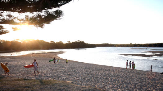
Currimundi Creek
A delightful little gem with a mix of paddling options depending on your mood.
Currimundi Creek named after the local aboriginal name for the area, Garrimundi or Girrimundi, meaning 'Place of flying foxes'.
What to expect
Lake Currimundi and the two arms of Currimundi Creek are fringed with fringed with paperbarks and she-oaks. The creek provides a peaceful haven for both wildlife and canoeists, contrasting with the built-up Lake Kawana and Wurtulla canals.
The northern section of Lake Kawana is used as a rowing course, so ensure you stay off the course if there are rowers about!
A weir separates Pangali Canal and Lake Kawana.
Paddling Options
Currimundi Creek
- Length
- 6 km
- Type
- Flatwater
- Time
- half day
- Trip
- Return
- Technical difficulty
- Grade I
- Rating
Lake Kawana
- Length
- 7 km
- Type
- Flatwater
- Time
- half day
- Trip
- Circumnavigation
- Technical difficulty
- Grade I
- Rating
The Canals
- Length
- 9.5 km
- Type
- Flatwater
- Time
- half day
- Trip
- Return
- Technical difficulty
- Grade I
- Rating
- Notes
- Includes a side-trip down Baroona Canal
Logistics
The following are likely the better spots to put in, but there are some other locations that you can use too. Refer to the Distance Table and the Interactive Map for additional details. Parking is not an issue in general.
Currimundi Creek
- 0.8 km
- Frank McIvor Park
- 0.9 km
- Crummunda Park
- 2.3 km
- Noel Burns Park
Lake Kawana
- Pontoon, Kawana Sports Precinct
- Mikoh’s Park
- Sportsman Parade
Parks and boat ramps are operated by Sunshine Coast Council.
Distances
Some key locations on the main waterways are listed below.
* Side represents either the left / port (L) or right / starboard (R) sides when facing downstream of the main river or the specified direction of travel for bays or lakes (usually anticlockwise).
† Most of the features were taken from local council pages.
§ Distances have been manually calculated from the river mouth.
Map
Explore the key locations in the map below. Most locations will have a photograph that can be seen by clicking on the icon or number in the map itself.
The map also has markers every 100 metres that start at 0 from the creeks mouth. Lake Kawana has similar distance markers.
You may need to zoom in to see all of these kilometer markers. These do not correlate with any existing numbering system on the creek.
- Mouth, Currimundi Beach
- Currimundi Lake
- Currimundi Creek
- Currimundi Creek (north branch)
- Pangali Canal
- Baroona Canal
- Tokara Canal
- Lake Kawana
- Boat Ramp
- Access Points
- Pontoons
- Weir or Low Head Dam
Quick Stats
- Length
- 15 km
- Navigable
- 15 km
- Type
- Mixed
- Council Areas
- First Nations
- Kabi Kabi
- Directions To
- Currimundi Lake
Lake Kawana
© Thomas and Olivia Williams


