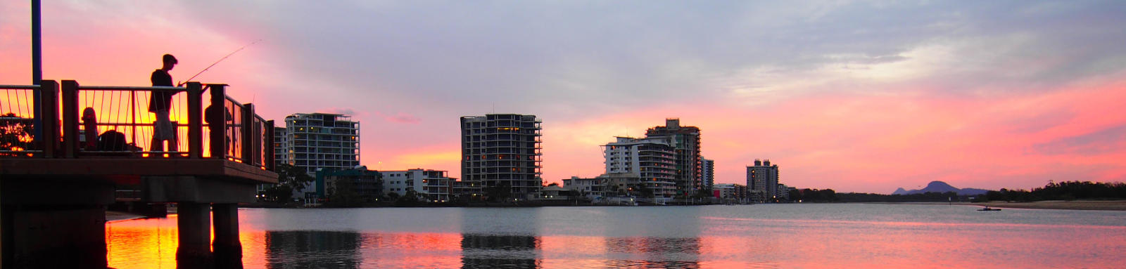
Coolum and Yandina Creeks
Coolum creek is a quiet and calm backwater tributary of the Maroochy River, tucked behind Mt Coolum. It travels up through Coolum Creek Conservation Area and provides multiple wildlife view opportunities. This is a quick guide to the navigable creeks around this section of the Maroochy River.
Easily navigable section is a 2.5 km section between the Maroochy River and the old Moreton Sugar Mill Tramway, but portaging past the old rail bridges allows navigation into the upper areas including the upper Yandina Creek.
The lower Yandina Creek section can be accessed from the Maroochy River, with the wetlands managed by unitywater. It passes past an old sugar cane farmland block that was recently purchased and is being restored back to its original wetland state. It also plays an important role in nutrient offsetting nitrogen from the Maroochy River. The upper and lower sections of Yandina Creek are no longer directly connected.
What to expect
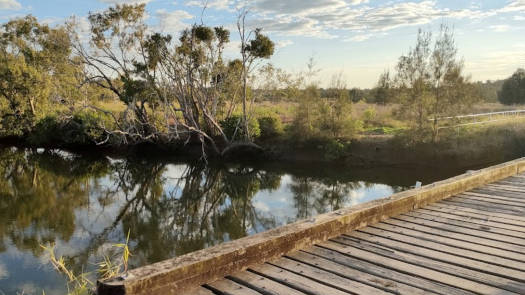
Lower Coolum Creek is lined by mangroves and provides pleasant paddling on a smallish tidal estuary. The old Moreton Sugar Mill Tramway blocks access to the upper sections on both sides of the island and must be portaged. As you go upstream, the creek narrows and becomes mostly unnavigable after the channel to the upper Yandina Creek section joins.
The upper Yandina Creek section provides the opportunity to extend the paddle by a few kilometers up to Coolum-Yandina Rd. The forested areas slowly give way to shruby farmland. Once you get past the road the creek can be best described as a weedy irrigation channel through private property, so this marks the end of any exploration.
The old sugar cane irrigation canal offers the chance to extend the paddle. However as this is rarely flushed by the summer rains, it can be fairly stagnant as you near Coolum-Yandina Rd.
The lower Yandina Creek section allows access to the wetlands, although there is a low bridge about 350 m from the Maroochy River that requires portaging up and over a small bank.
The Coolum Drain is a very short navigable section that quickly chokes with weeds as you head up the channel.
Paddling Options
There are a few options from short trips based around Coolum Creek.
Coolum Creek - Tramway
- Length
- 4.8 km
- Type
- Return
- Time
- half day
- Technical difficulty
- Grade I
- Rating
- Elevation Loss
- N/A (tidal)
- Sections
- 1.3 km Tramway
2.3 km Maroochy River
1.0 km Boat Ramp
Yandina Creek (upper)
- Length
- 9.4 km
- Type
- Return
- Time
- half day
- Technical difficulty
- Grade II
- Rating
- Elevation Loss
- N/A (tidal)
- Notes
- A portage required over old tramway bridges.
Logistics
There is only a single put-in spot on Coolum Creek, a concrete boat ramp. The two nearest ramps on the Maroochy River are Stony Wharf (2.5 km downstream) and Dunethin Rock (7.5 km upstream). All are operated by Sunshine Coast Council.
Refer to the Distance Table and the Interactive Map for additional details. Coolum Creek and Stony Wharf only have small parking areas, they are usually fairly quiet and parking is not an issue.
Coolum Creek
- Length
- 7.3 km
- Navigable
- 3.6 km (est)
- Catchment
- 66 sq km
- Elevation Loss
- Council Areas
- First Nations
- Kabi Kabi
© Thomas and Olivia Williams
Tides
There is minimal tidal influence for most trips, though high tide will allow exploration further up the creek. Tides for the lower Yandina Creek are roughly 5 to 10 minutes later than Coolum Creek.
No current tide details for port: BQ019, low_offset=170, high_offset=115, title=Coolum Creek Mouth, container-classes=tides-block mb-3
#0: core/debug.inc, line 285, dpr()
#1: core/filters/tides.inc, line 235, print_filter_error()
#2: core/base.inc, line 299, filter_tides()
#3: core/base.inc, line 264, process_page_filters()
#4: docroot/index.php, line 41, process_request()
This could be from a parental filter such as meta
Distances
Some key locations on the main Coolum and Yandina Creek navigable sections are listed below.
* Side represents either the left / port (L) or right / starboard (R) sides when facing downstream of the main river or the specified direction of travel for bays or lakes (usually anticlockwise).
† Most of the features were taken from local council pages.
§ Distances have been manually calculated from the river mouth.
Map
Explore the key locations in the map below. Most locations will have a photograph that can be seen by clicking on the icon or number in the map itself.
The map also has markers every kilometer that start at 0 at where the creeks meet the Maroochy River.
You may need to zoom in to see all of these kilometer markers. These do not correlate with any existing numbering system on the river.
- Coolum Drain
- Coolum Creek
- Irrigation Channel
- Yandina Creek (Upper)
- Yandina Creek (Lower)
- Yandina Creek Wetland
- Boat Ramps
- Bridges
© Thomas and Olivia Williams
