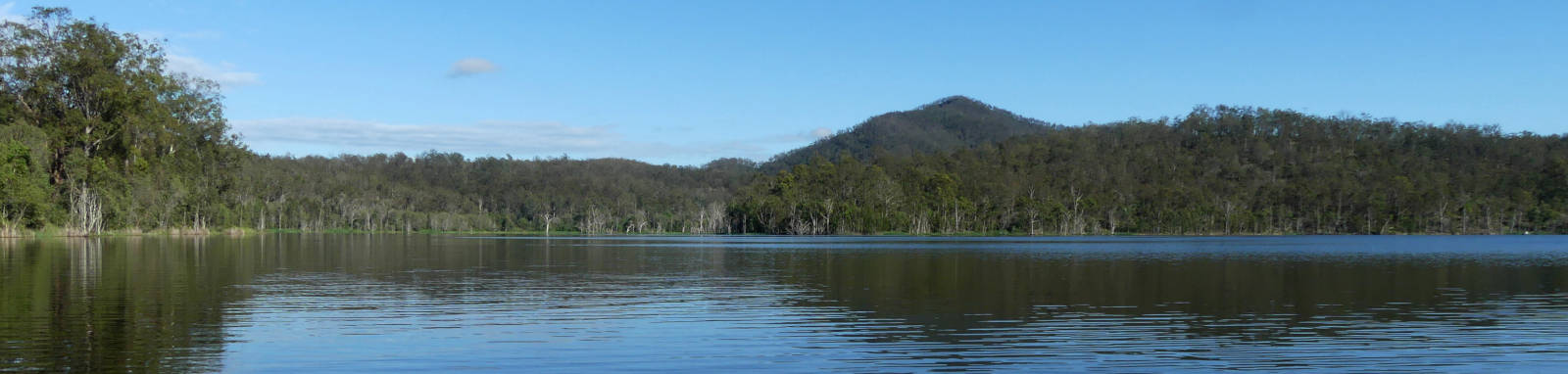
Lake Wyaralong
Wyaralong Dam
What to expect

Wyaralong Dam is one of the newest dams of South East Queensland, completed in 2011. It is also home to the Queensland State Rowing Centre that has a permanent Olympic-standard rowing course that has regular regattas on the lake.
The lake is approximately 15 km long from the dam wall to the head of the lake if travelled in a fairly straight line. It contains a large number of smaller arms to fish from with occasional creeks that you can explore. It has a narrow profile that is never much more than 500 m wide.
While it is flatwater paddling, it is a fairly large body of water so conditions can get rough in stormy or windy weather. Winds often push in during the afternoon and tend to be funnelled east or west along the western arm of the lake.
Logistics
There are two put in spots at either end of the lake and a third that is accessible only by water and the walking track to the Ngumbi Remote Camping Area. This camping area is also known as the Mt Joyce Base Camp.
For traffic travelling from Brisbane, there are two main routes via the Ipswich or Beaudesert. The Wyaralong Dam Recreational Facility boat ramp has a well maintained sealed road, while the Knehr Road carry in point is accessed along an unsealed road that is still suitable for 2wd.
The dam and recreation facilities are open to the public seven days a week at the time of writing, from 5:30am to 6:30pm (September – April) and 6:00am to 5:30pm (May – August).
Features and facilities
Primary point of truth for the lake should be the official SEQWater published Location maps and guides.
Only tank rainwater water is available, bring your own drinking water.
There are two camping options on the lake:
- Lilybrook Recreation Area (Western Trail Access)
- Camping facilities suited for horse enthusiasts with holding paddocks, watering areas and loading ramps. These are available for event use only at this stage and include a cleared area suitable for large groups. Toilets, showers (cold only), picnic tables and shelter are available on site.
- Ngumbi Remote Campsite
- Tucked under Mt Joyce, this bush campsite is only accessible from the surrounding trails or water. Basic shelter and toilets only.
The following is a rough guide about the different locations around the lake. Starting from the dam wall and going clockwise:
† Most of the features were taken from SEQWater published Location maps and guides.
‡ Distances are approximate only and are based on roughly staying near the shoreline while crossing most of the lakes sidearms. These
crossings may be up to 750 m wide.
Access Restrictions
Access is restricted directly above and below the dam wall. Most of the surrounding land is privately owned land, especially along the entire southern shoreline.
Refer to the SEQWater Lake Wyaralong guide for up to date information.

Trip Details
Spillway to Knehr Rd
- Length
- 28 km
- Type
- Flatwater
- Time
- full day
- Trip
- Return
- Technical difficulty
- Open Water II
- Rating
Quick Stats
- Lake / Reservoir
- Lake Wyaralong
- Dam / Weir
- Wyaralong Dam
- Waterway
- Teviot Brook
- Shoreline
- 65 km
- Capacity
- 103 GL
- Catchment
- 546 sq km
- Area
- 12.3 sq km
- Elevation
- Dangers
- Wind waves
- Council Areas
- First Nations
- Bundjalung
- Directions To
- Meebun (dam)
Knehr Rd
11:10pm
12:12pm
S at 6 kph
Strongest Gust: 41 kph ESE at 2:51pm
Sun and Twilight Times
Civil: 04:21—19:09 / 14hr 48m
Nautical: 03:49—19:41 / 15hr 52m
Moon Info
▼ Tue 6:05am ▲ 8:45pm
Map
Explore the key locations in the map below. Most locations will have a photograph that can be seen by clicking on the icon or number in the map itself.
Take note of the small island that partially obscures the main western arm of the lake when you are coming from the Meebun Day Use Area. You can head west at about the 1,250 m marker on the rowing course to take the northern longer way around, or head west between the 1,000 m and 750 m markers. There is a single line of buoys along the main western side arm that runs from near the Wyaralong Overflow Estate towards the southern side of this island.
- Spillway
- Boat Ramp
- Campsite
- Water Access Only
- Kayak Ramp or Path
- Viewpoints
What to take
Ensure electronic devices and gear have waterproof containers / dry bags if needed.
What to wear
- Sunscreen / Chapstick *
- Sunglasses *
- Hat *
- Swimwear or shorts †
- Sun protective clothing (rashie) †
- Water shoes †
What to take
- Water
- Snacks
- Phone
- Camera
- Watch
- Sponge
- Rain jacket
- Spare clothes / Towel
Safety
- PDF (life jacket) *
- Whistle
- Paddle float ‡
- Bilge pump ‡
- Paddle lease *
- Spare paddle
- Light (night paddling)
* Highly recommended (aka required)
† You should wear clothing and footwear that you can comfortably swim in.
‡ These are for self or assisted rescues as there are places that you can't easily swim back to the shore.
Wildlife
There is a wide variety of birdlife on the lake and you could be lucky and see some turtles and the protected Australian Lungfish. Mammals are less frequent, but occasional kangaroos and wallabies could be seen along the water's edge


