Lake Moogerah
Moogerah Dam
What to expect
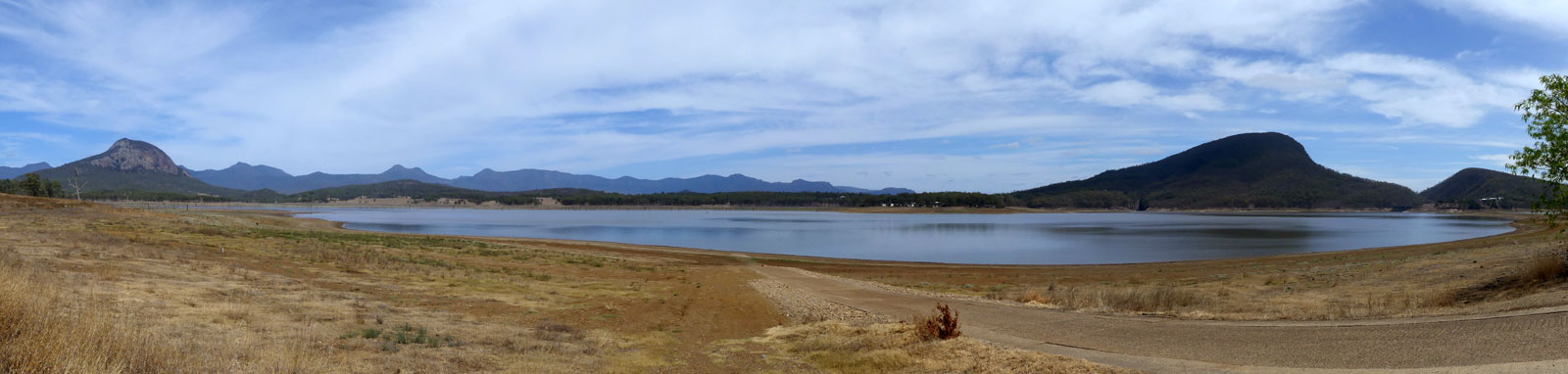
Lake Moogerah is an inland lake that is popular over summer with fishermen and campers escaping the QLD heat. The lake is mostly surrounded by farmland with small sections backing up into national parks. Excellent views of Mount Greville and Mount Alford can be found from almost everywhere on the lake.
Moogerah Dam is primarily used for irrigation purposes around Boonah and feeds to both Reynolds and Warrill creeks. As such, water levels can drop significantly in the dry.
The lake is approximately 4 km long and 2 km wide. It is a fairly shallow lake so you may have to traverse the shoreline a bit further out than normal to avoid sticking your paddle into the lakebed
Features and facilities

There are two boat ramps located at AG Muller Park (Lake Moogerah Caravan Park) and one could launch with care from Fred Haigh Park. Camp Moogerah has a private boat ramp for guests that are staying there.
Fred Haigh Park is open to the public seven days a week at the time of writing, from 5:30am to 6:30pm (September – April) and 6:00am to 5:30pm (May – August).
AG Muller Park is within the privately run Lake Moogerah Caravan Park and can be accessed free of charge during the day. The caravan park has a boom gate across the entry, so you need to pop in to get the pin used to enter and exit the park. This pin changes daily around 6pm.
Refer to the SEQWater Lake Moogerah guide for up to date information.
† Most of the features were taken from SEQWater published Location maps and guides.
‡ Distances are approximate only and are based on roughly staying near the shoreline with a 500 m crossing to get to
the dam, Fred Haigh Park and Sandy Creek.


 and Fred Haigh Park (right)")
Map
Explore the key locations in the map below. Most locations will have a photograph that can be seen by clicking on the icon or number in the map itself.
- Spillway
- Fred Haigh Park
- Boat Ramps
- Viewpoints
What to take
Ensure electronic devices and gear have waterproof containers / dry bags if needed.
What to wear
- Sunscreen / Chapstick *
- Sunglasses *
- Hat *
- Swimwear or shorts †
- Sun protective clothing (rashie) †
- Water shoes †
What to take
- Water
- Snacks
- Phone
- Camera
- Watch
- Sponge
- Rain jacket
- Spare clothes / Towel
Safety
- PDF (life jacket) *
- Whistle
- Paddle float ‡
- Bilge pump ‡
- Paddle lease *
- Spare paddle
- Light (night paddling)
* Highly recommended (aka required)
† You should wear clothing and footwear that you can comfortably swim in.
‡ These are for self or assisted rescues as there are places that you can't easily swim back to the shore.
Wildlife
There is a wide variety of birdlife on the lake and you could be lucky and see some turtles. Livestock is common around the lake.


Quick Stats
- Lake / Reservoir
- Lake Moogerah
- Dam / Weir
- Moogerah Dam
- Waterway
- Reynolds Creek
- Shoreline
- 29.8 km
- Navigable
- 21 km
- Capacity
- 83.8 GL
- Catchment
- 228 sq km
- Area
- 6.8 sq km
- Council Areas
- First Nations
- Bundjalung
- More Info
- Seqwater
QLD DAF
Directions
