The Broadwater
The Broadwater is a large shallow estuary that stretches from Southport to the southern end of Moreton Bay in the north. The estuary is separated from the ocean by South Stradbroke Island.
The southern entrance is Seaway that was constructed in 1986 to stabilise the shifting river mouth of Nerang River. The northern entrance, Jumpinpin Channel, is still in its natural state after forming recently from spring storms in 1896, likely due to the salvage activity for the Cambus Wallace in 1894 that likely weakened the sandbar.
Wave Break Island is a man-made island built in 1985 to protect the area from storm surges coming in from the Seaway, but it's now naturalised and is a fantastic day trip with its white sand beaches and snorkelling opportunities.
What to expect
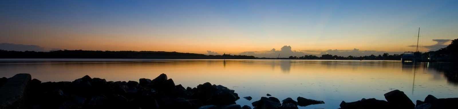
Wide estuary with white sandy beaches with plenty of islands and side creeks to explore.
Paddling Options
There are multiple options from short trips based at one of the put-in locations, to longer trips of the main estuary itself noting that a full return trip is over 60 km, significantly longer if you explore along the way.
South Straddie
- Length
- 60 km
- Trip
- Return
- Time
- Two days
- Technical difficulty
- Open Water II
- Type
- Tidal
- Rating
Tipplers
- Length
- 17.2 km
- Trip
- Return
- Time
- One day
- Technical difficulty
- Open Water II
- Type
- Tidal
- Rating
Logistics
There are multiple spots along the Broadwater and mostly operated by Gold Coast City Council though the very upper reaches encroach towards the Redland City Council region of Southern Moreton Bay.
The following are likely the better spots to put in, but there are some other locations that you can use too. The Blue Marker indicates the approximate distance from Main Beach on the Gold Coast. It's a 5 km paddle just to access the main Broadwater from Jacobs Well, but other access points get much closer as you head south and are on the Broadwater itself once you get south of the Coomera River.
Refer to the Interactive Map for additional details.
Boat Ramps
For those paddling solo trying for a longer trip, Translink provides regular bus services along the lower stretches below the Coomera River, but there aren't any services to the towns in the main middle and upper sections, meaning you would have to paddle all the way through to Redlands in Moreton Bay.
Tides
There is a strong tidal influence for most trips, with care required near the Gold Coast Seaway and Jumpinpin Channel due to the strong current and ocean waves.
The tidal patterns are complex with channels to the north, south and centre. Tides are mostly calculated from either the Brisbane Bar or Gold Coast Seaway, although there are official predictions for Runaway Bay and the Gold Coast Operations Base at Southport too.
No current tide details for port: BQ003, key_locs_title=Tides for selected locations on the northern Broadwater for {day}, "key_locs=Cabbage Tree Point:29:30,Jacobs Well:18:28,Jumpinpin Channel:-55:-50,Pimpama River Entrance:32:28", container-classes=tides-block mb-3#0: core/debug.inc, line 285, dpr()
#1: core/filters/tides.inc, line 235, print_filter_error()
#2: core/base.inc, line 299, filter_tides()
#3: core/base.inc, line 264, process_page_filters()
#4: docroot/index.php, line 41, process_request()
This could be from a parental filter such as meta
No current tide details for port: BQ011, key_locs_title=Tides for selected locations on the southern Broadwater for {day}, "key_locs=Tipplers Island:70:75,Coomera River Entrance:96:70,Paradise Point:85:61,Howard Street:61:42", container-classes=tides-block mb-3#0: core/debug.inc, line 285, dpr()
#1: core/filters/tides.inc, line 235, print_filter_error()
#2: core/base.inc, line 299, filter_tides()
#3: core/base.inc, line 264, process_page_filters()
#4: docroot/index.php, line 41, process_request()
This could be from a parental filter such as meta
Map
Explore the key locations in the map below. Most locations will have a photograph that can be seen by clicking on the icon or number in the map itself.
The map also has markers every kilometer that start at 0 at the Nerang River Entrance all the way to Jumpinpin Channel.
You may need to zoom in to see all of these kilometer markers. These do not correlate with any existing numbering system on the bay.
- Logan River
- Southern Moreton Bay
- Swan Bay
- Jumpinpin Channel (The Pin)
- Pimpama River
- Coomera River
- Coombabah Creek
- Runaway Bay
- Gold Coast Seaway
- Wavebreak Island
- Biggera Creek
- Loders Creek
- Nerang River
- Restricted Area
- Boat Ramps
- Campsites
- Kayak Ramp or Path
- Access Points
- Pontoons
")
Quick Stats
- Length
- 29 km
- Navigable
- 29 km
- Dangers
- Other boats, sea channels
- Council Areas
- First Nations
- Bundjalung
