Pimpama River
The Pimpama River is situated between Brisbane and the Gold Coast and the catchment provides a green belt connecting Moreton Bay with hinterland areas.
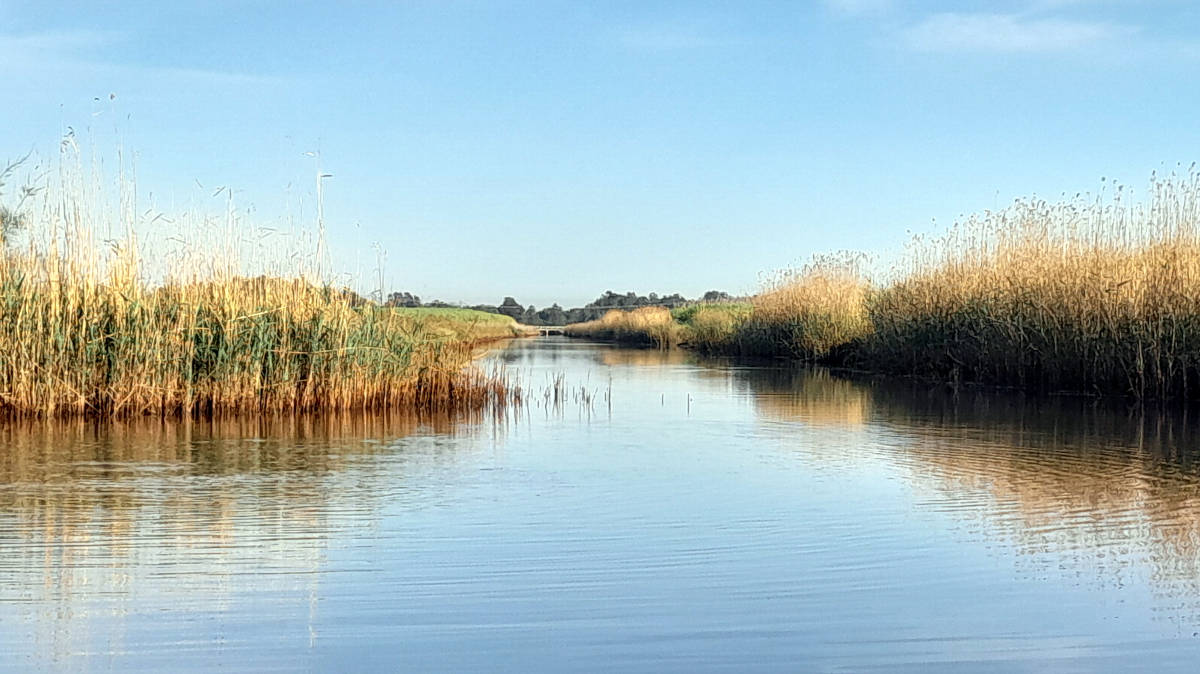
One of my favorite paddles on the coast, although it would lose much of its charm if done on a low tide due to the extensive mudflats.
What to expect
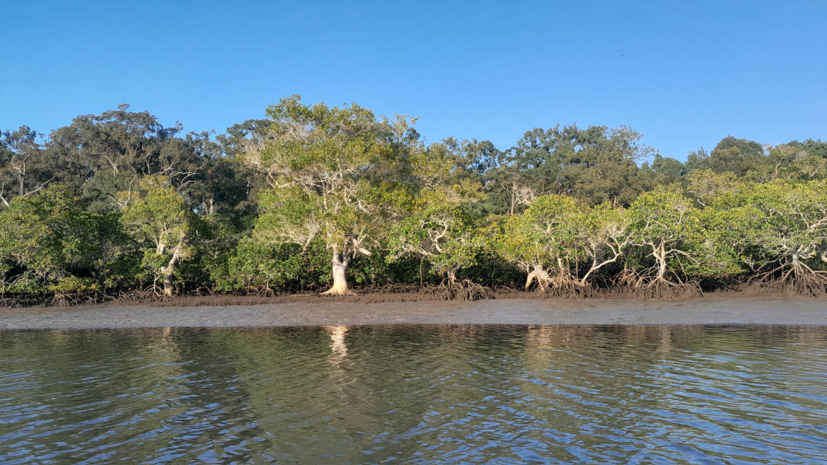
A tidal river with some mangroves that is mostly in its natural state up to the tidal barrage with the exception of a small section beside Calypso Bay development that has seen the complete removal of the mangroves from the northern side.
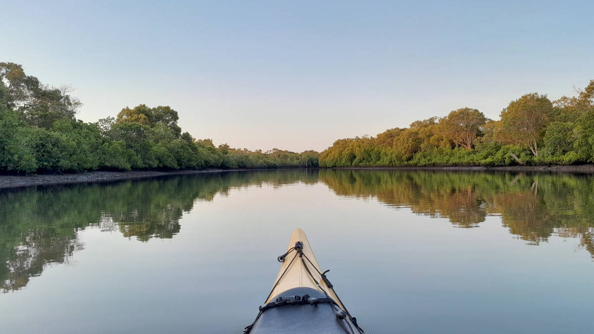
Above the barrage, the river is navigable another 8 km to around Ormeau before it becomes difficult to navigate.


Paddling Options

There are three main trip options from Coleman Road Reserve, the river itself, Woogoompah Island, or to explore the islands south. These can be easily extended by exploring any of the smaller side creeks. Looking at the first two options:
Aim to visit during higher tides for the best experience and this helps to avoid the extensive mudflats seen at low tide. The snippet from the Northern Gold Coast Beacon to Beacon Guide indicates likely problematic areas.
There are no lights on the navigational markers within the Pimpama River.
Tidal Barrage
- Length
- 12.2 km
- Time
- half day
- Trip
- Return
- Technical difficulty
- Grade I
- Rating
- Type
- Tidal
- Elevation Loss
- N/A (tidal)
- Notes
- Mid to high tide only
Woogoompah Island
- Length
- 15.2 km
- Time
- half day
- Trip
- Circumnavigation
- Technical difficulty
- Grade I
- Rating
- Type
- Tidal
- Elevation Loss
- N/A (tidal)
- Notes
- Mid to high tide only
The only real option to explore the upper non-tidal sections is from the tidal barrage. It is generally easy paddling up past the Pimpama Jacobs Well Rd bridge, getting slightly harder in places up to the agricultural / flood canal that runs off past Eggersdorf Rd. This canal effectively marks the end of the navigable sections, with the canal being on private property.
This network of canals eventually met up with Sandy Creek (Logan River) with about a dozen farm bridges, blockbanks and / or regulators.
I was able to paddle 0.9 km up Hotham Creek to a small weir. There is possibly another 0.5 km of navigable waters above this if you wanted to portage the weir.
Upper Section
- Length
- 16 km
- Time
- half day
- Trip
- Return
- Technical difficulty
- Grade I
- Rating

Quick Stats
- Length
- 34.5 km
- Navigable
- 16.7 km
- Catchment
- 161 sq km
- Elevation Loss
- Council Areas
- First Nations
- Bundjalung
- Directions To
- Colman Road Reserve
Kerkin Road Weir
Logistics
There are a few put in spots along the river operated by Gold Coast City Council.
Coleman Road Reserve Boat Ramp is the main put in spot for the tidal section, and there is a pull-off area beside the barrage on the southern side that allows for fairly easy access to the non-tidal upstream sections. There is a small portage across the weir to the put-in spot for the upper section.
Refer to the Distance Table and the Interactive Map for additional details. Parking is not an issue in general.
Those wanting a longer day, there are options to start north at Jacobs Well or south on the Coomera River at either Colman Family Park or Boat Harbour ramps.
One-way distances to Kerkin Road Weir:
- 6.1 km
- Coleman Road Reserve Boat Ramp
- 9.7 km
- Jacobs Well, direct via creeks (mid to high tides)
- 12.4 km
- Colman Family Park via Nth Branch
- 15.2 km
- Boat Harbour via The Broadwater
- 16.8 km
- Jacobs Well, via The Broadwater
Tides
Due to the shallow nature of the extensive mud flats, it is best to plan any trip around high tide that allows you to paddle the entire width of the river. At low tide, care needs to be taken to avoid bottoming out on sandbars / mud flats, with some trips impossible.
There is a moderate tidal influence for most trips, with enough flow to provide a noticeable current in the tidal sections but unlikely enough to be of much concern.
No current tide details for port: BQ003, low_offset=32, high_offset=28, "format=datum,days", title=Pimpama River Mouth, key_locs_title=Tides for selected locations on the lower Pimpama River for {day}, "key_locs=Jacobs Well:18:28,Coleman Road Reserve:45:35,Kerkin Rd Weir:87:57", loc-classes=col-12 col-sm-4 pb-3, day-classes=col-12 col-sm-6 pb-3, container-classes=tides-block mb-3#0: core/debug.inc, line 285, dpr()
#1: core/filters/tides.inc, line 235, print_filter_error()
#2: core/base.inc, line 299, filter_tides()
#3: core/base.inc, line 264, process_page_filters()
#4: docroot/index.php, line 41, process_request()
This could be from a parental filter such as meta
Distances
Some key locations are listed below.
* Side represents either the left / port (L) or right / starboard (R) sides when facing downstream of the main river or the specified direction of travel for bays or lakes (usually anticlockwise).
† Most of the features were taken from local council pages.
§ Distances have been manually calculated from the river mouth.
Map
Explore the key locations in the map below. Most locations will have a photograph that can be seen by clicking on the icon or number in the map itself.
The map also has markers every kilometer that start at 0 at The Broadwater all the way to the source.
You may need to zoom in to see all of these kilometer markers. These do not correlate with any existing numbering system on the river.
- Pimpama River
- Jewel Creek
- McCoys Creek
- Woogoompah Creek
- Hotham Creek
- Eggersdorf Rd Flood Channel
- Boat Ramps
- Bridges
- Causeways
- Kayak Ramp or Path
- Weir or Low Head Dam
Tributaries
Jewel Creek
Small cutting that joins the Pimpama and Coomera rivers at high tide.
It's about a 1.3 km paddle using the shorter upstream channel, a 1.8 km paddle on the longer downstream channel.
Quick Stats
- Length
- 1.3 km
- Navigable
- 1.3 km
McCoys Creek
Just upstream of the boat ramp at Coleman Road Reserve.
Quick Stats
- Length
- 8.3 km
- Navigable
- 3.3 km
(Woogoompah Creek)
Cuts across to Jacobs Well forming Woogoompah Island. I got through on low to mid tide, though I struggled with some shallow sections.
The upstream cutting beside Calypso Bay is shallower. While slightly longer, it is a slight shortcut when navigating between Jacobs Well and Kerkin Road Weir (tidal barrage).
Note that this creek was never officially named in the maps that I have seen.
Quick Stats
- Length
- 5.4 km
- Navigable
- 5.4 km
Hotham Creek
Cuts across to Jacobs Well forming Woogoompah Island. The upstream cutting beside Calypso Bay is shallower.
Note that this creek was never officially named in the maps that I have seen.

Quick Stats
- Length
- 16.8 km
- Navigable
- 0.9 km
(Eggersdorf Rd Drain)
The most major of the drains connecting to the river that also roughly marks the end of the navigable section of the main river.
Note that this drain / irrigation channel / flood channel is never officially named in the maps that I have seen.