Major Tributaries
Details on some of the largest tributaries
My personal take on the dangers of the trip
It is safest to complete the journey in a group of three or more. This allows one person to stay with the injured party while the third person cautiously continues on for help.
There is a risk of fire any time of the year but these are highest in the fire season. Check the conditions regularly, especially if there are active fires.
If in a remote area without coverage, if it is very hot or just hot and windy assume that there is a total fire ban. You will often smell smoke long before the main fire front.
Active fires can be tracked with a number of tools:
For more tips and hints on fire safety visit the fire service websites and check out my fire safety notes.
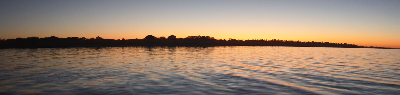
Alpine storms can dump snow at any time of the year and heavy rain will lead to the risk of localised flash flooding and high flows that can be dangerous. Rough conditions on open sections of water are one of the leading causes of deaths on the Murray River. While experienced kayakers can handle the choppy waves stirred up by 15 knots plus winds, these will be dangerous for inexperienced paddlers.
Always check the weather forecasts when accessing remote areas or open water crossings. The Bureau of Meteorology (BoM) Weather Warnings for NSW and VIC should be read before heading out into the upper sections, as well as general weather and / or marine forecasts for the larger lake crossings along the way.
Windy.com is a great tool to visualise current wind patterns and WillyWeather.com.au is another useful site.
Don't panic about snakes, but take simple precautions and stay alert. They are most common in the upper sections, but you could come across these little guys anywhere along the river. They are most active during the warmer months and numbers are greatest after a good wet season where their food supply of mice and frogs can support higher populations.
On the upper Murray section, I saw ~15 red belly blacks, two tigers, one copperhead, two small-eyed and one yellow eyed whip snake. These were mostly on the off-trail sections. In the lower section, I only saw two browns and one copperhead. I saw none in the water and all bar one of the snakes were seen off trail.
Some advice and precautions about snakes can be found here.
Some locals do drink the water directly from the river in Kosciuszko National Park and between the Hume Dam and Albury. Having been sick personally after a water filter failed in Kosciuszko National Park, I would not recommend doing this!
All of the major Australian rivers will have a risk of these during the warmer months and the Murray River is no exception.
Read a bit more about it here that includes some warning information sites and contacts too.
The hike to the source and down the gorge goes through some very remote alpine terrain. You should be self-sufficient with at least 7 days supplies for the upper Murray loop depending on how you tackle this section. There is effectively no mobile reception with fellow hikers few and far between on the fire trails, with none will be found after leaving Cowombat Flat. Your plans should consider floods, snow and fires that could mean difficult off trail hiking.
Without a guide you should be skilled in compass navigation and emergency first-aid. Key gear to take includes:
You will have to treat water along the way to make it fully safe to drink. I used a lightweight filter with backup options of chemical or boiling treatment. Refer to the Water Treatment page for various options on how you can clarify and treat water.
Dehydration is a risk in the upper section. In dry years, reliable sources on the Cascade and Cowombat trails can be found here. In drought conditions, talk to the parks staff to assess what water will need to be carried.
Helpful when moving through the bush to keep your boots dry and skin intact when wearing shorts. Many people wear these for snake protection, albeit unprovoked snake bites are much rarer than lightning strikes!
In saying that, these are highly recommended if going off-trail where you can not see where you are stepping.
Before you go:
Check the park status in case of warnings or even closures.
Check the local fire agency for current fire dangers. Most people will advise not to hike these remote areas under extreme fire conditions.
Check the Bureau of Meteorology (BoM) for long term forecasts and weather warnings, however assume these could change for the worse.
Finally, once you leave, keep to your planned route, including your contingency routes that you could use in case of emergency.
The two leading causes of death kayaking are drowning and exposure (hypothermia).
Hypothermia is a very real risk in the colder months with the water temperature at Bringenbrong Bridge hovering around 5°C. Wear a wetsuit or other suitable clothing that will allow you to survive a long swim in the water.
The risks of drowning are greatest with whitewater kayaking, but even flat water kayaking has its own dangers. Historically, being caught out on open water is the most dangerous part of the entire trip where self-rescue and even swimming becomes difficult in very rough conditions.
The whitewater sections should only be done with at least two experienced paddlers, so I will not go into these dangers here. Many of the common flat water risks such as sweepers, weirs, etc, are covered here and there are a number of important safety gear requirements that are covered here.

©2026 Alan Davison // Credit // Disclaimer