Edward‐Wakool River System
A brief look at some of the longest anabranches of the Murray River
See any detour as an opportunity to experience new things.
This is a placeholder stub in participation of a future paddle down one or both of these rivers.
The Edward and Wakool Rivers are the two major anabranches of the Murray River. Taking Edward River is 435 km, the Murray 500 km, however being a smaller river with weirs, it is unlikely to be a quicker shortcut.
If you paddle the Wakool River, then that is slightly longer total trip, adding 33 km, and it is slightly harder with less flow assist. The Niemur River is a 30 km shortcut compared to the Edwards, but is much more intrepid journey and slightly more difficult. Tagging on the Collagen Creek to the Niemur trip cuts this down to a 12 km shortcut.
Note that there are no key waypoints on the smaller Wakool or Niemur Rivers other than the odd bridge.
Key Waypoints of the Edward River
-
minus 95.6 km
Tocumwal, NSW
-
0 km
Picnic Point
The Edward River leaves the Murray just as you reach Picnic Point.
Be careful that you do not pass this and head up Gulpa Creek. That is 1.2 km downstream and is 54.9 km, adding 20 km if it is navigable all the way up to where it rejoins Edward River.
-
36.1 km
Gulpa Creek
One may want to study the correlation between the Murray River Height at the Gulpa Creek offtake and flows before committing to this option.
-
67.2 km
-
76.2 km
-
96.8 km
-
147.9 km
Niemur River Offtake
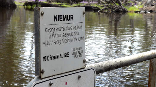
-
276.1 km
-
400.8 km
Wakool River
-
405.1 km
Kyalite
Some limited supplies are available from the pub/caravan park.
-
435.7 km
Murray River
-
494.4 km
-
586.4 km
Supplies
There are a number of supply options along the river. Leaving Tocumwal, you could find limited supplies at the Picnic Point Caravan Park, although if you take Gulpa Creek, Mathoura has a small general store. After this there are a couple supermarkets at Deniliquin and a small general store at Moulamein. Towards the bottom end of the system, limited supplies can be had at Kyalite pub and Boundary Bend general store. Robinvale has a large supermarket for those contining down the Murray.
Distances from key locations, including a couple that are on the Murray River.
Tap or hover your mouse over a table cell to show the estimated number of days it will likely take between two locations.
| Distances (KM) | Cobram | Tocumwal | Picnic Point | Deniliquin | Moulamein | Kyalite | Murray River | Boundary Bend | Robinvale | Distances (KM) |
|---|---|---|---|---|---|---|---|---|---|---|
| Cobram | 0 | 27 | 123 | 190 | 399 | 528 | 558 | 617 | 709 | Cobram |
| Tocumwal | 27 | 0 | 96 | 163 | 372 | 501 | 531 | 590 | 682 | Tocumwal |
| Picnic Point | 123 | 96 | 0 | 67 | 276 | 405 | 436 | 494 | 586 | Picnic Point |
| Deniliquin | 190 | 163 | 67 | 0 | 209 | 338 | 369 | 427 | 519 | Deniliquin |
| Moulamein | 399 | 372 | 276 | 209 | 0 | 129 | 160 | 219 | 311 | Moulamein |
| Kyalite | 528 | 501 | 405 | 338 | 129 | 0 | 31 | 89 | 181 | Kyalite |
| Murray River | 558 | 531 | 436 | 369 | 160 | 31 | 0 | 59 | 151 | Murray River |
| Boundary Bend | 617 | 590 | 494 | 427 | 219 | 89 | 59 | 0 | 92 | Boundary Bend |
| Robinvale | 709 | 682 | 586 | 519 | 311 | 181 | 151 | 92 | 0 | Robinvale |
| Distances (KM) | Cobram | Tocumwal | Picnic Point | Deniliquin | Moulamein | Kyalite | Murray River | Boundary Bend | Robinvale | Distances (KM) |
The distances were calculated by manually digitising the river path from various aerial images (ESRI, Bing, Google) in QGIS (WGS 84).
Map
The map has markers every km starting from 0 at the confluence where the Wakool meets the Murray. Zoom in to see all of these markers. These numbers do not correlate with any existing numbering system on the river.
- Edwards River
- Wakool River
- Niemur River
- Gulpa Creek
- Collagen Creek
- Tumudgery Creek
- Merron Creek
- Murray River
Flows
Water NSW gauges are noted below:
Climate
Mean Temps
Annual: 23.6°C
Monthly low: 3.3 to 16.7°C
Monthly high: 14.4 to 33.4°C
Mean Rainfall
Annual: 375 mm
Monthly min: 0 to 7.6 mm
Monthly max: 66 to 187 mm
Data sourced from Bureau of Meteorology (Deniliquin 1997-2023)
Mean Temps
Annual: 23.6°C
Monthly low: 3.3 to 16.7°C
Monthly high: 14.4 to 33.4°C
Mean Rainfall
Annual: 375 mm
Monthly min: 0 to 7.6 mm
Monthly max: 66 to 187 mm
Seasonal Wind Roses for Deniliquin (3pm)
These wind roses are based on limited data from early 2022 onwards.
My Personal Journeys
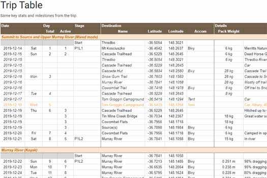
My rambling blogs and trip tables for trips down the three rivers.
Edward River
First trip starting from Toocumwal and finishing at Boundary Bend
Wakool River
Second trip starting from Toocumwal and finishing at Boundary Bend again, but this time on the Wakool and starting on Gulpa Creek.
Niemur River
Third and final trip starting from Stevens Weir on Collagen Creek and finishing Kyalite.

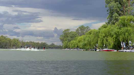
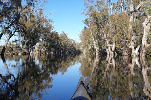
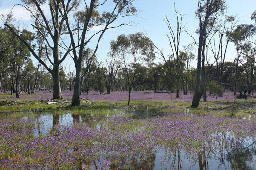

Robinvale can get extremely busy with water skiers and wakeboarders during the summer school break and they also host a water ski race around easter.