Supplies
Where to find food and water along the way
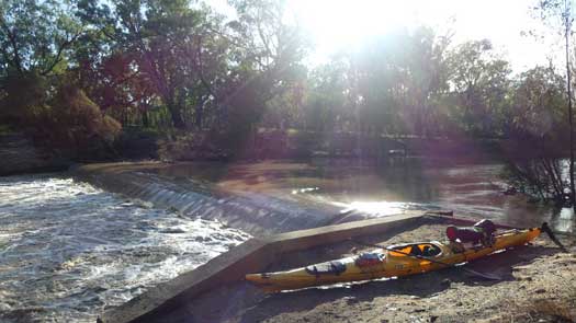
One of the least concerning looking hazards is actually one of the more lethal dangers that you are likely to encounter on the Macquarie River. Without firsthand experience, I do not know how well these weirs are marked. In the right conditions some weirs can be hard to see from a distance, stay alert.
The dangers posed by a weir are very dependent on the flow. With no flow it is just a hassle to portage over it. With very high flows it may be fully submerged and may not even create a ripple. However, with the right flow many of the weirs can create a perfect hydraulic across the structure that even the most experienced paddler may not be able to escape.
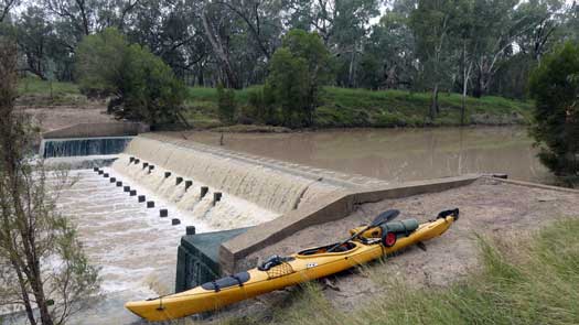
There is only one way to safely navigate a flowing weir, to portage around it. The current can be deceptively strong near the weir, so stay close to the river bank and exit well before the weir. Below the weir wall there will likely be a strong upstream current going back towards the weir as the eddy flow is recirculating back. Finish your portage below well below these currents.
| Name | Hazard | |
|---|---|---|
 |
Bathurst Waterworks Weir | Weir |
Storage for town supply. Portage seems easist on the left rather than in the willows on the right. |
||
 |
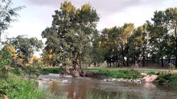
Rock Weir | Weir |
First of two small loose rock weirs that have been partially deconstructed to create a fish passageway. |
||
 |
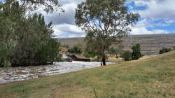
Rock Weir | Weir |
Just downstream of the other rock weir. |
||
 |
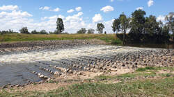
Burrendong Dam | Dam |
Controls the flow for domestic, environmental and agricultural usage in the Macquarie Valley. Additional images: Image Two, Image Three |
||
| Falls Rd | Causeway | |
. |
||
 |
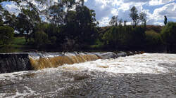
South Dubbo Weir | Weir |
Forms a pumping pool for irrigation and domestic water. Also known as the Dubbo City Council Weir. Additional images: Image Two |
||
 |
North Dubbo Weir | Weir |
. Additional images: Image Two |
||
| Narromine Weir | Weir | |
Forms a pumping pool for irrigation. |
||
| Old Gin Gin Weir | Weir | |
Forms a pumping pool for irrigation. The 9m concrete overflow weir built around the 1900s was damaged in the floods of 1903, reducing the height from 9 m to 5 m. It's original purpose was to direct water into Crooked Creek that flowed to Ewenmar Creek, but a channel now connects this all the way to Marthaguy Creek. There are plans to replace the weir with a new structure 200m downstream. The new gated weir will have an operating range of 0 to 8.5 m and a fishway. Another 3.5 m flood mitagration with a operating storage capacity of 6 GL. Additional images: Image Two |
||
| Warren (Top) Weir | Weir | |
Controls flow diversion to Gunningbar Creek from which further regulators supply Duck Creek, Crooked Creek and the Albert Priest Canal (man-made). Portage is on the right due to the diversion to Gunningbar Creek on the left. Additional images: Image Two |
||
| Bryan Egan Weir | Weir | |
Also known as the Warren Shire Council Weir. Additional images: Image Two |
||
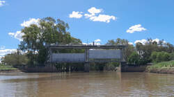 |
Marebone Weir | Weir |
Marebone Weir upstream of the Macquarie Marshes supplies water to Marra and Bulgeraga Creeks. Additional images: Image Two |
||
©2026 Alan Davison // Credit // Disclaimer