What to expect?
Spoiler of the conditions along the route
There are no supply options other than for the start and finish locations.
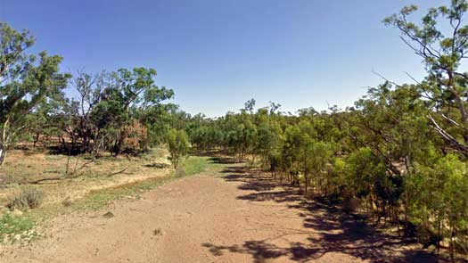
Keep track of where you are to avoid paddling past it. At 1.3 m (460 ML/day) in the Darling, there was no flow into the Darling Anabranch as seen in the photo. The river needs to pass the 6 m mark before the Darling Anabranch receives any water. This has only happens very rarely.
There is direct access to the Darling Anabranch offtake via Old Pooncarie Rd.
The flow will increase at Redbank Creek if there is water being released from the dams.
The gauge at Packers Crossing is 55 km upstream on Redbank Creek, and the guage at Wycot is 20 km downstream of the confluence.
If planning on taking the lake route, there is direct access to both Cawndilla Channel offtake at Lake Cawndilla and Packers Crossing via Old Pooncarie Rd.
Old Broken Hill Rd can be used to access Dam 183.

Bunnerungee Bridge is where the Silver City Hwy crosses the Darling Anabranch.
The gauge at Dam 183 is 32 km upstream and the gauge at Bulpunga is 55 km downstream.
The Anabranch Hall serves as a hub for local social events and groups for those that live in the community. It has full toilet and shower facilities but these were locked as I passed by. It is possible to get some tank rain water here, be careful not to waste this.
Access is via Anabranch Mail Rd.
The Darling Anabranch divides left and right at Box Island, just downstream of the Old Renmark Road bridge (Ten Mile Bridge). The official path is to the right rather than to the left to Six Mile Creek confluence with the Murray River.
Joining the Murray, turn left to go to Wentworth upstream, or right to go with the flow to Fort Courage Caravan Park 3 km downstream or to keep going to South Australia.
©2026 Alan Davison // Credit // Disclaimer