First Nations of the Murray
Details about the first nations people along the Murray

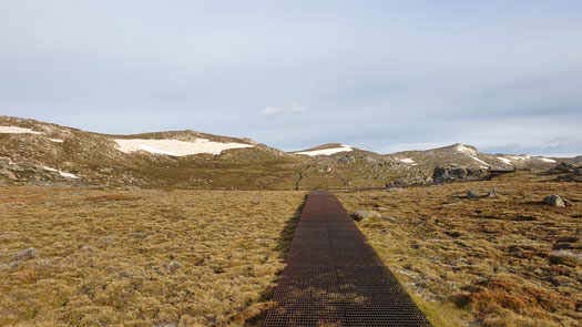
Ngarigo: Kunama Namadgi (snow mountain), Tar-gan-gil (Bogong Moth).
Australia's highest mountain, ignoring Mawson Peak (2,745 m) on Heard Island and Dome Argus (4,030 m) in the Australian Antarctic Territory. Mount Kosciuszko got it's current name after it was climbed by Polish explorer Pawel Strzelecki in 1840. Strzelecki named it in honour of his homeland hero Tadeusz Kosciuszko.
It was once an important summer Aboriginal gathering point where the Bogong Moth was used as a food source. Today the area is commonly visited by hikers and bikers in summer and skiers and snowboarders in winter.
Kunama Namadgi is one of the original Ngarigu names for Australia's highest mainland mountain. It is believed to mean snow and mountain, although Professor Jakelin Troy suggests that it actually means mother of snow where Ku- ‘snow’, -nama ‘making and having the quality of snow’, nama- for ‘breasts’, -dgi ‘having’. A reference to how important both snow and water is to the land.
There is a current submission to the Geographical Names Board of NSW for duel naming of Kunama Namadgi and Mount Kosciuszko for our highest peak.
Tar-gan-gil is more commonly associated with Mt Townsend.
Australia's longest river at 2,531 km in length, flowing from the Cowombat Flat, VIC, in the Snowy Mountains down past Lake Alexandrina, SA, to Long Bay. It's path determines the border between NSW and VIC. It also makes up the final section of Australia's longest continuous river system, the Murray-Darling with a combined length of 3,917 km.
Captain Charles Sturt named the river in 1829 after Colonial Secretary Sir George Murray.
©2026 Alan Davison // Credit // Disclaimer