Additional information
Other things about the Lachlan River and surrounding area
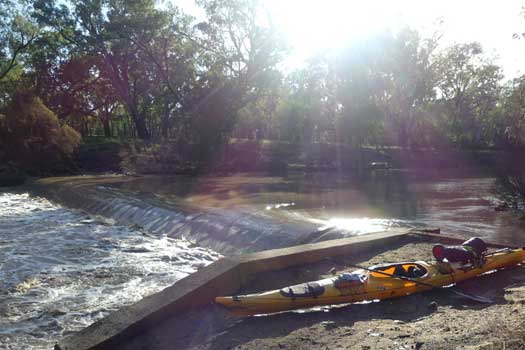
One of the least concerning looking hazards is actually one of the most lethal dangers that you are likely to encounter on the Lachlan. Unlike most of the weirs in populated centres, one would assume that the weirs are usually unmarked, especially in the more remote sections. In the right conditions some weirs can be hard to see from a distance, stay alert.
The dangers posed by a weir is very dependent on the flow. With no flow it is just a hassle to portage over it. With very high flows it may be fully submerged and may not even create a ripple. However, with the right flow many of the weirs can create a perfect hydraulic across the structure that even the most experienced paddler may not be able to escape.
There is only one way to safely navigate a flowing weir, to portage around it. The current can be deceptively strong near the weir, so stay close to the river bank and exit well before the weir. Below the weir wall there will likely be a strong upstream current going back towards the weir as the eddy flow is recirculating back. Finish your portage below well below these currents.
All weirs have been pieced together from misc sources. Many of the weirs were drowned out when I paddled down on a high flow.
| Name | Hazard | |
|---|---|---|
| Wyangala Dam | Dam | |
| Apex Weir, Forbes | Weir | |
Fixed crest rock weir that is 1.2m high and drowns out at approximately 1,000 ML/day. |
||
| Cottons Weir, Forbes | Weir | |
Fixed crest (concrete) 2m high and 35m across. An old report suggested it would drown out when flows are in excess of 5,000 ML/day. A small but noticable drop was still present at 10,000 ML/day. Additional images: Image Two |
||
 |
Jemalong Weir | Weir |
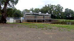
Adjustable crest (vertical lift gates). |
||
| Unknown | Weir | |
Low weir or rock shelf. |
||
| Island Creek | ||
| Island Creek Weir | Weir | |
Helps regulate the outflow onto Wallamundry Creek. |
||
| Bumbuggan Creek | ||
| Bumbuggan Creek Weir | Weir | |
Gated weir. Washed out at 5,000 ML/day. Additional images: Image Two |
||
| Bumbuggan West Weir | Weir | |
Private weir on Bumbuggan Creek. Fixed crest (rock fill) that is 2m high and 20m across. Exact location uncertain. Before modifications, an old report suggested it would drown out with flows above 500 ML/day. There was a low fixed crest weir (wooden piling and rock fill) 500m downstream that was recommended to be removed. This was known as the Travelling Stock Reserve (TSR) weir. It is 1m high and 20m across and would drown out at just 200 ML/day. Additional images: Image Two |
||
| Goobang Creek | ||
| Kennedy's Weir | Weir | |
Private weir, exact location uncertain. Fixed crest (steel gates, wooden piling, concrete and rock fill) that is 1.5m high and 25m across. Likely washes out with flows greater than 450 ML/day. The piles from the defunct regulating structure are likely the biggest concern. |
||
| Brady's Weir | Weir | |
Private weir, exact location uncertain. Fixed crest (wooden piling and concrete) that is 0.85m high and 25m across. Likely washes out at 300 ML/day, or in excess of 700 ML/day if fully restored. |
||
| Lachlan Shire Council Weir | Weir | |
Fixed crest (rock fill) used for the town water supply. It is 4m high and 35m across. An old report suggested it would drown out when flows exceed 4,500 ML/day on Goobang Creek. Additional images: Image Two |
||
| Lachlan River | ||
| Condobolin Weir | Weir | |
Fixed crest (fully concrete) that is 2.1m high and 24m across. It is located just around the bend 300m downstream of the Williams Street Bridge. An old report suggested it would drown out with flows in of approximately 4,100 ML/day. |
||
| West Condobolin Weir | Weir | |
Adjustable crest (dropboards) that is 1.5m high and 25m across. An old report suggested it would drown out with flows in excess of 3,800 ML/day |
||
| Micabil Weir | Weir | |
Fixed crest (concrete) that is 1.6m high and 29m across. An old report suggested it would drown out when flows are in excess of 4,500 ML/day. |
||
| Kiacatoo Weir | Weir | |
Fixed crest (concrete) that is 1.5m high and 18m across. An old report suggested it would drown out when flows are in excess of 4,000 ML/day. |
||
 |
Booberoi Weir | Weir |
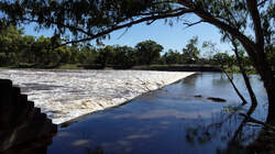
Fixed crest (fully concrete) that is 3.5m high and 85m across. An old report suggested it would drown out with flows in excess of 12,000 ML/day. |
||
 |
Lake Cargelligo Weir | Weir |
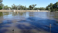
Adjustable crest. The regulator to the lake is 500m upstream, (Lake Cargelligo Diversion Weir). Additional images: Image Two |
||
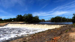 |
Lake Brewster Weir | Weir |
Fixed crest (concrete and rock fill) about 9m high and 90m across. The weir remained operable during the 1990 floods, so the drown out is higher than 26,300 ML/day. |
||
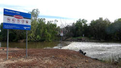 |
Willandra Weir | Weir |
Fixed crest (sheet piling and rock fill) 4m high and 30m across. A second regulator controls the outflow into Willandra Creek. An old report suggested it would drown out with flows in excess of 8,500 ML/day. Additional images: Image Two |
||
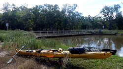 |
Gonowlia Weir | Weir |
Adjustable crest (dropboards). |
||
| Hillston Weir | Weir | |
Fixed crest (sheet metal, wooden piling and rock fill) 4m high and 25m across. An old report suggested it would drown out with flows in excess of 4,750 ML/day. Additional images: Image Two |
||
| Tallawanta Weir | Weir | |
Private fixed crest (concrete and rock fill), 5 km upstream from Whealbah Rd bridge. It is 1.8m high and 22m across. An old report suggested it would drown out with flows in excess of 3,000 ML/day. |
||
| Booligal Weir | Weir | |
Fixed crest (sheet/ wooden piling, rock fill and concrete cap) that is 1.8m high and 30m across. An old report suggested it would drown out when flows are in excess of 1,710 ML/day, well under at 2,800 ML/day. |
||
| Brassbutt Dam | Weir | |
Exact location uncertain, pin is about 750m downstream of "The Brass But" homestead. |
||
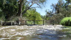 |
Oxley Dam | Weir |
Small weir before some willows. |
||
©2026 Alan Davison // Credit // Disclaimer